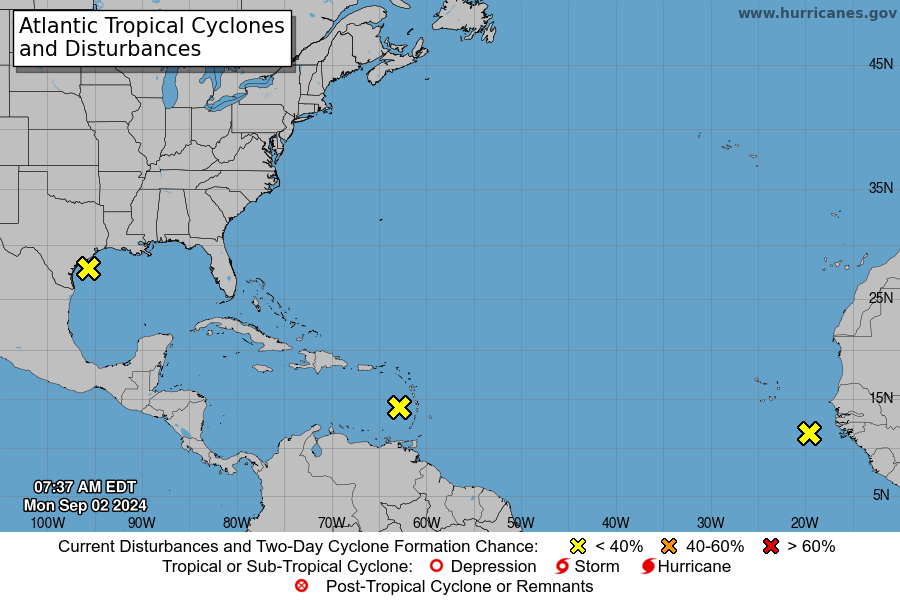
SAN JUAN — Disorganized shower and thunderstorm activity continues in association with a tropical wave located near the Lesser Antilles.
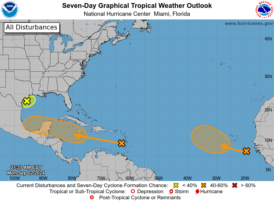
The disturbance is expected to move westward and cross the eastern Caribbean Sea through tomorrow with little development.
Environmental conditions are forecast to become more conducive for development while the system moves across the central and western Caribbean Sea during the middle and latter parts of the week, and a tropical depression could form during that time.
This system could cause gusty winds and locally heavy rainfall over portions of the Lesser Antilles today.
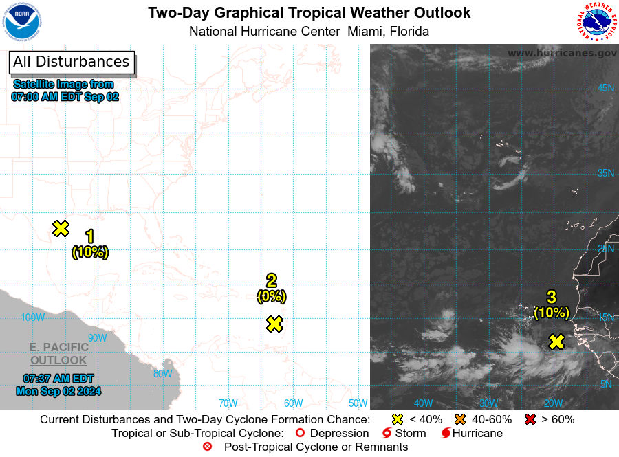
* Formation chance through 48 hours…low…near 0 percent.
* Formation chance through 7 days…medium…40 percent.

Eastern Tropical Atlantic Ocean
A tropical wave along the west coast of Africa is producing a large area of showers and thunderstorms.
Environmental conditions are forecast to gradually become more favorable for development, and a
tropical depression could form in a few days while the disturbance moves slowly west-orthwestward or northwestward over the eastern tropical Atlantic Ocean.
* Formation chance through 48 hours…low…10 percent.
* Formation chance through 7 days…medium…40 percent.

Northwestern Gulf of Mexico
A broad area of low pressure just offshore of the upper Texas coast continues to produce some disorganized shower activity near the coast and over the adjacent waters of the northwestern Gulf of
Mexico.
This system is expected to meander near the coast for the next couple of days, and some slow development is possible if it remains offshore.
By Tuesday, the system is forecast to move inland, and further development is not expected. Regardless, heavy rains could cause some flash flooding across portions of the Texas coast
during the next couple of days.
* Formation chance through 48 hours…low…10 percent.
* Formation chance through 7 days…low…10 percent.


