
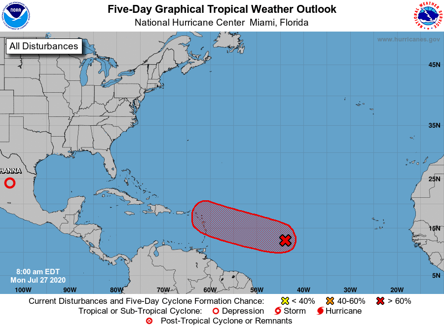
MIAMI — NOAA’s National Hurricane Center in Florida issued a Tropical Weather Outlook at 8 a.m. today, due to the presence of Invest 92-L that will likely form into a tropical cyclone over the Atlantic Ocean.
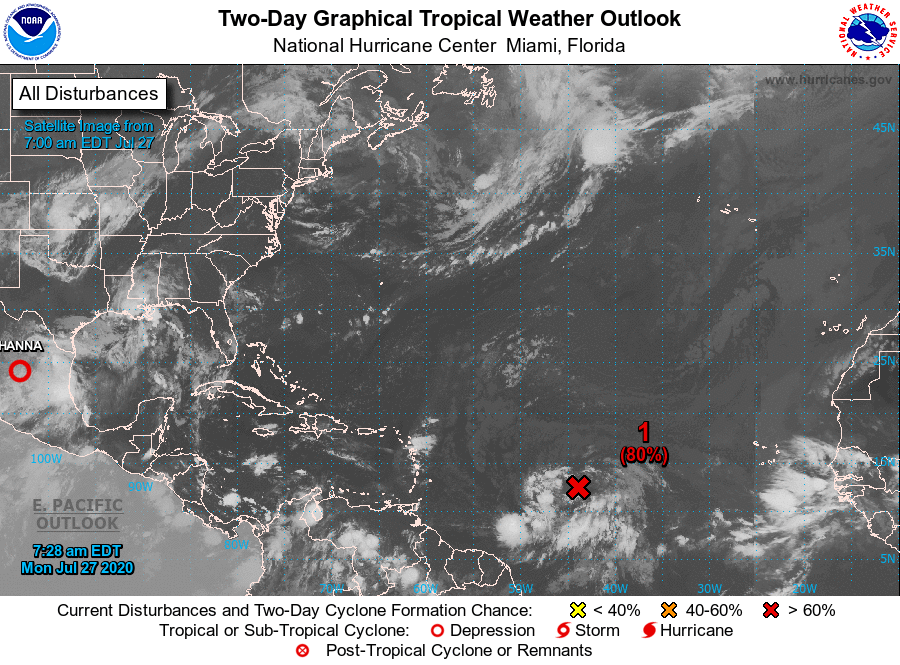
Invest 92-L is a broad area of low pressure associated with a tropical wave over the central tropical Atlantic about midway between the coast of Africa and the Lesser Antilles that is producing a large area of cloudiness, showers, and thunderstorms (marked with a red “X”).
Invest 92L 2020 Projected Path
NHC forecasters say that environmental conditions are expected to become increasingly conducive for development of this system, and a tropical depression or tropical storm is likely to form within the next day or two while moving westward to west-northwestward at 15 to 20 mph.
If Invest 92-L becomes a tropical storm or hurricane, the next name on the 2020 Atlantic Hurricane Names List is Isaias.
Invest 92-L has a 90 percent chance of tropical cyclone formation within the next 5 days and an 80 percent chance within the next 48 hours.
This system is expected to begin affecting portions of the Lesser Antilles on Wednesday or Wednesday night, and interests on those islands should continue to monitor its progress.
Invest 92-L 2020 Computer Models
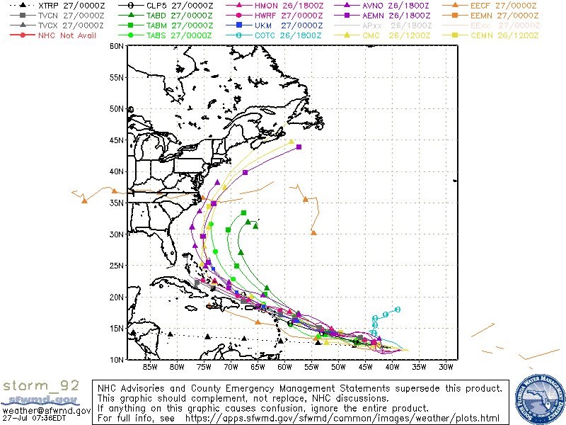
Spaghetti models are in general agreement that Invest 92L will move in a west-northwesterly direction across the tropical Atlantic Ocean followed by a curve to the northwest near Puerto Rico.
NOAA forecasts an ‘above-normal’ 2020 Atlantic Hurricane Season which runs from June 1 through November 30.