MIAMI — People in the U.S. Virgin Islands and Puerto Rico still have to keep one eye on the Atlantic Ocean.
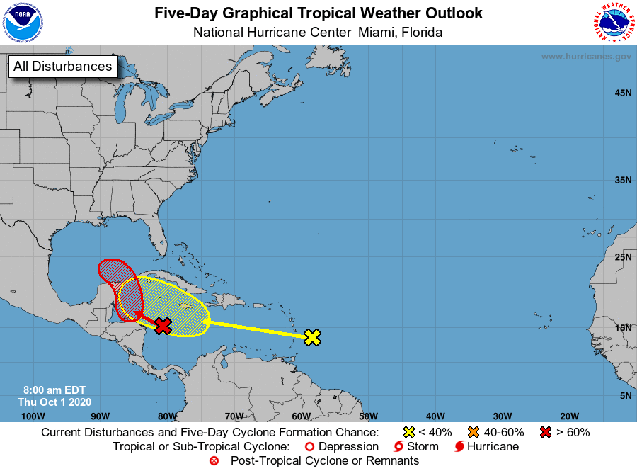
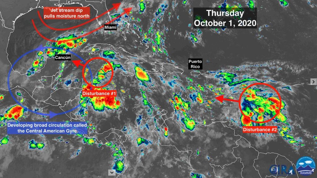
Two tropical waves were being tracked by meteorologists on Wednesday evening. One is in the west-central Caribbean Sea and has a good chance of strengthening into a tropical depression this weekend.
The other one was identified late Wednesday by the National Hurricane Center hundreds of miles east of the Lesser Antilles, its future still uncertain.

The tropical wave in the Caribbean was designated Tropical Disturbance 1. It’s forecast to move west and produce an area of low pressure in the western Caribbean (or the southern end of the Gulf of Mexico), according to the hurricane center
It has a 70 percent chance of strengthening into a tropical depression in the next five days or so, according to the hurricane center’s 8 p.m. Wednesday advisory. It’s expected to slowly move west-northwest, and those who live in Belize, western Cuba and the Yucatán Peninsula should watch out for the tropical system as it continues to gain strength.
The other tropical wave, classified as Tropical Disturbance 2, is still disorganized and also forecast to head west. The hurricane center gave it just a 20 percent chance of developing in the next five days. But conditions for strengthening could improve as it moves into the central or western Caribbean Sea early next week.
This has been a historically active Atlantic storm season, producing 23 named storms, eight hurricanes and two major hurricanes, Laura and Teddy, at a rapid rate.
September 2020 set a record with 10 named storms forming — Nana, Omar, Paulette, Rene, Sally, Teddy, Vicky, Wilfred, Alpha and Beta — and besting the old September record of eight named storms, according to Colorado State University hurricane forecaster Philip Klotzbach. September 2020 also tied the record for storms reaching the U.S. coastline. The record of nine storms making landfall was set when Tropical Storm Nine hit the Carolinas on Sept. 6, 1916.
While the Atlantic is emerging from a recent lull of tropical activity, hurricane season is far from over.
The emergence of two tropical systems could mean more meteorological records are about to fall as October starts. The emergence of La Niña could not only produce stronger storms, but also extend hurricane season past the official end date of Nov. 30.
La Niña is a weather phenomenon of cooler surface temperatures in the central and eastern Pacific Ocean that affects storm development in the Caribbean and Atlantic by reducing the wind shear that could disrupt storms before they form and weaken them as they cross the ocean.
This season has been so busy that meteorologists ran out of storm names. For the first time since 2005, the Greek alphabet is being used to identify storms. The next named storm to form would be the 24th of the year and would be called Gamma.
The Atlantic storm season is back: Meteorologists are tracking two systems, and one could become a tropical depression this weekend.


