SAN JUAN — Tropical Storm Earl has begun to intensify northeast of Puerto Rico and is now expected to become a hurricane.
Earl formed late Friday evening after Hurricane Hunters found a closed center and winds of 40 mph.
Since then, Earl has been fighting with wind shear and is a lopsided system. Much of the thunderstorm activity is being pushed eastward from the system. Despite this, slow intensification is expected.
There are two roadblocks that are slowing the development of this system for now. One factor is dry air and the other is the continued unfavorable upper-level winds.
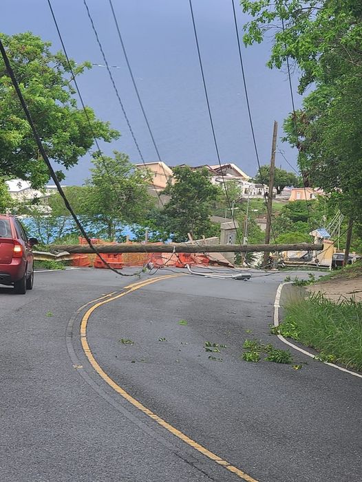
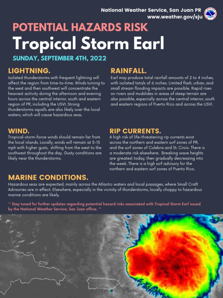
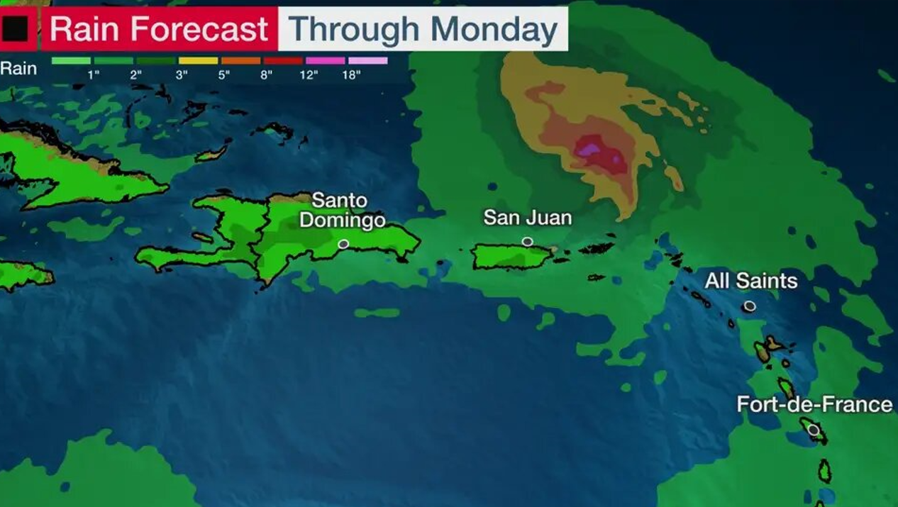
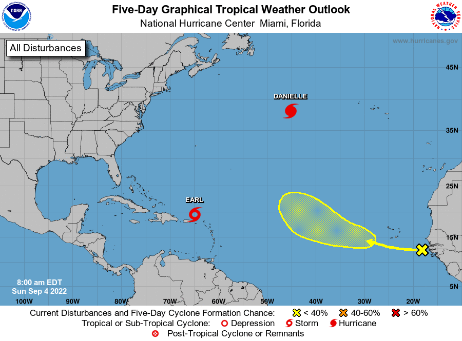
Forecast models suggest this area could develop and head slowly west-northwest to an area near or north of the Lesser Antilles by Saturday. Some additional showers and thunderstorms are possible from Puerto Rico to Barbados into this weekend. Between 2-4 inches of rainfall are expected with isolated totals to 6 inches. Rip currents and rough surf are also possible.
This system will likely then turn more northward into the western Atlantic with time through a weakness that develops in its high pressure steering wheel. Intensification is likely as it moves northward away from the Caribbean and Earl could take a run a hurricane status after Labor Day.
Earl would be the second hurricane of the season. Significant strengthening is possible by midweek.
That should allow it to pass well off the southeast U.S. coast, but we’ll be watching closely for any changes to that thinking. It’s possible high surf and rip currents generated by this system could reach the Southeast U.S. coast after Labor Day.