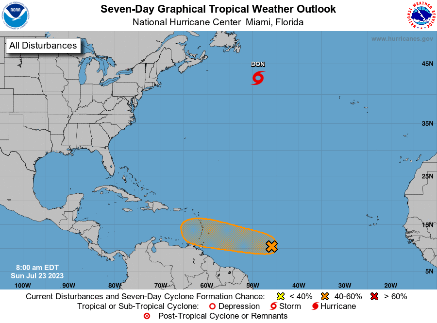
MIAMI — The first hurricane of the 2023 Atlantic Hurricane Season formed on Saturday afternoon.
Hurricane Don is still far from any land and hasn’t triggered any warnings.
Forecasters are still watching a disturbance in the eastern Tropical Atlantic that has a medium chance of becoming a tropical depression but is still a concern for those in the Lesser Antilles as it moves west over warmer waters and in the direction of eastern Caribbean islands, according to the National Hurricane Center.
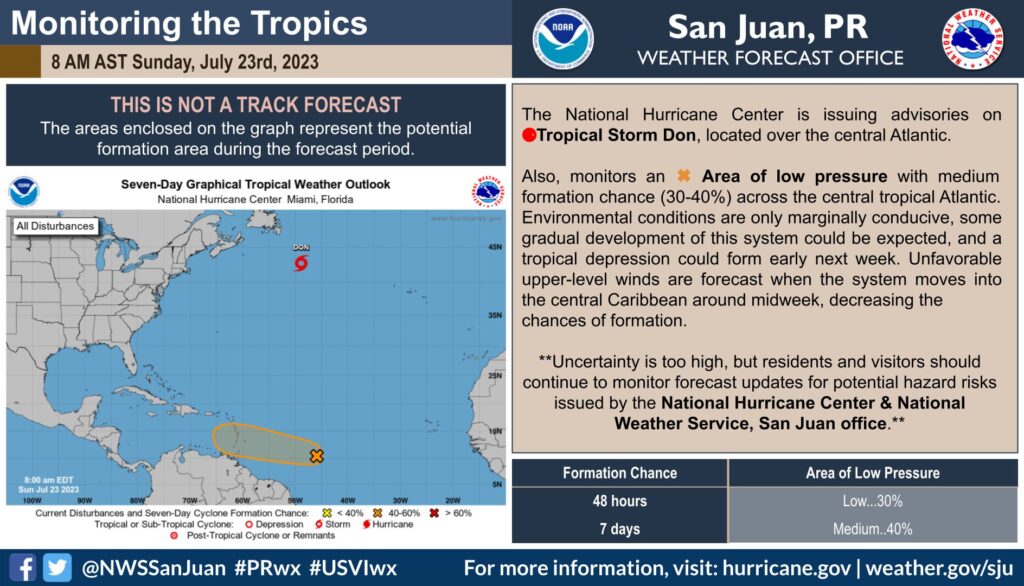
WHERE IS THE DISTURBANCE?
The tropical wave was roughly midway between the Cabo Verde Islands and the Lesser Antilles and showing signs of organization, according to the advisory from hurricane specialists Larry Kelly and Daniel Brown.
According to Brian McNoldy, senior research associate of the University of Miami’s Rosenstiel School, “The ocean is VERY warm ahead of it and those ocean temperatures are certainly relevant,” he wrote on his Tropical Atlantic Update blog. “Model guidance generally indicates it will reach the Lesser Antilles around Tuesday at tropical storm intensity or possibly Category 1 hurricane.”
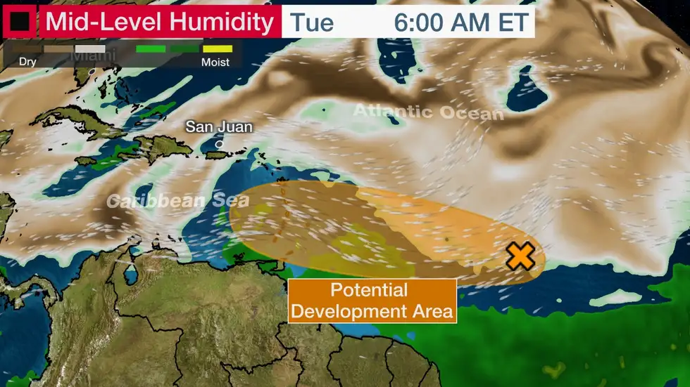
THE WAVE’S DIRECTION?
The shower activity surrounding this system became a little less organized compared to Friday, according to the 2 p.m. Saturday advisory. “Environmental conditions are forecast to remain marginally conducive for some gradual development, and this system could become a tropical depression early next week while it moves westward across the tropical Atlantic.
“Interests in the Lesser Antilles should monitor the progress of this system,” Kelly said.
The storm would be named Emily. The system’s formation chances declined by 20 percentage points over the next two days.
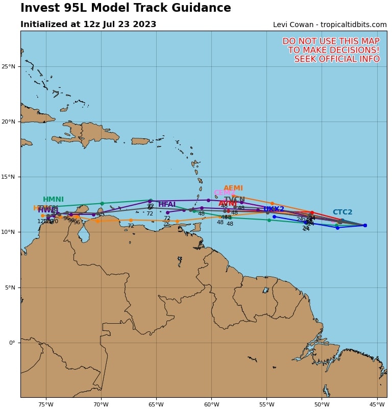
Forecasters expect Invest 95L to arrive south of our region as a strong depression or tropical wave sometime between Tuesday and Wednesday.
Shower activity remains limited in association with a small area of low pressure located about 1,000 miles east of the Windward Islands.
Although environmental conditions are only forecast to be marginally conducive for some gradual development, this system could still become a tropical depression during the next few days while it
moves westward across the tropical Atlantic and eastern Caribbean Sea.
Unfavorable upper-level winds are forecast when the system moves into the central Caribbean around midweek, decreasing the chances of formation.
* Formation chance through 48 hours…low…30 percent.
* Formation chance through 7 days…medium…40 percent.
