SAN JUAN — Light to moderate rainfall will continue today across the U.S. Virgin Islands and Puerto Rico, the National Weather Service said.
This rain will slowly diminish this evening or early tomorrow, and drier conditions are expected after that, according to the NWS.
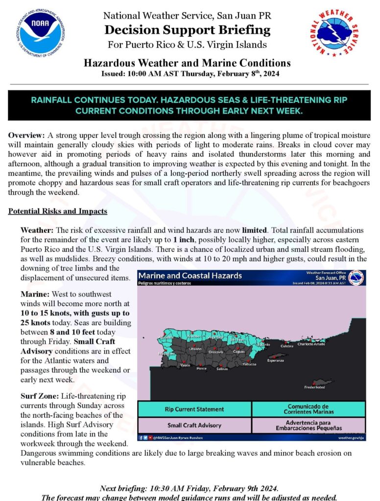
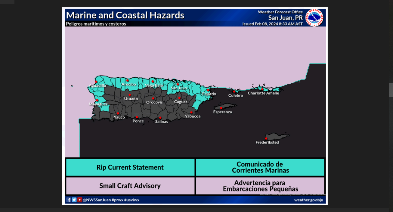
Marine and coastal conditions are deteriorating due to a northwesterly swell. Conditions will be hazardous for the Atlantic and for the north and west facing beaches of PR, Culebra, St. Thomas and St. John.
A strong upper level trough crossing the region along with a lingering plume of tropical moisture
will maintain generally cloudy skies with periods of light to moderate rains.
Breaks in cloud cover may however aid in promoting periods of heavy rains and isolated thunderstorms later this morning and afternoon, although a gradual transition to improving weather is expected by this evening and tonight.
In the meantime, the prevailing winds and pulses of a long-period northerly swell spreading across the region will promote choppy and hazardous seas for small craft operators and life-threatening rip currents for beachgoers through the weekend.
Potential Risks and Impacts
Weather: The risk of excessive rainfall and wind hazards are now limited. Total rainfall accumulations
for the remainder of the event are likely up to 1 inch, possibly locally higher, especially across eastern
Puerto Rico and the U.S. Virgin Islands. There is a chance of localized urban and small stream flooding,
as well as mudslides. Breezy conditions, with winds at 10 to 20 mph and higher gusts, could result in the downing of tree limbs and the displacement of unsecured items.
Marine: West to southwest winds will become more north at 10 to 15 knots, with gusts up to 25 knots today. Seas are building between 8 and 10 feet today through Friday. Small Craft Advisory conditions are in effect for the Atlantic waters and passages through the weekend or early next week.
Surf Zone: Life-threatening rip currents through Sunday across the north-facing beaches of the islands. High Surf Advisory conditions from late in the workweek through the weekend. Dangerous swimming conditions are likely due to large breaking waves and minor beach erosion on vulnerable beaches.