
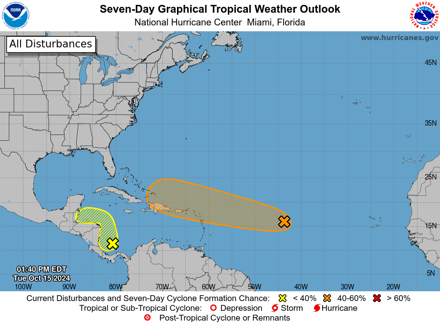
MIAMI — Forecasters continue to monitor two areas of disturbed weather that could develop into tropical systems.
One area being watched closely is located over the central Atlantic Ocean and has been designated Invest 94L, while the second area of disturbed weather is centered over the western Caribbean Sea.
Forecasters with the National Hurricane Center (NHC) said Invest 94L remains over the central Atlantic Ocean and is a well-defined area of low pressure that has been producing precipitation and thunderstorms.
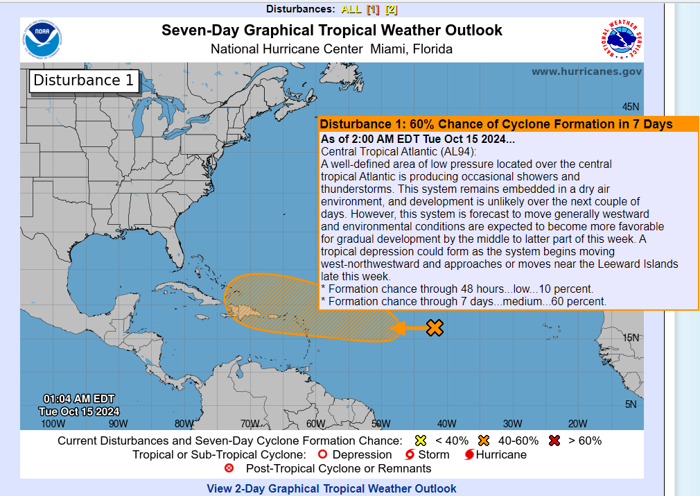
The NHC said Invest 94L remains in a dry air environment, and development of the system over the next day or two remains unlikely. However, the system is expected to continue to move off to the west into an environment that will be more favorable for development, and a tropical depression could form as it approaches or moves near the Leeward Islands and into the Caribbean Sea.
The NHC said the system has a low chance of developing over the next two days and a medium chance of developing over the next week.
But people living in, working in and visiting the U.S. Virgin Islands and Puerto Rico should closely monitor the forecast this week.