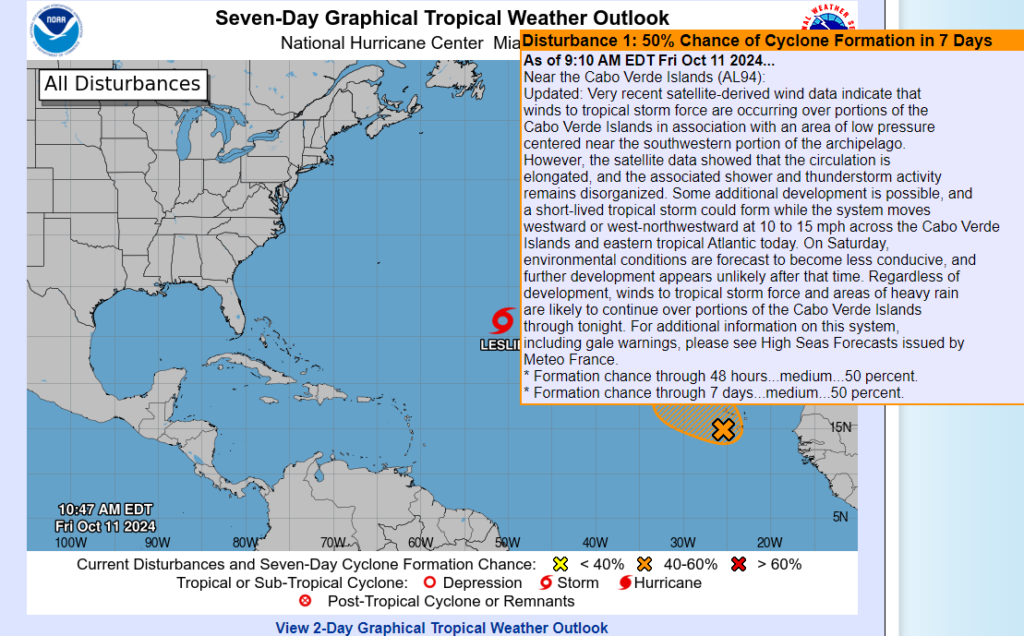
MIAMI —Very recent satellite-derived wind data indicate that winds to tropical storm force are occurring over portions of the Cabo Verde Islands in association with an area of low pressure centered near the southwestern portion of the archipelago.
However, the satellite data showed that the circulation is elongated, and the associated shower and thunderstorm activity remains disorganized.
Some additional development is possible, and a short-lived tropical storm could form while the system moves westward or west-northwestward at 10 to 15 mph across the Cabo Verde Islands and eastern tropical Atlantic today.
On Saturday, environmental conditions are forecast to become less conducive, and further development appears unlikely after that time.
Regardless of development, winds to tropical storm force and areas of heavy rain are likely to continue over portions of the Cabo Verde Islands through tonight.
For additional information on this system, including gale warnings, please see High Seas Forecasts issued by Meteo France.
* Formation chance through 48 hours…medium…50 percent.
* Formation chance through 7 days…medium…50 percent.
High Seas Forecasts issued by Meteo France under WMO header FQNT50 LFPW and available on the web at:
www.meteofrance.com/previsions-meteo-marine/bulletin/grandlarge/metarea2.