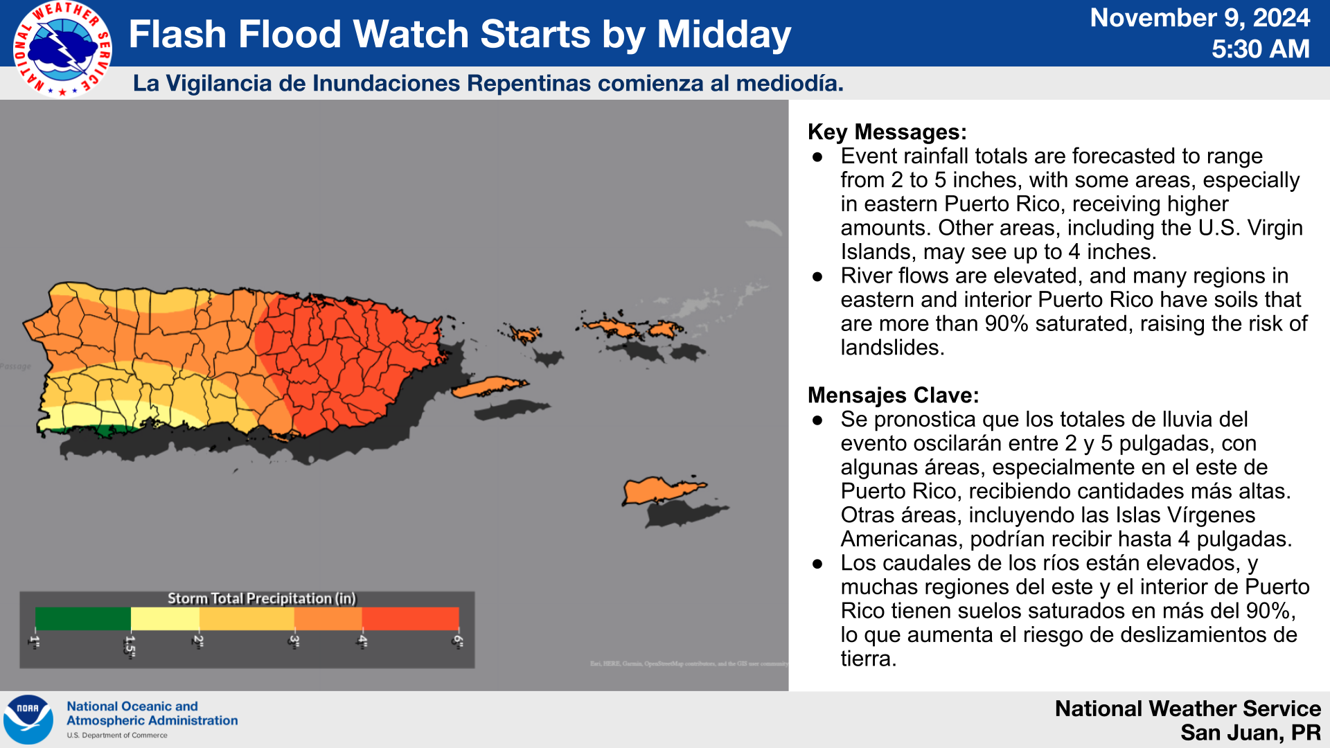
CHRISTIANSTED — A Flash Flood Watch remains in effect for the U.S. Virgin Islands and Puerto Rico, the National Weather Service said this morning.
A wet and unstable weather pattern with an elevated to significant flooding risk is expected, according to the NWS.
This is due to a combination of an exceptional tropical moisture pattern, a lingering frontal boundary to the north, persistent southerly winds bringing additional tropical moisture, and the passage of a tropical wave.

Areas at Risk:
- Flooding threat: All of Puerto Rico and the U.S. Virgin Islands, with the greatest risk concentrated in eastern Puerto Rico.
- Mudslide threat: All of Puerto Rico, with the highest risk across eastern and central sections, particularly in areas where soils are nearly 90% saturated.

Hazardous Events & Potential Threats/Impacts:
- Flash Flood Watch: In effect from midday today through 8 PM AST Sunday.
- Additional Hazards:
- Thunderstorms: Producing frequent lightning and strong gusty winds.
For updates on excessive rainfall, lightning, and other hazard risks, along with a detailed map of the areas at risk, refer to the Experimental Graphical Hazard Weather Outlook: https://www.weather.gov/erh/ghwo?wfo=sju.


