SAN JUAN — Wet and unstable weather conditions will prevail across the region as moisture associated with a tropical wave continues to filter into the area, the National Weather Service said this morning.
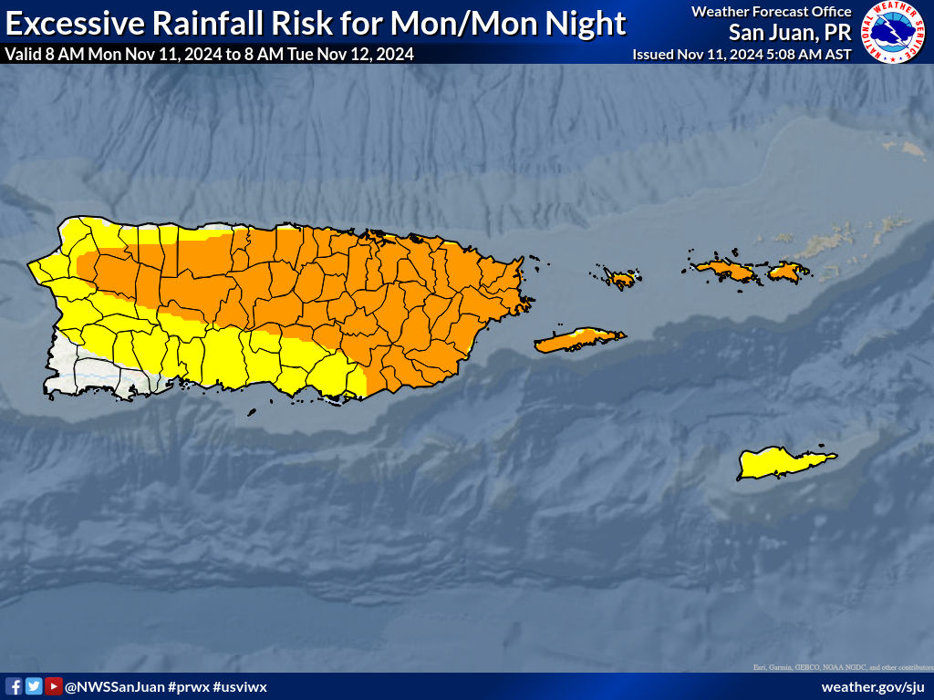
Additional rainfall is expected today, which will enhance the potential for flooding, landslides, and rapid river rises, according to the NWS.
Marine and coastal conditions will gradually deteriorate from today onwards with the arrival of a northerly swell, it said.
This will bring hazardous seas and life-threatening rip currents, particularly along the northern coast of Puerto Rico, Culebra, and the U.S. Virgin Islands.

Areas at Risk:
- Flooding threat: From limited to elevated across Puerto Rico and the U.S. Virgin Islands. (See attached image).
- Mudslide threat: Saturated soils due to rainfall over the recent days.
Dangerous marine and coastal conditions:
- High risk of rip currents: Across the north-facing beaches of Puerto Rico, from Rincón to Fajardo, Culebra, and the U.S. Virgin Islands, in effect from this afternoon until at least Tuesday afternoon.
- High Surf Advisory: Across the north-facing beaches of Puerto Rico, from Aguadilla to Fajardo, Culebra, St. Thomas, and St. John in the U.S. Virgin Islands, in effect from Tuesday morning until at least Tuesday afternoon. Large breaking waves up to 10-12 feet producing dangerous swimming conditions and minor beach erosion.
- Small Craft Advisory: For Atlantic waters and local passages, in effect until at least Tuesday afternoon.
For updates on excessive rainfall, lightning, and other hazard risks, along with a detailed map of the areas at risk, refer to the Experimental Graphical Hazard Weather Outlook: https://www.weather.gov/erh/ghwo?wfo=sju.


