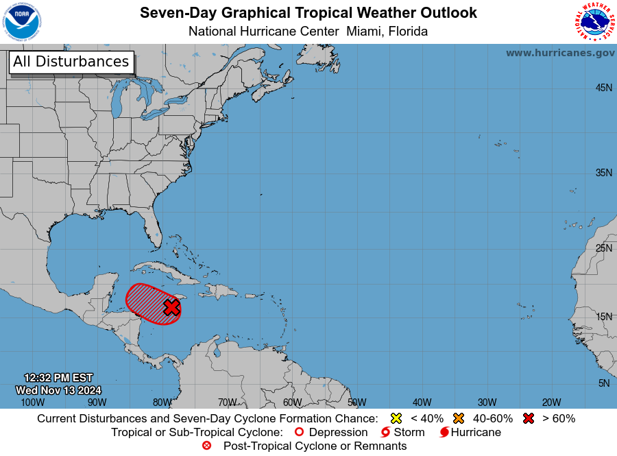
KINGSTON — A broad area of low pressure over the central Caribbean Sea has an 80% chance of becoming a cyclone in the next 48 hours, the National Hurricane Center said today.
“Environmental conditions appear conducive for development, and a tropical depression is likely to form within the next couple of days,” the NHC said.
The developing cluster of showers and thunderstorms over the Caribbean now has a name.

The NHC is tracking Invest 99L as it moves over the central Caribbean Sea and gives the tropical rainstorm a 90% chance of developing into a tropical depression in the next two days.
AccuWeather forecasters say it’s likely going to be named Tropical Storm Sara, and could potentially threaten Florida as a major hurricane next week.
“The potential exists for the rainstorm to intensify into a hurricane as early as Friday morning,” AccuWeather forecasters said. “Further intensification is expected after that, and a Category 3 major hurricane (maximum sustained winds of 111 mph or greater) is likely to be churning in the western Caribbean this weekend.”

“We’ll likely be dealing with a hurricane as we head into this weekend. There is increasing confidence that a tropical storm will develop in the central to western Caribbean later this week,” AccuWeather Lead Hurricane Expert Alex DaSilva said in an email release. “We could be dealing with a storm that rapidly intensifies into a major hurricane in these very conducive conditions. The atmosphere is primed for development.”
The wave is on course to approach the same region of warm water that produced hurricanes Rafael, Milton and Helene. What happens next depends on the position of a dome of high pressure along the southern Atlantic coast.
- If the high pressure stays where it is, it will likely steer the storm into Central America or southeastern Mexico later this weekend to next week, AccuWeather said.
- If the dome of high pressure moves away or weakens, it could allow steering breezes to guide the storm toward the Florida Keys and South Florida or along the Gulf coast.

DaSilva said the speed of development and track early on could affect landfall and direct impacts.
“Not only does this have a significant chance of becoming a hurricane, but it may become a major hurricane very quickly,” he said.
Meanwhile, remnants of Rafael are expected to merge with a cold front moving over the U.S. Wednesday and Thursday and bring heavy rain to Mississippi, Louisiana, Alabama, Tennessee, and the tip of the Florida Panhandle. The northern Gulf Coast, including Florida, can expect high surf and dangerous rip currents.


