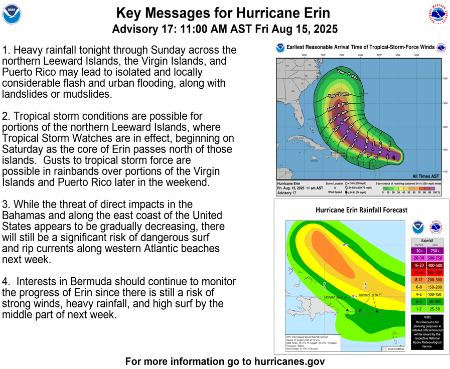
While it’s looking very likely that Hurricane Erin will avoid landfall in the USVI, the territory will likely still feel some effects – mainly in the form of tropical storm force winds, flash floods, high surf and rip currents.
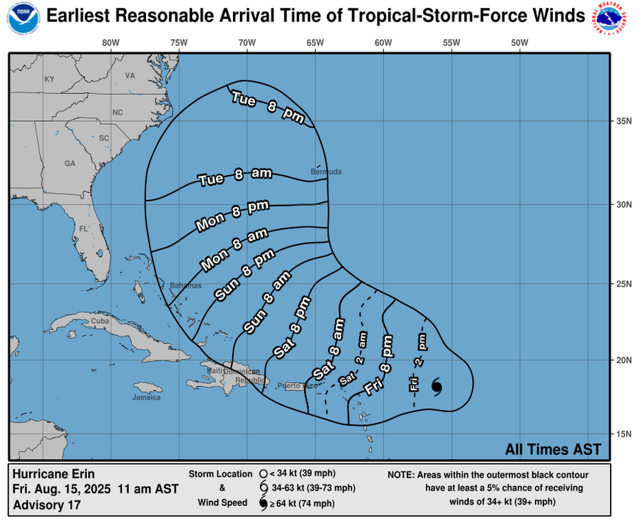
Experts say the earliest arrival of tropical storm force winds in the U.S. Virgin Islands will be between 2:00 a.m. and 8:00 a.m. tomorrow.
Puerto Rico is likely to see tropical storm force winds about 8:00 a.m. with outlying islands such as Culebra and Vieques seeing them sooner than that.
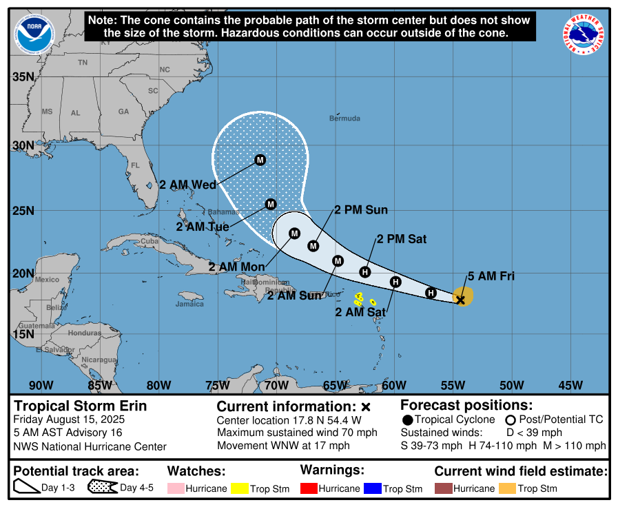
The latest forecast from the National Hurricane Center calls for Erin to cruise west for the next few days — staying comfortably north of inhabited islands — before hooking north early next week and avoiding direct landfall in the Bahamas or Florida.
Although the storm is expected to remain over open waters, tropical storm watches were issued for Anguilla, Barbuda, Saint Martin, St. Barts, Saba, St. Eustatius and Sint Maarten.
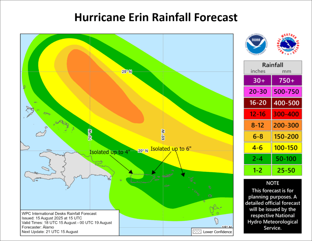
Heavy rains were forecast to start late today in Antigua and Barbuda, the U.S. and British Virgin Islands and southern and eastern Puerto Rico. Up to 4 inches (10 centimeters) are expected, with isolated totals of up to 6 inches (15 centimeters), according to the National Hurricane Center in Miami.
Forecasters also warned of dangerous swells.
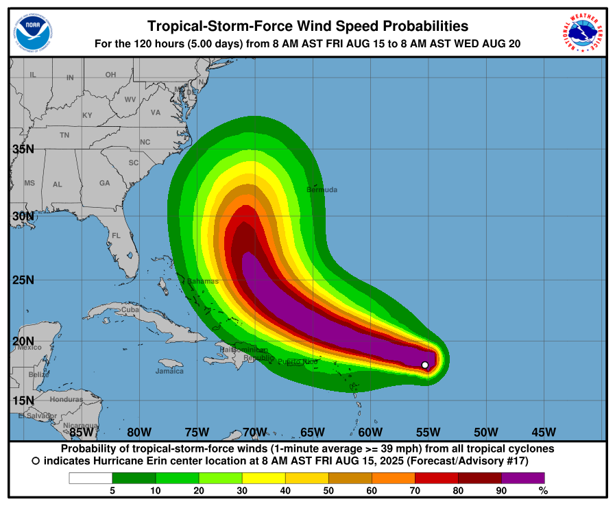
The storm was located about 415 miles (665 kilometers) east of the Northern Leeward Islands. It had maximum sustained winds of 75 mph (120 kph) and was moving west-northwest at 17 mph (28 kph).
National Weather Service Miami Meteorologist Donal Harrigan said that swells associated with Erin could begin reaching Florida shores early Saturday.
That could push waves 3 to 5 feet higher than normal in some spots on the central and north Florida coast.
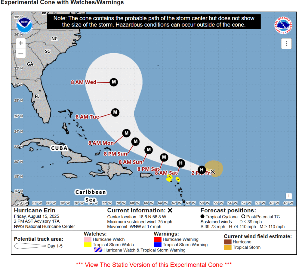
Erin strengthened into the first hurricane of the 2025 Atlantic season about 11:00 a.m., and is now forecast to hit Category 4 in a few days in the open ocean.
The latest forecast from the National Hurricane Center calls for Erin to cruise west for the next few days — staying comfortably north of inhabited islands — before hooking north early next week and avoiding direct landfall in the Bahamas or Florida.
Hurricane specialist and storm surge expert Michael Lowry said Erin is forecast to eventually take a sharp turn northeast that would put it on a path between the U.S. and Bermuda.
“The forecasts for next week still keep the future hurricane safely east of the mainland U.S.,” he said.
Erin, which is the Atlantic season’s first hurricane, is forecast to become a major Category 3 storm late this weekend and pass some 200 miles (320 kilometers) north of Puerto Rico.
The hurricane center noted “there is still uncertainty about what impacts Erin may bring to portions of the Bahamas, the east coast of the United States, and Bermuda in the long range.”
Dangerous surf and rip currents are expected to affect the U.S. East Coast next week, with waves reaching up to 15 feet (5 meters) along parts of the North Carolina coast that could cause beach erosion, according to Accuweather.

“Erin is forecast to explode into a powerful Category 4 hurricane as it moves across very warm waters in the open Atlantic. Water temperatures at the surface and hundreds of feet deep are several degrees higher than the historical average,” said Alex DaSilva, Accuweather’s lead hurricane expert.
Erin is the fifth named storm of the Atlantic hurricane season, which runs from June 1 to Nov. 30.
This year’s season is once again expected to be unusually busy. The forecast calls for six to 10 hurricanes, with three to five reaching major status with winds of more than 110 mph (177 kph).