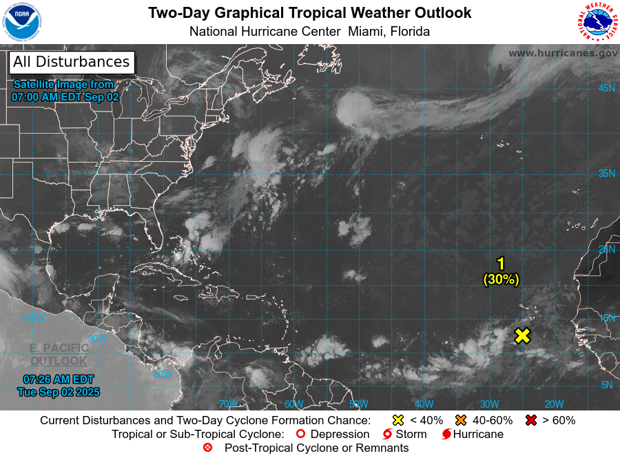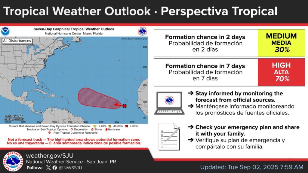
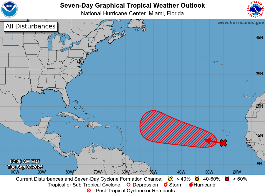
The National Hurricane Center (NHC) continues monitoring a tropical wave over the Atlantic with a low formation chance in the next 48 hours (30%) and a high formation chance in the next seven days (70%).
Central Tropical Atlantic
A tropical wave located over the far eastern tropical Atlantic south of the Cabo Verde islands is producing disorganized showers and thunderstorms.
Environmental conditions appear conducive for gradual development of this system during the next several days, and a tropical depression is likely to form later this week or this weekend.
This system is expected to move westward to west-northwestward at around 15 mph across the eastern and central tropical Atlantic through the weekend.
* Formation chance through 48 hours…low…30 percent.
* Formation chance through 7 days…high…70 percent.
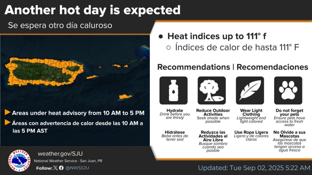
HEAT ADVISORY NOW IN EFFECT FROM 10 AM THIS MORNING TO 5 PM AST THIS AFTERNOON
* WHAT...This level of heat affect most individuals sensitive to heat, especially those without effective cooling and/or adequate hydration. Impacts possible in some health system and in heat-sensitive industries.
* WHERE…Portions of Puerto Rico and Virgin Islands.
* WHEN…From 10 AM this morning to 5 PM AST this afternoon.
* IMPACTS…Hot temperatures and high humidity may cause heat illnesses.
PRECAUTIONARY/PREPAREDNESS ACTIONS
Drink plenty of fluids, stay in an air-conditioned room, stay out of the sun, and check up on relatives and neighbors.
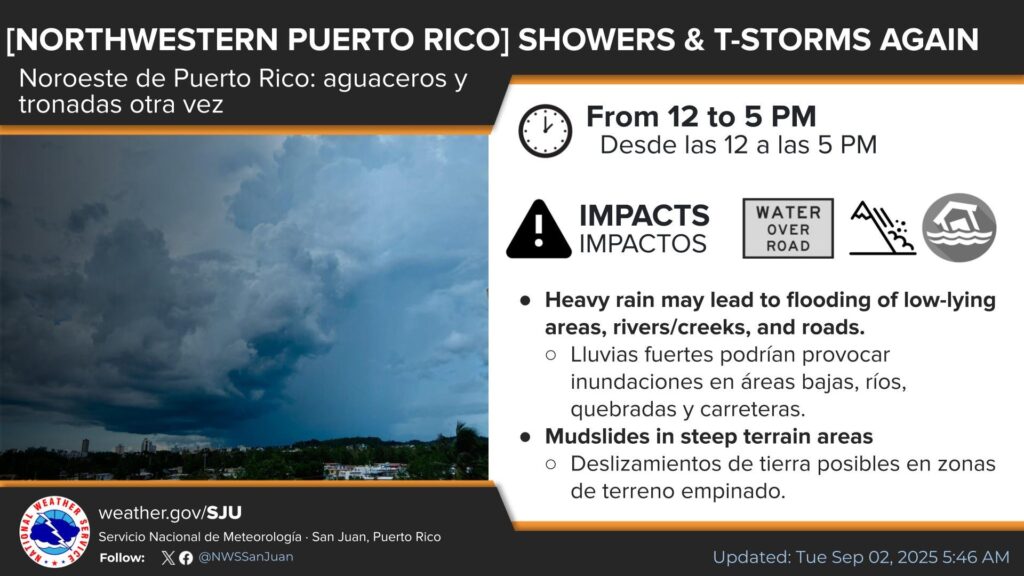
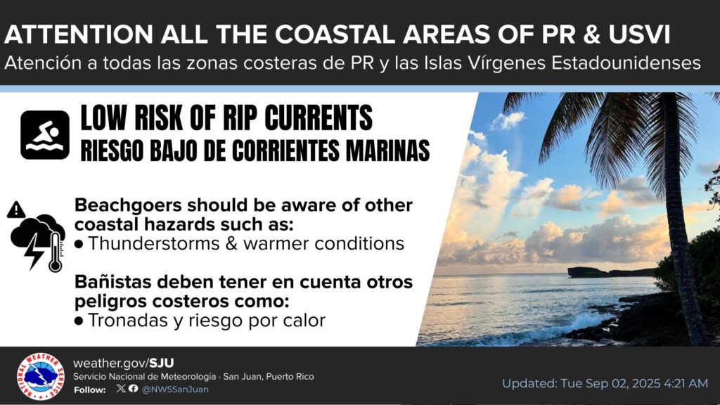
We can expect afternoon showers today resulting in minor and low-lying flooding along the northwestern sections of Puerto Rico.