![]()
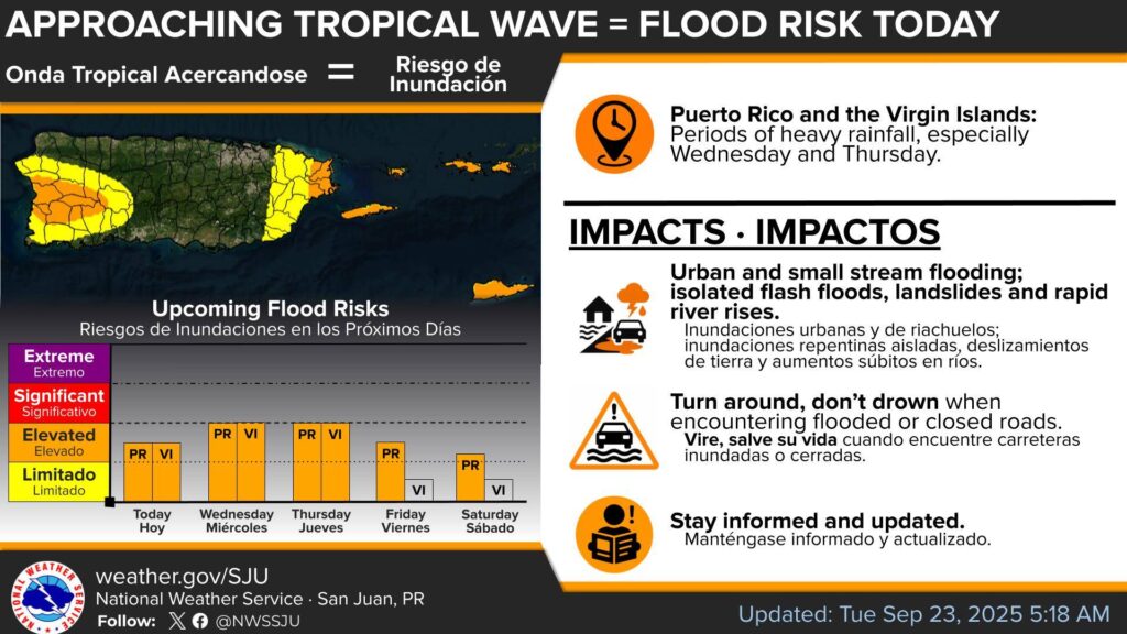
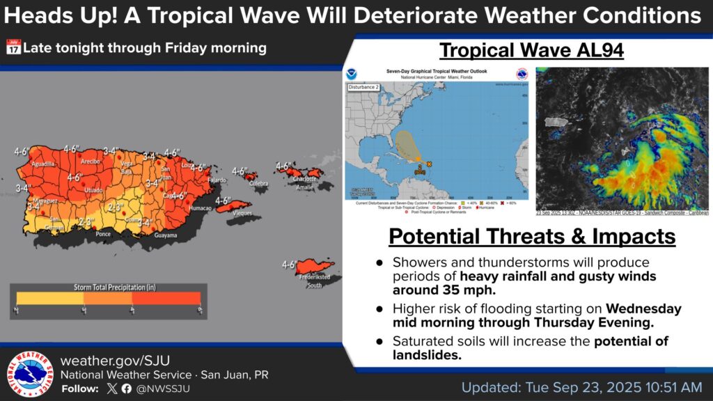
![]() With the approach of the tropical wave Invest 94-L late tonight, a wet pattern is expected to persist throughout the rest of the workweek, increasing the risk of flooding.
With the approach of the tropical wave Invest 94-L late tonight, a wet pattern is expected to persist throughout the rest of the workweek, increasing the risk of flooding.
Scrutinize your plans for this week, don’t forget the umbrella!
Always remember, turn around, don’t drown when you find flooded areas!![]()
![]()
![]()
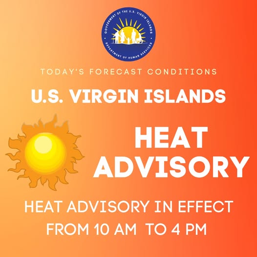
![]() Heat Advisory is in effect for the U.S. Virgin Islands and Puerto Rico from 10 AM through 4 PM today.
Heat Advisory is in effect for the U.S. Virgin Islands and Puerto Rico from 10 AM through 4 PM today.
![]()
![]() AFTERNOON hours: there is an elevated risk of flooding for the western and southwestern sections of the islands.
AFTERNOON hours: there is an elevated risk of flooding for the western and southwestern sections of the islands.
![]()
![]() TONIGHT: There is an elevated risk of flooding in eastern Puerto Rico, Vieques, Culebra and the U.S. Virgin Islands.
TONIGHT: There is an elevated risk of flooding in eastern Puerto Rico, Vieques, Culebra and the U.S. Virgin Islands.
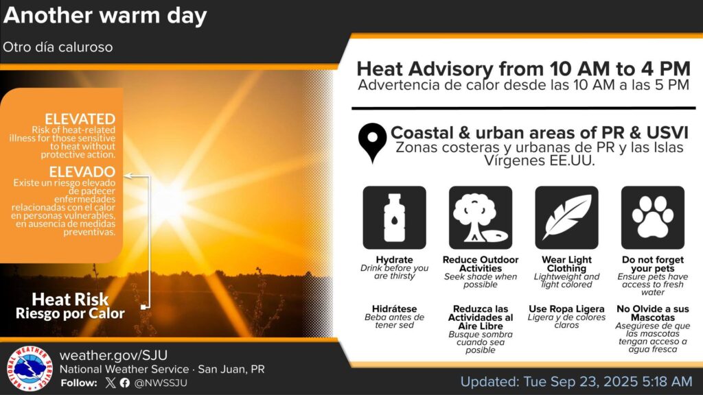
HEAT ADVISORY IN EFFECT FROM 10 AM THIS MORNING TO 4 PM AST THIS AFTERNOON
* WHAT…This level of heat affect most individuals sensitive to heat, especially those without effective cooling and/or adequate hydration. Impacts possible in some health system and in heat-sensitive industries.
* WHERE…All urban and coastal areas, as well as the eastern interior of Puerto Rico, Vieques, Culebra, and U.S. Virgin Islands.
* WHEN…From 10 AM this morning to 4 PM AST this afternoon.
* IMPACTS…Hot temperatures and high humidity may cause heat illnesses.
PRECAUTIONARY/PREPAREDNESS ACTIONS
Drink plenty of fluids, stay in an air-conditioned room, stay out of the sun, and check up on relatives and neighbors.
Take extra precautions when outside. Wear lightweight and loose fitting clothing. Try to limit strenuous activities to early morning or evening.
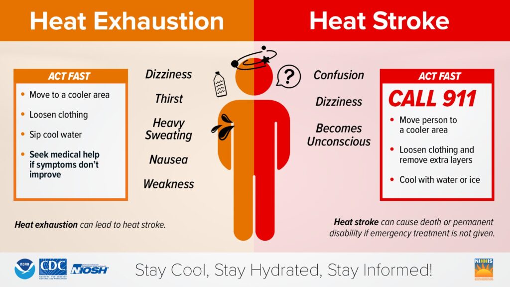
Take action when you see symptoms of heat exhaustion and heat stroke.
Active Systems
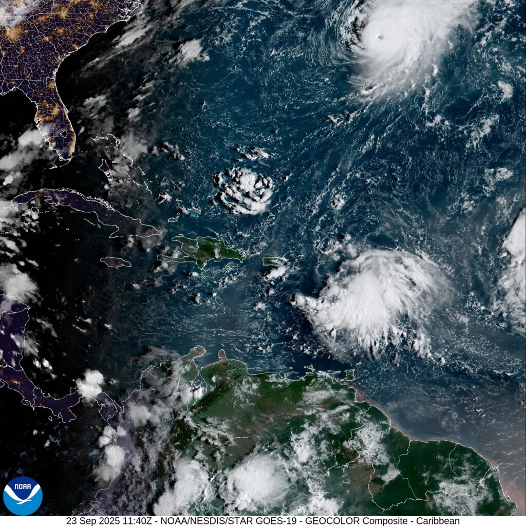
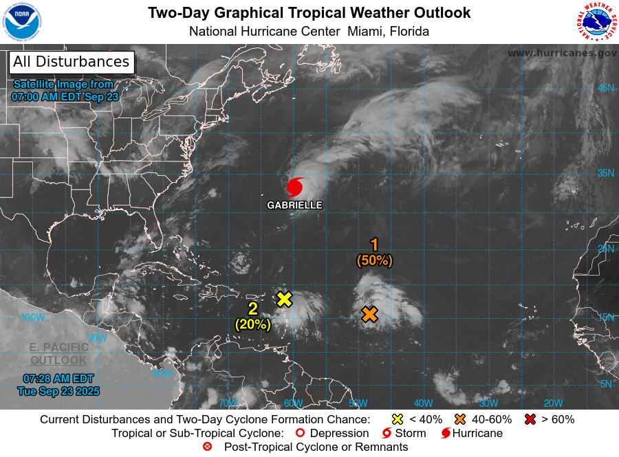
The National Hurricane Center is issuing advisories for Hurricane Gabrielle, located over the central subtropical Atlantic.
Central and Western Tropical Atlantic (Invest 93-L)
Shower and thunderstorm activity associated with a tropical wave located a little less than 1000 miles east of the Lesser Antilles continues to show signs of organization.
Environmental conditions are forecast to be favorable for development over the next several days, and a tropical depression is likely to form by the latter half of this week while the system moves west-northwestward to northwestward into the western tropical Atlantic.
* Formation chance through 48 hours…medium…50 percent.
* Formation chance through 7 days…high…90 percent.
East of the Leeward Islands (Invest 94-L)
A tropical wave is producing a large area of disorganized showers and thunderstorms, and gusty winds across much of the Windward and Leeward Islands.
This wave is expected to move west-northwestward at 15 to 20 mph, spreading heavy rainfall and gusty winds into Puerto Rico and the Virgin Islands tonight and Wednesday.
The system is then expected to slow down and turn northwestward when it reaches the southwestern Atlantic near the Bahamas late this week, and a tropical depression could form when the disturbance is in that region.
Interests in the Virgin Islands, Puerto Rico, the Turks and Caicos Islands, and the Bahamas should monitor the progress of this system.
* Formation chance through 48 hours…low…20 percent.
* Formation chance through 7 days…medium…60 percent.