![]() Wednesday, October 15, 2025
Wednesday, October 15, 2025
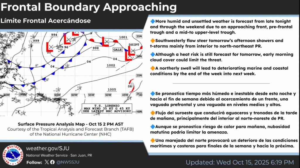
Frontal Boundary Approaching
![]() More humid and unsettled weather is forecast from late tonight and through the weekend due to an approaching front, pre-frontal trough and a mid-to upper-level trough.
More humid and unsettled weather is forecast from late tonight and through the weekend due to an approaching front, pre-frontal trough and a mid-to upper-level trough.
![]() Southwesterly flow steer tomorrow’s afternoon showers and t-storms mainly from interior to north-northeast PR.
Southwesterly flow steer tomorrow’s afternoon showers and t-storms mainly from interior to north-northeast PR.
![]() Although a heat risk is still forecast for tomorrow, early morning cloud cover could limit the threat.
Although a heat risk is still forecast for tomorrow, early morning cloud cover could limit the threat.
![]() A northerly swell will lead to deteriorating marine and coastal conditions by the end of the week into next week.
A northerly swell will lead to deteriorating marine and coastal conditions by the end of the week into next week.
![]()
![]()
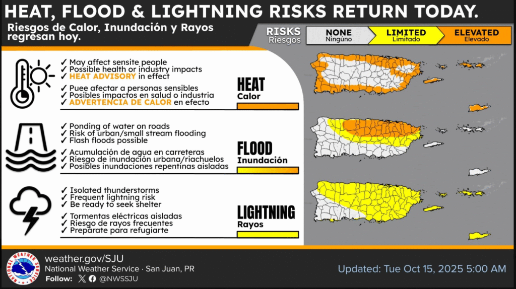
![]() HEAT, FLOOD & LIGHTNING RISKS RETURN TODAY
HEAT, FLOOD & LIGHTNING RISKS RETURN TODAY
![]() Although the timing remains typical (12–5 PM), S–SW winds will push storms into the northeast, including parts of the San Juan Metro, during peak driving hours.
Although the timing remains typical (12–5 PM), S–SW winds will push storms into the northeast, including parts of the San Juan Metro, during peak driving hours.
![]() Heat Advisory early, heat will decrease later in the afternoon.
Heat Advisory early, heat will decrease later in the afternoon.
![]() Flooding and
Flooding and ![]() lightning may continue into the evening and night.
lightning may continue into the evening and night.
![]() Greatest impacts likely when most people are on the road.
Greatest impacts likely when most people are on the road.
![]() Plan for delays
Plan for delays
![]() Be ready to seek shelter
Be ready to seek shelter
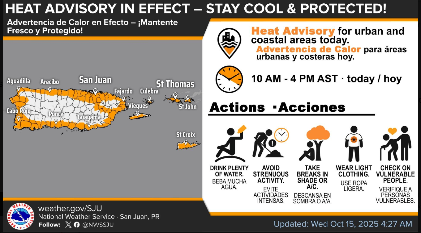
HEAT ADVISORY IN EFFECT FROM 10 AM THIS MORNING TO 4 PM AST THIS AFTERNOON
* WHAT…This level of heat affect most individuals sensitive to heat, especially those without effective cooling and/or adequate hydration. Impacts possible in some health system and in heat-sensitive industries.
* WHERE…Portions of the Virgin Islands and Puerto Rico.
* WHEN...From 10 AM this morning to 4 PM AST this afternoon.
* IMPACTS…Hot temperatures and high humidity may cause heat illnesses.
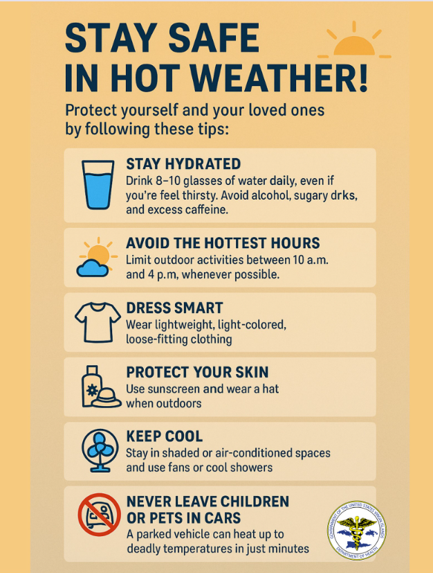
PRECAUTIONARY/PREPAREDNESS ACTIONS
Drink plenty of fluids, stay in an air-conditioned room, stay out of the sun, and check up on relatives and neighbors.