
By V.I. Free Press Staff
ST. CROIX — Residents across the territory should prepare for a “weather sandwich” today: significant rainfall and potential flooding coupled with dangerously high heat levels.
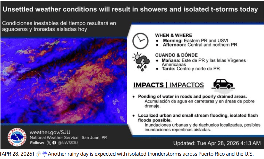
The Wet Weather Outlook
A surge of deep moisture is filtering into the region, pushing precipitable water values to approximately 2 inches—well above normal for late April.
- Morning Timing: Showers and isolated thunderstorms are expected to increase in frequency across the U.S. Virgin Islands and eastern Puerto Rico through the morning hours.
- Flooding Risks: Because winds are light (under 5 knots), rain clouds will move slowly, leading to prolonged downpours in specific areas. This increases the risk of:
- Ponding of water on roadways and in poorly drained areas.
- Localized urban flooding and small stream flooding.
- Lightning strikes from isolated thunderstorms.
The Heat Factor
Despite the cloud cover and rain, temperatures remain unseasonably high.
- Heat Index: Urban and coastal areas can expect heat indices—the “feels like” temperature—to reach or exceed 100°F.
- Winds: A light southeasterly flow will keep the air humid and heavy through midweek.
Marine and Beach Conditions
- Rip Currents: A moderate risk of rip currents remains in effect for north and east-facing beaches on St. Croix, St. Thomas, and St. John.
- Seas: Marine conditions remain relatively calm with seas between 2 and 4 feet, though mariners should be alert for gusty winds and higher waves near thunderstorms.