
By JOHN McCARTHY / V.I. Free Press Staff Writer
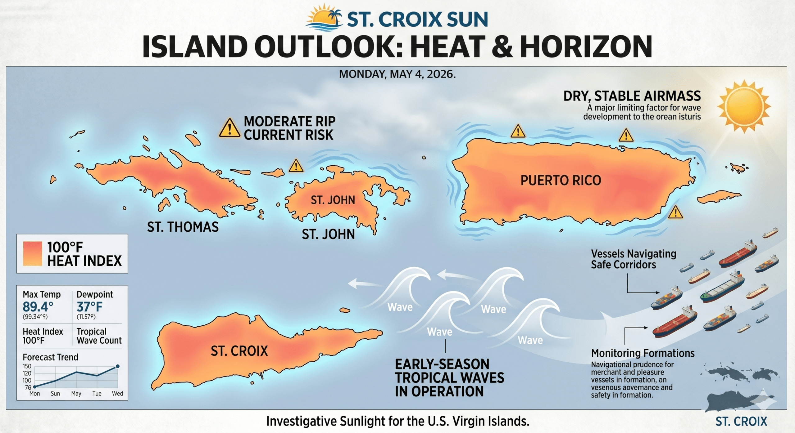
ST. CROIX — Residents across the U.S. Virgin Islands should prepare for a week of sweltering conditions as a warm airmass advected by southeasterly flow continues to push heat indices toward the triple-digit mark. National Weather Service forecasters in San Juan warned Monday that the combination of high humidity and above-normal temperatures will create a limited heat risk, with urban and coastal areas likely to see the mercury feel as high as 100°F or more throughout the afternoon. While the morning hours remain dominated by a strengthening trade wind cap and mid-level drying, the stability is expected to give way slightly by Tuesday as a weak polar trough approaches from the west, potentially introducing isolated thunderstorms to a region currently parched by a lack of significant rainfall.
The marine environment remains a primary concern for local mariners and beachgoers alike, as a small, long-period northeasterly swell continues to filter through the local passages. This swell is maintaining a moderate risk of rip currents across north- and east-facing beaches, with breakers occasionally reaching heights that require caution for small craft operators venturing beyond the reef. Despite the breeze occasionally gusting up to 25 mph, the broader pattern remains one of increasing dryness, a factor that has already pushed the Keetch-Byram Drought Index above 600 and prompted a Fire Danger Statement for parts of the region as fine fuels continue to desiccate under the relentless Caribbean sun.
Looking toward the horizon, meteorologists are beginning to monitor the progress of early-season tropical waves currently transiting the southern sectors of our region. While moisture availability remains the primary limiting factor for widespread deep convection this week, these low-level disturbances are advecting patches of moisture that could bring a much-needed increase in shower activity by Wednesday. Though significant development is not anticipated in the immediate term, the proximity of these waves serves as a reminder that the transition toward a more dynamic weather pattern is underway, even as a secondary drying trend looms for the upcoming weekend.
Current Conditions & Daily Outlook
- Today (Monday, May 4, 2026): Expect daytime highs of 29°C (84°F) with scattered thunderstorms possible and a 35% chance of rain.
- Conditions: The area is currently partly sunny with a temperature of 29°C and a feels-like temperature of 32°C (90°F).
- Wind & Humidity: Winds are coming from the east at 16 mph, and humidity is currently at 70%.
- Evening: Tonight will be clear with periodic clouds, a low of 26°C (79°F), and a 15% chance of rain.
Hazardous Weather Alerts
- Heat Risk: A Limited Heat Risk is in effect today; warm temperatures are expected to lead to heat indices near or above 100°F, especially across coastal and urban areas.
- Marine & Beach: A moderate risk of rip currents will continue through at least Thursday along north- and east-facing beaches.
- UV Exposure: The UV index is currently high at 7, and is expected to reach a maximum of 10 today.
For the safety of our local residents spending time outdoors, be sure to stay hydrated, wear light-colored clothing, and avoid prolonged sun exposure.