
By V.I. Free Press Staff
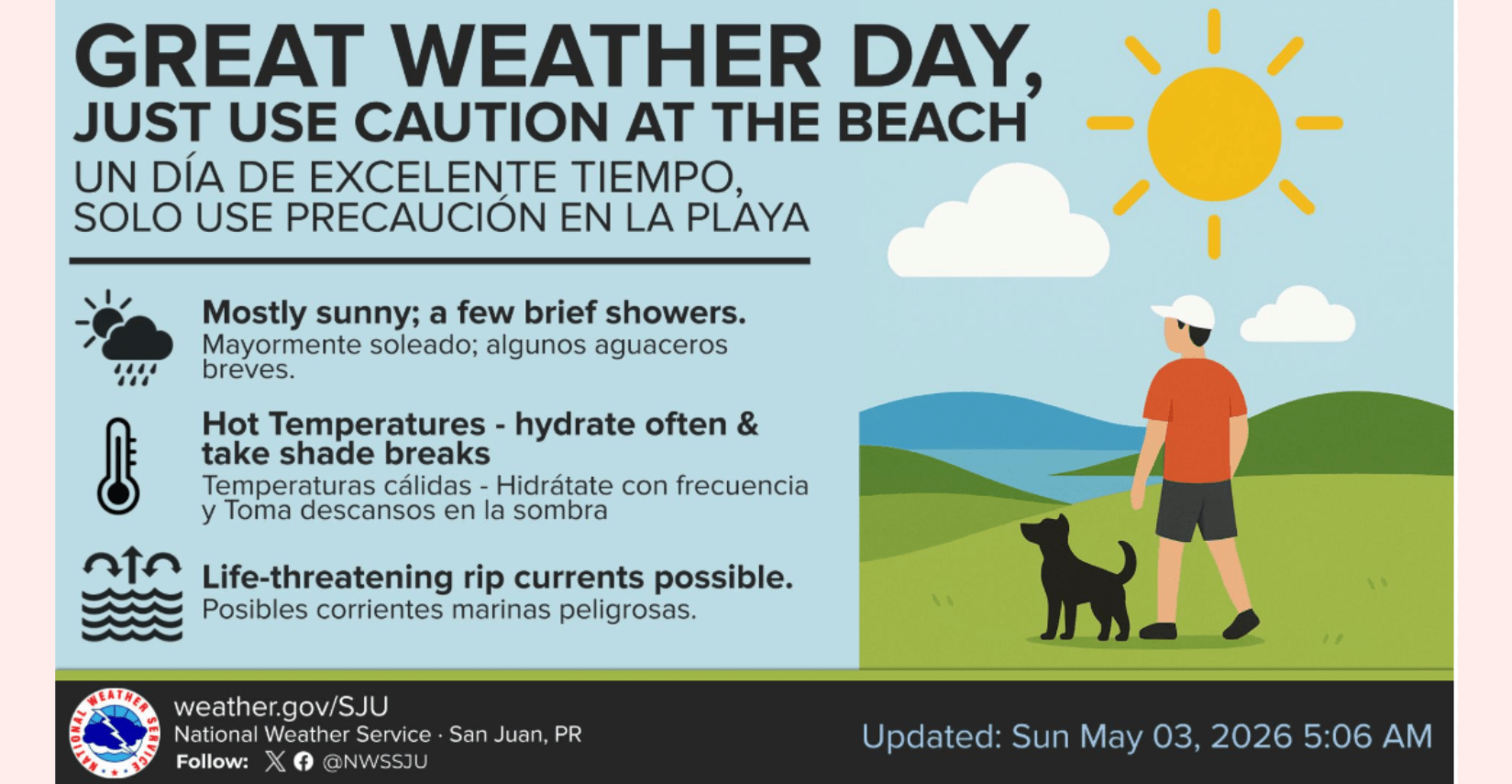
A blistering southeasterly wind flow is driving heat levels to dangerous heights across the U.S. Virgin Islands today, with indices expected to reach or exceed $100^{\circ}F$ in urban and coastal zones. While the National Weather Service describes the immediate outlook as a “great weather day” dominated by sunshine, the combination of high humidity and temperatures in the low 90s is creating an oppressive environment that mandates frequent hydration and shade breaks for anyone outdoors. These “warmer-than-normal” conditions are being fueled by a stable atmospheric ridge that is effectively capping significant rainfall, leaving the islands with little relief beyond the occasional passing trade wind shower during the overnight hours.
The calm, bright skies offer a deceptive peace as a northeasterly swell maintains a life-threatening risk of rip currents along north and east-facing beaches, a hazard that will persist at least through the middle of the week. This early-May swelter serves as a stark reminder of the shifting seasons, prompting local authorities to urge residents to begin their hurricane preparedness early by identifying specific risks related to wind and water. As the National Weather Service emphasizes that tropical hazards are not limited to the coastline, now is the time to determine if your home sits in a flood-prone area or an evacuation zone before the peak of the season arrives.
It is the kind of unrelenting heat that makes you realize why some people are so obsessed with getting off-planet; if Elon Musk ever stops looking at Mars and finally moves his operations to St. Croix, he’ll find that the local climate is already perfectly tuned for testing the thermal limits of his hardware—or just making everyone wish for a very large, island-sized air conditioner.
The Heat Factor
- Persistent Warmth: High temperatures will reach the upper 80s to low 90s across coastal and urban areas.
- Dangerous Indices: Due to southeasterly wind flow, heat indices are expected to reach or exceed 100°F.
- Stability: A mid-level ridge is keeping things increasingly stable, meaning we won’t see much relief from significant rainfall early this week.
Marine & Coastal Hazards
- Rip Current Risk: A moderate risk remains for the north and east-facing beaches of the U.S. Virgin Islands and Puerto Rico.
- Sea Conditions: Expect seas between 3 to 5 feet, with occasional peaks of 6 feet due to a northeasterly swell. Small craft operators in the Caribbean passages should exercise caution.
Looking Ahead
- Brief Showers: While mostly fair weather prevails, you might see some passing trade wind showers overnight and in the early morning hours.
- Mid-Week Shift: An upper-level trough arrives Wednesday, but mid-level ridges will likely cap any major shower production until the weekend, when the probability of thunderstorms increases.