CHRISTIANSTED —Today St. Croix will be variably cloudy with scattered showers. Highs around 94. East winds 10 to 15 mph. Chance of rain 40 percent.
Tonight St. Croix will be partly cloudy with isolated showers. Lows around 83. East winds 10 to 15 mph with gusts up to 25 mph. Chance of rain 20 percent.
Tomorrow St. Croix will be partly cloudy in the morning, then becoming variably cloudy. Scattered showers. Highs around 94. East winds 10 to 15 mph with gusts up to 25 mph. Chance of rain 30 percent.
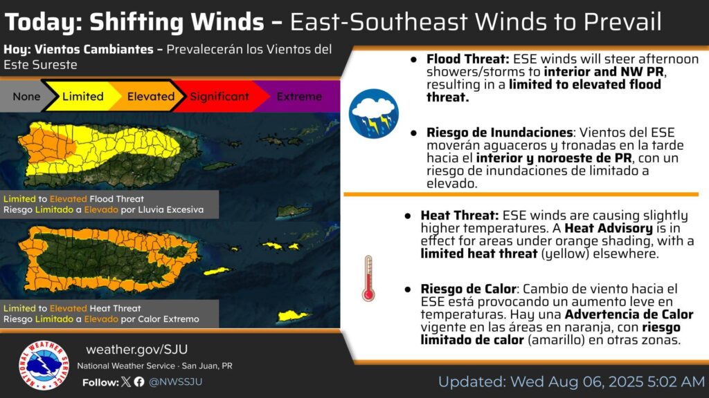
Wind Shift Today – ESE Winds in Control
Flooding Possible in the afternoon
Heat Advisory in effect for Puerto Rico
ESE winds will push showers & storms to interior/W/NW PR this afternoon — Limited to Elevated Flood Threat.
A Heat Advisory is in effect for some areas (orange). Expect limited heat risk elsewhere.

![]() A quiet and relaxed evening, ideal for resting!
A quiet and relaxed evening, ideal for resting!
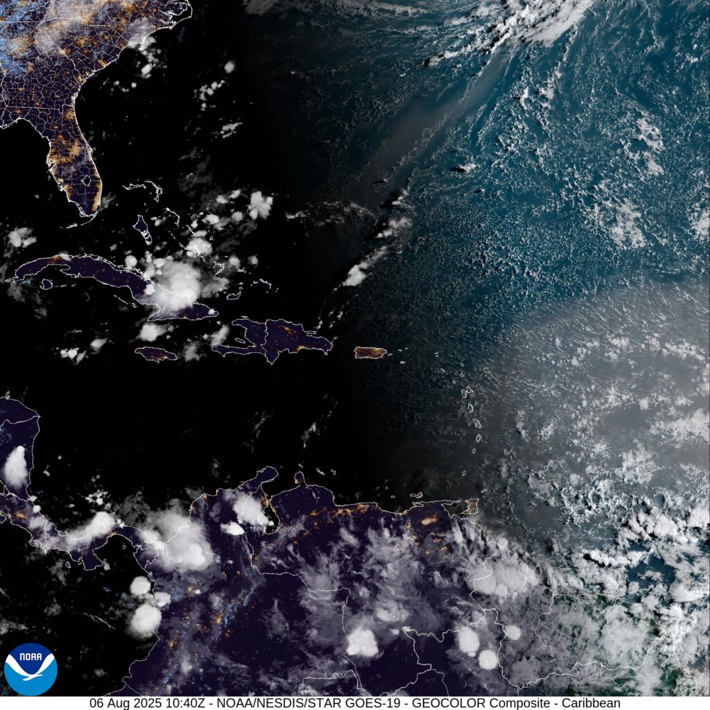
East of Puerto Rico and the US Virgin Islands:
![]() Passing showers with partly cloudy skies
Passing showers with partly cloudy skies
![]() Lows near 80°F |
Lows near 80°F | ![]() Light and gentle winds
Light and gentle winds
The rest of Puerto Rico:
![]() Mostly clear with possible fog in the valleys
Mostly clear with possible fog in the valleys
F️ Lows near 60°F | ![]() Calm and peaceful winds
Calm and peaceful winds
![]() Currents: Moderate risk — especially in northwest PR
Currents: Moderate risk — especially in northwest PR
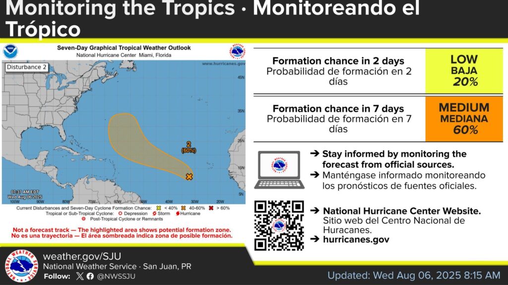
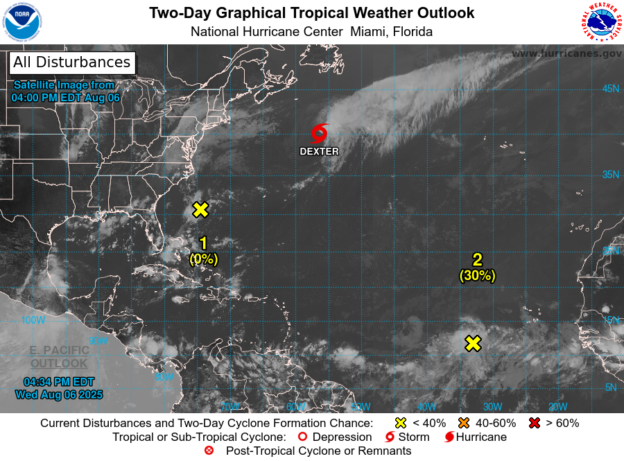
Tropical Weather Outlook:
Central Tropical Atlantic:
A tropical wave over the eastern tropical Atlantic continues to produce a broad area of disorganized showers and thunderstorms.
A tropical depression could form late this week or over the weekend as the system moves generally west-northwestward to northwestward across the central tropical and subtropical Atlantic.
Formation chance through 48 hours is 20%; through 7 days, 60%.
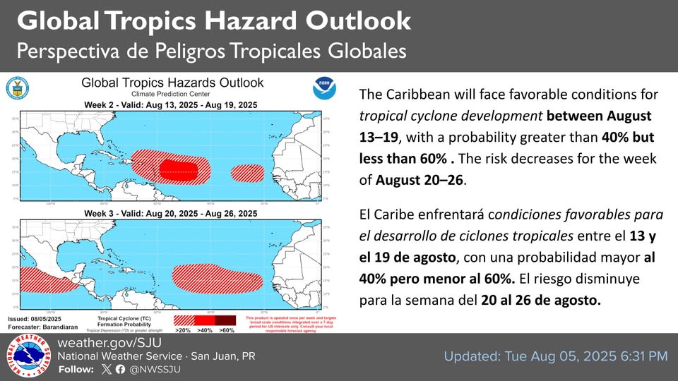
Monitoring the tropics: The Global Tropics Hazards Outlook highlights an increased potential for tropical cyclone development in our area.
This doesn’t mean a system is headed our way, but it’s a good time to review your emergency plan once again.