
Tropical Storm Jerry has developed, becoming the tenth named storm of the 2025 Atlantic hurricane season. According to the U.S. National Hurricane Center (NHC), Jerry is forecast to pass north of the Caribbean and Leeward Islands this weekend.
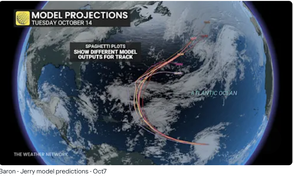
The NHC forecasts steady strengthening, with Jerry likely to reach hurricane status within the next day or two. However, current model guidance suggests the storm will likely remain over open waters, similar to several earlier named storms this season.
What has kept storms away from the Caribbean?
After early-season landfalls by Barry in Mexico and Chantal in the Carolinas, the Atlantic hurricane season has been relatively quiet for the Caribbean and North America.
With the recent formation of Tropical Storm Jerry, the current likelihood of a U.S. or Canadian landfall remains low.
Major storms like Dexter, Erin, Gabrielle, Fernand, and Humberto have all avoided a North America landfall. This is due to atmospheric patterns that redirected the systems.
High pressure over the Atlantic consistently steered storms away from the U.S. East Coast and back out to sea, while well-timed continental high pressure systems occasionally added an additional layer of protection.
In the case of Imelda, the storm’s proximity to Hurricane Humberto caused a sharp rightward turn, sparing the Carolinas from potentially significant rainfall impacts.
So far, these steering patterns have shielded Canada and the U.S. from major impacts this season. However, the Atlantic remains active, and it’s important to continue to monitor future tropical developments closely.
The Atlantic hurricane season officially runs from June 1 to November 30 each year.