

By V.I. Free Press Staff
ST. CROIX — If you’re waiting for a downpour to cool off your morning coffee, you might be waiting a while. Despite some grumbling from residents about “missing rain” yesterday, the National Weather Service (NWS) in San Juan confirms that the U.S. Virgin Islands are currently caught in a limited heat risk that isn’t going anywhere fast.
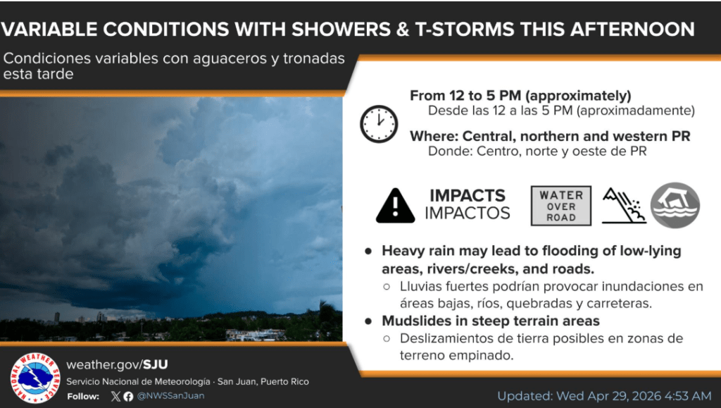
The Local Outlook: Heat Over Humidity While Puerto Rico faces an elevated flooding risk today, the story for St. Croix is about the thermometer.
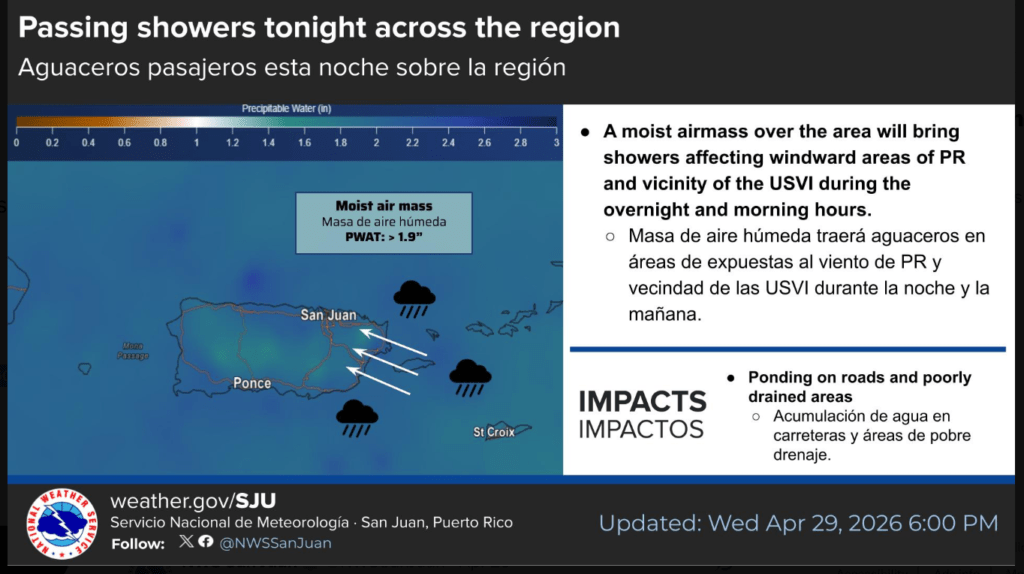
- The “Passing” Showers: Expect a few morning showers embedded in the wind flow, but the NWS warns of “minimal impacts” across the USVI.
- Limited Heat Risk: Without prolonged rain or cloud cover to act as a shield, urban and coastal areas remain under a limited heat threat.
- The Index: Residents should prepare for heat indices reaching the upper 90s to low 100s. If you’re outside, the NWS isn’t just suggesting hydration—they’re practically mandating it.
The Marine & Beach Alert The water might look inviting, but the “threat” you felt this morning extends to the shoreline:
- Rip Current Risk: A Moderate Risk of rip currents remains in effect for north and east-facing beaches on St. Croix.
- Beachgoer Caution: Life-threatening currents are a real possibility near reefs and piers.
Looking Ahead: The Weekend Dry-Out A gradual drying trend is expected to begin Thursday and solidify by the weekend as a mid-level ridge builds over the region. For those complaining about the rain that never came—congratulations, you’re about to get exactly what you wanted: clear skies and persistent heat through early next week.
The Burn Index: Reaching the Red Line
Checking the UV index is a smart move—today’s readings are leaning into the danger zone.
- Current UV Index: St. Croix is seeing a Very High UV index of 10+.
- The Heat Gap: Surface temperatures in coastal areas are reaching the upper 80s and low 90s, but with the moisture filtering in, the heat index (what it actually feels like to the body) is hitting the upper 90s to low 100s.
- Sun Stroke Alert: At these levels, the NWS warns of a “limited heat risk,” meaning heat exhaustion and sunstroke become mechanical certainties for those without shade or hydration.
The ‘First Waves’ of the Season
Meteorologist Brian Shields (Mr. Weatherman) said today that the first tropical waves of 2026 are expected to emerge from the coast of Africa within the next 1 to 3 weeks.
- Atmospheric Shield: While these waves are clusters of rain and storms, they are currently moving into a pocket of Saharan dust and dry air near Barbados and Trinidad.
- Early Development: Although the hurricane season doesn’t officially start until June 1, Shields notes that we start looking for “spins” this time of year as the transition from the dry season to the wet season begins.
- The “Arthur” Watch: The first name on the 2026 Atlantic list is Arthur, followed by Bertha. While the Atlantic water isn’t quite warm enough for development yet, the Eastern Pacific is already heating up, with their season starting May 15.
SIDEBAR: The Incompetency of (Rain) Expectations
Weather forecasting in the Caribbean isn’t a retail transaction—you don’t always get what you “ordered.” While Puerto Rico is dealing with 2.0 inches of precipitable water and a flooding threat, the USVI is largely bypass-territory for this specific moisture plume.
The Beat Note: One has to wonder if the local Department of Health is as prepared for a heat-exhaustion spike as the Bureau of Corrections is for its $14 million budget leak. If the heat is a “threat,” the government’s lack of a cooling infrastructure is the smoking gun. Perhaps Elon Musk can pivot from Starlink to a giant space-umbrella for the territory—at least then we’d have someone specific to complain to when the shade doesn’t hit our porch exactly at noon.