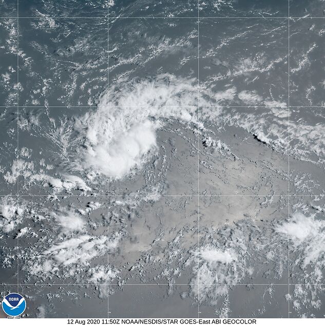
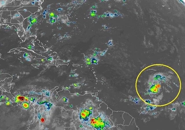
MIAMI — NOAA’s National Hurricane Center issued a Public Advisory at 5 a.m. today due to the presence of Tropical Depression Eleven (formerly Invest 95L) that is tracking near the Caribbean.
If T.D. 11 strengthens into a tropical storm, the next name on the 2020 Atlantic Hurricane Names list is Josephine.
PROJECTED PATH
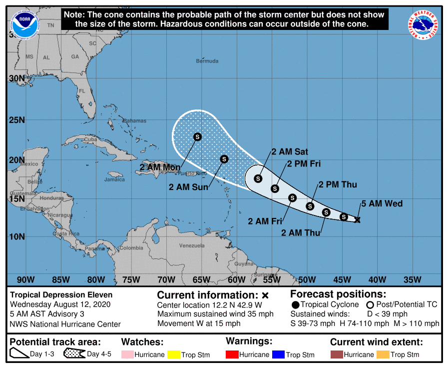
Tropical Depression 11 is located about 1405 miles east-northeast of the Lesser Antilles and is moving to the west at 15 mph (24 km/h).
NHC forecasters say that this general motion is expected to continue through today.
On the NHC forecast track, the center of the depression is expected to move west-northwestward at a similar forward speed tonight and continue through the rest of the week.
Future Tropical Storm Josephine Computer Models
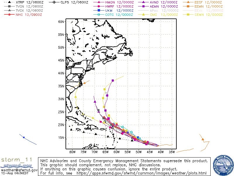
Spaghetti models are in strong agreement that Tropical Depression 11 will move west-northwestward across the tropical Atlantic then curve northwestward into the open Atlantic before the system reaches the Lesser Antilles.
The HRWF computer model (pink circle) is the southern outlier that keeps T.D. 11 on a west-northwestward track closer to the northern Leeward Islands and Puerto Rico.
The HWRF solution that takes the cyclone near the Leeward Islands is considered less likely at this time, hence the official NHC forecast track (red circle) is shaded toward the other model solutions.
The GFS American model (purple square) forecasts a turn to the north towards Bermuda.
The European model (orange triangle) forecasts an earlier turn to the northwest.
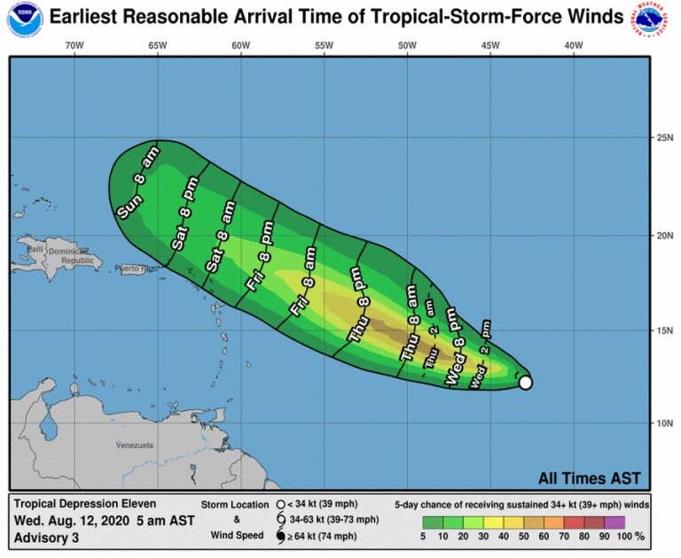
Tropical Depression 11 has maximum sustained winds of 35 mph (55 km/h), with higher gusts.
T.D. 11 is forecast to slowly strengthen into Tropical Storm Josephine later today.
