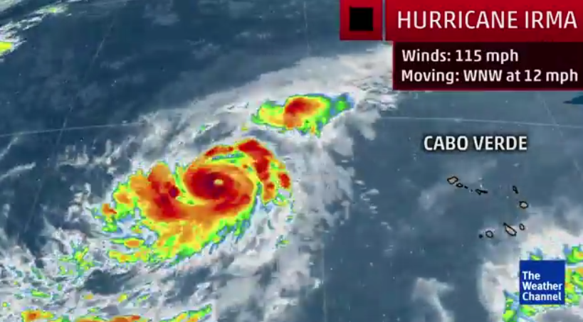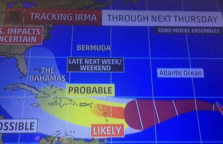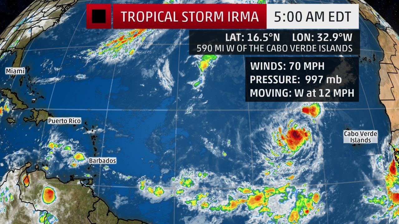
IRMA IRKING: Category 3 Hurricane Irma began its westward track across the Atlantic Wednesday, becoming the ninth named storm of an increasingly busy hurricane season. Early tracking models by The Weather Channel project it hitting St. Croix directly in seven days as a Category 4 storm.
[ad name=”HTML-68″]MIAMI — Tropical Storm Irma continued to gather strength overnight and quickly intensified into a hurricane today, National Hurricane Center forecasters said.
Irma was intensifying steadily in the eastern Atlantic Ocean and grew into the fourth hurricane of the season before 11 a.m. today. By 12 noon, Irma had already become a Category 2 hurricane.
It had sustained winds of 100 mph but presents no immediate threat to any land areas.
The center of Irma is located about 650 miles to the west of the Cabo Verde Islands and is moving westward at 12 mph.
“Global models indicate that the upper-level winds are likely to be favorable for strengthening of Irma during the next several days,” the National Hurricane Center warned. “However, Irma will be moving over more marginal water temperatures and into drier mid-level conditions, which should temper the intensification rate. Irma is forecast to become a hurricane later today but remain over the tropical Atlantic through Tuesday.”
For the next five days, Irma will continue its general westward movement on the south side of a ridge of high pressure called the Bermuda High, which is centered in the central Atlantic.
Irma should move through a portion of the Atlantic Ocean where upper-level winds are mostly favorable for intensification the next few days. The only hindrance to Irma’s organization is some dry air to its north and west.
The National Hurricane Center said Irma is expected to strengthen into a hurricane today.
Irma will not reach the longitude of the Lesser Antilles (eastern Caribbean) until the middle of next week.
The Lesser Antilles are made up of: Antigua and Barbuda, Barbados, Dominica, Grenada, St. Kitts and Nevis, St. Lucia, St. Vincent and the Grenadines and Trinidad & Tobago.
While it’s still not clear what impacts it will have to land, The Weather Channel’s track models this morning show it steering more to the southwest on a more ominous course to be a direct hit of St. Croix within seven days (see graphic below).
It’s expected to turn slightly south in the next two days in response to a high pressure system.
It’s far too early to determine if this new system will pose any threat to the Lesser Antilles and if it will eventually ever pose a threat to other locations, including the U.S.
Check back with the Virgin Islands Free Press online and the V.I. Freep Facebook platform for updates on Irma through the weekend ahead for the very latest.
We will be updating our coverage of Irma frequently based on the latest forecast guidance for its future track and intensity.
This is the first time the name Irma has been used for an Atlantic tropical storm or hurricane.
Irma replaced the name Irene after it was retired for the damage it caused in the Bahamas and the U.S. during the 2011 hurricane season.
To read more about Hurricane Irma becoming a Cat 3 hurricane please click on the first two links below:
https://www.clickorlando.com/weather/irma-grows-into-category-2-hurricane
http://www.nhc.noaa.gov/text/refresh/MIATCPAT1+shtml/310844.shtml

IN THE LINE OF FIRE? The Weather Channel this morning produced this graphic indicating that Cat 3 Hurricane Irma is tracking directly towards St. Croix.

