

MIAMI — NOAA’s National Hurricane Center issued a Tropical Weather Outlook at 2 a.m. today due to an area of low pressure that could become a Tropical Storm Irma later this week.
The area of low pressure, dubbed Invest 93L, is located just west of the Cabo Verde Islands.
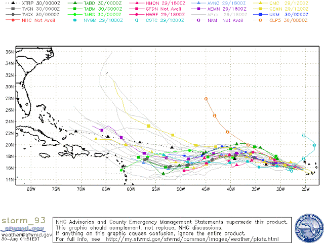
NHC forecasters say that Invest 93L remains organized, and any significant increase in the associated thunderstorm activity would result in the formation of Tropical Depression 11 by Thursday over the eastern Atlantic.
Invest 93L is forecast to move generally west-northwestward at 15 to 20 mph over the tropical Atlantic during the next several days.
“Invest 93L… it’s going to develop, of that everyone is certain… where is it going to go is what is making everyone nervous,” the U.S. Virgin Islands Tropical Hurricane Weather Station said today. “Will the islands get a direct hit, glancing blow… or dead Still as it passes to our east? Forecast models aren’t in agreement after the next couple of days. That’s nothing new! Sahara dust, wind shear and other factors are just too far out to predict.”
This system has an 90 percent chance of becoming a tropical cyclone within the next 48 hours.