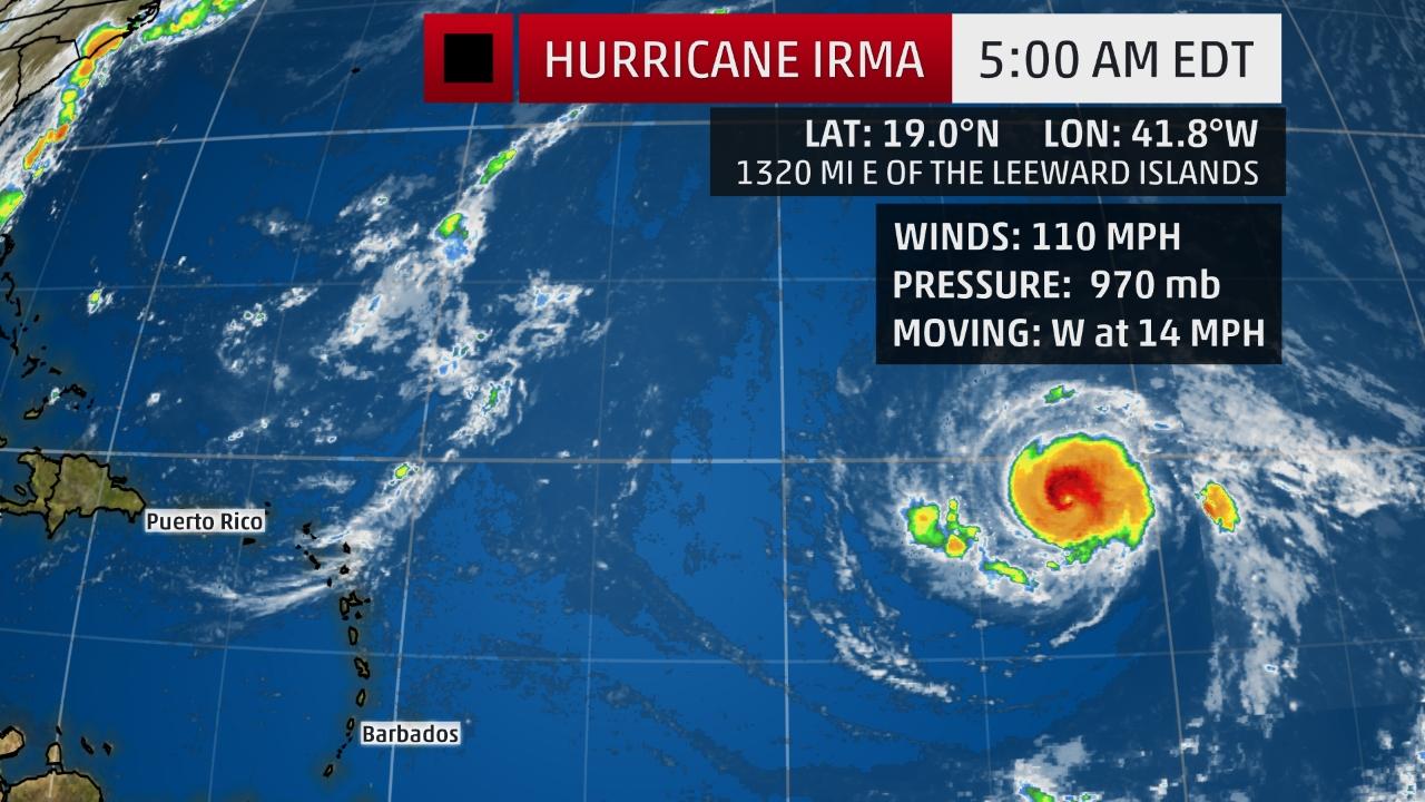
MIAMI — Massive Hurricane Irma finished its first cycle of reorganization called an eyewall replacement cycle, common to all strong hurricanes, during which a new eyewall forms and replaces the old.
This allowed Irma to once again strengthen into a Category 3 hurricane.
Irma will likely undergo a few of these cycles in the coming weeks.
Irma appears to have weakened slightly overnight and fluctuations in intensity will continue over the next few days.
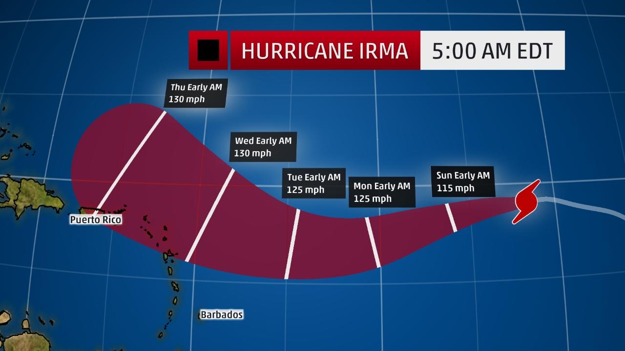
But later this weekend Irma is expected to move over progressively warmer waters and into a more moist environment, which combined with low to moderate wind shear should allow additional strengthening, possibly to Category 4 or 5 status by early in the week ahead.
For the next five days, Irma will move westward, turn west-southwest, then west-northwest again on the south side of a ridge of high pressure called the Bermuda high, centered in the central Atlantic.
Leeward Islands Concern?
Irma is expected to reach the longitude of the Lesser Antilles (eastern Caribbean) around Wednesday, and could be a formidably intense hurricane at that time.
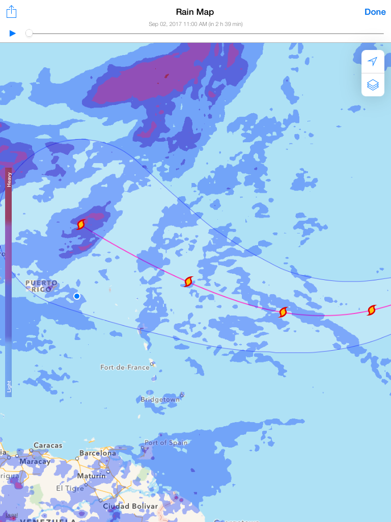
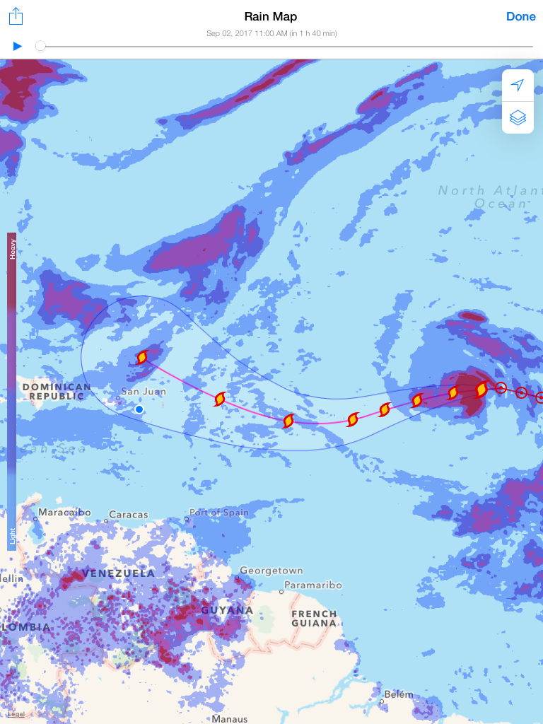
It is looking like direct impacts to the Lesser Antilles, if any, are more likely to be in the northern Leewards from Guadaloupe northward, but this may change in the coming days.
The possibilities range from a direct raking of many of the Leeward Islands to the hurricane passing far enough north to only deliver periphery impacts such as high surf, gusty winds and rainbands.
For now, residents of the Lesser Antilles, Puerto Rico, and the Virgin Islands should follow the progress of Irma closely.
A U.S. Threat?
It is far too soon to speculate on any potential U.S. threat from Irma.
Whether Irma ultimately strikes the U.S. at all will depend on the strength and expansiveness of the Bermuda-Azores high over the Atlantic Ocean, and the timing, depth and location of a southward dip in the jet stream near the eastern U.S.
The range of solutions spans from a track safely east of the U.S. East Coast to a track into the Gulf of Mexico.
If Irma would strike the U.S., and again, that is not by any means a certainty, that could happen as soon as next weekend, or possibly early the second week of September.
For now, all residents along the East Coast and Gulf Coast should monitor the progress of Irma.
As UCAR scientist and FEMA task force lead Michael Lowry notes, storms that become hurricanes near the Cabo Verde Islands often don’t make a U.S. landfall, but when they do, they can be noteworthy.
Check back with the V.I. Free Press website and Facebook platform for the latest updates on Irma through the weekend. We will be updating our coverage of Irma frequently on Facebook based on the latest forecast guidance for its future track and intensity.
This is the first time the name Irma has been used for an Atlantic tropical storm or hurricane. Irma replaced the name Irene after it was retired for the damage it caused in the Bahamas and the U.S. during the 2011 hurricane season.


2017 VIRGIN ISLANDS FREE PRESS STORM TRACKER: HURRICANE IRMA SATURDAY SEPT. 2

