
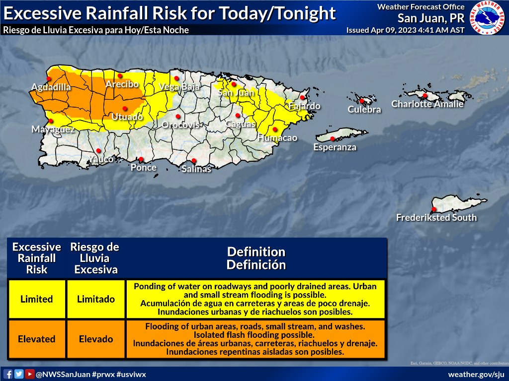
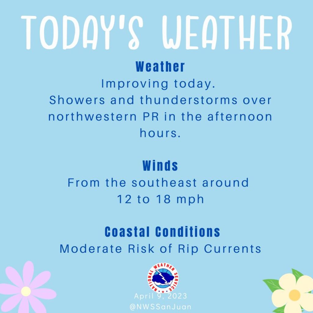
SAN JUAN — Weather conditions will continue to improve, however; available moisture and local effects will support afternoon showers with isolated thunderstorm development each day, mainly across western sections.
Elsewhere, limited shower activity will persist. Across the local beaches, there is a moderate risk of rip currents across most shorelines.
A non-tropical low pressure system centered over the northwestern Atlantic Ocean about 300 miles north of Bermuda is producing storm-force winds. Although the cyclone is producing some thunderstorm activity near the center, it is embedded in a cold air mass with nearby frontal boundaries.
The low is expected to move northeastward today and northward tonight, bringing the system over much colder waters and across Atlantic Canada by early Tuesday. Therefore, it is unlikely that the low will transition to a subtropical or tropical cyclone.
Nevertheless, the system is expected to remain a strong non-tropical low during the next day or so, and additional information, including storm-force wind warnings, can be found in High Seas Forecasts issued by the National Weather Service.
No additional Special Tropical Weather Outlooks are scheduled for this system. Regularly scheduled Tropical Weather Outlooks will resume on May 15, 2023, while Special Tropical Weather Outlooks will be issued as necessary during the off-season.
* Formation chance through 48 hours…low…near 0 percent. * Formation chance through 5 days…low…near 0 percent.
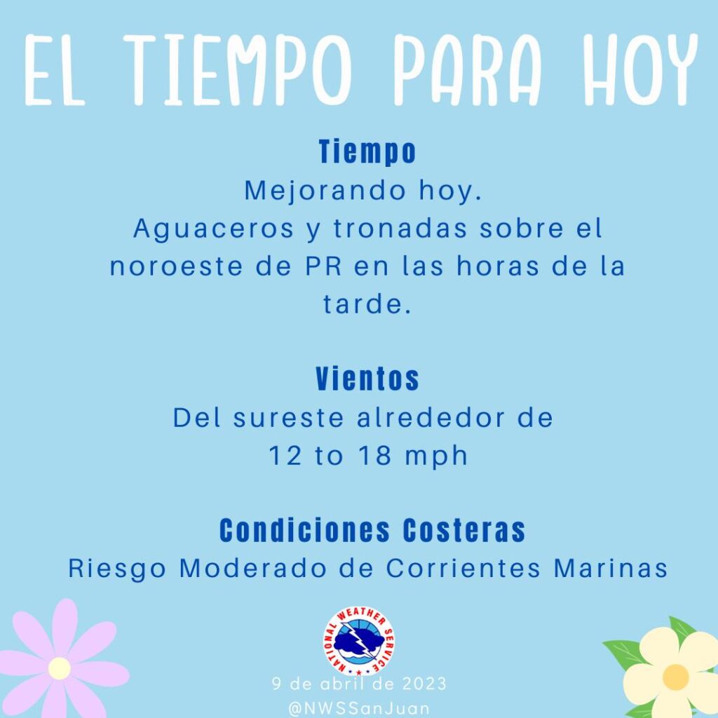
Las condiciones del tiempo continuarán mejorando, sin embargo, la humedad disponible y los efectos locales darán paso al desarrollo de los aguaceros de la tarde con tronadas aisladas cada día, mayormente a través del cuadrante oeste. En el resto de la isla, los aguaceros limitados persistirán. Existe un riesgo moderado de corrientes marinas para la mayoría de las costas de las playas locales.
Monitor the latest Extended Graphical Hazardous Weather Outlook for our 5-day impact-based forecast, which will update daily.