
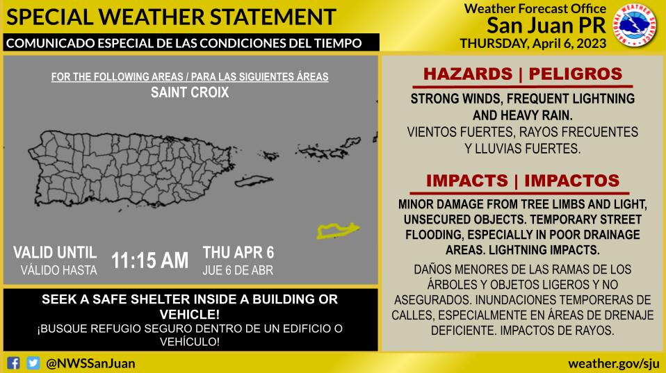
SAN JUAN — The National Weather Service is warning USVI and Puerto Rico residents of a significant rain event taking place right now due to a mid-to upper level trough.
WHAT… The combination of a potent upper-level low and induced surface trough with increasing moisture is resulting in a very unsettled weather pattern. This is promoting showers and thunderstorms across the area.
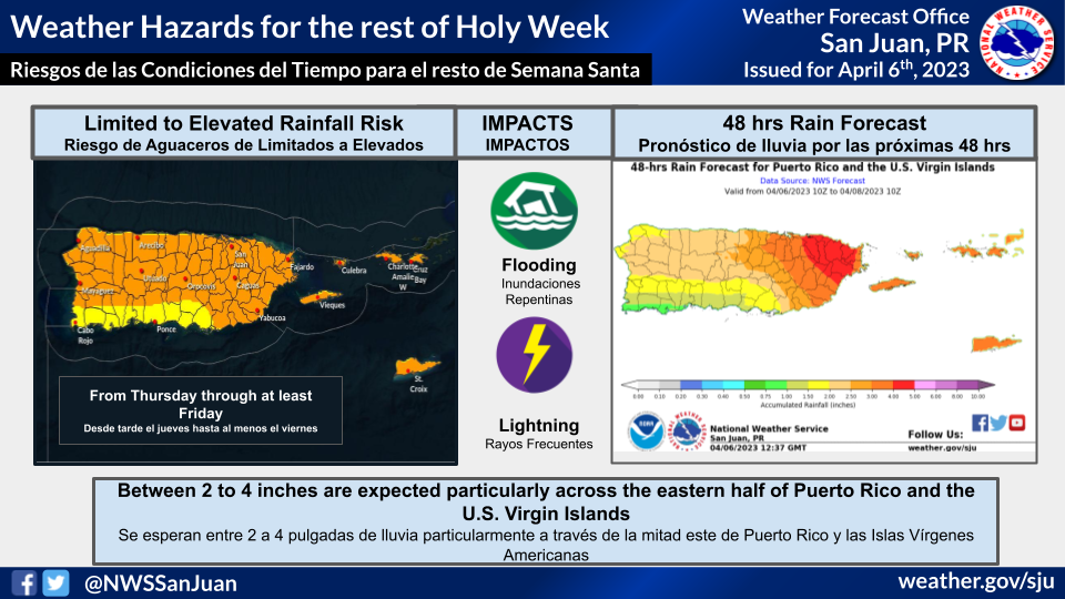
WHERE… Although all the forecast areas will be prone to flooding, the eastern half of Puerto Rico, Vieques, and Culebra, and the U.S. Virgin Islands are expected to receive greater amounts. In terms of rainfall amounts, 2 to 4 inches of rain are expected, with higher isolated amounts.
WHEN… Through at least Saturday. The most active period is expected today through Friday.
IMPACTS… Although low streamflows and dry soils may delay the onset of runoff conditions, persistent shower activity will increase the chance of excessive runoff. This will result in flooding of rivers, creeks, streams, and other low-lying and flood-prone locations. Creeks and streams may rise out of their banks. Flooding may occur in poor drainage and urban areas. Low-water crossings may be flooded. Gusty wind conditions and frequent lightning are possible.
LATEST FORECAST…Monitor the latest Extended Graphical Hazardous Weather Outlook for our 5-day impact-based forecast which will update daily.
RAIN FORECAST…You can find rainfall amounts expected with this event in the 3-day rainfall forecast for Puerto Rico and U.S. Virgin Islands.
…CHOPPY MARINE CONDITIONS AND MODERATE RISK OF RIP CURRENTS…
WHAT… Wind-driven seas combined with small northeasterly swell pulses will maintain choppy to hazardous marine conditions across the regional waters. These swell pulses will also produce breaking wave action, causing life-threatening rip currents and dangerous swimming conditions.
WHERE…For the marine conditions, Atlantic and offshore Caribbean waters and Anegada Passage. For the coastal areas, north- and east-facing beaches of all the local islands.
WHEN…Through the weekend.
IMPACTS…Dangerous conditions for small craft. Hazardous rip currents will result in a moderate to high potential for swimmers to be swept away from shore into deeper water.