
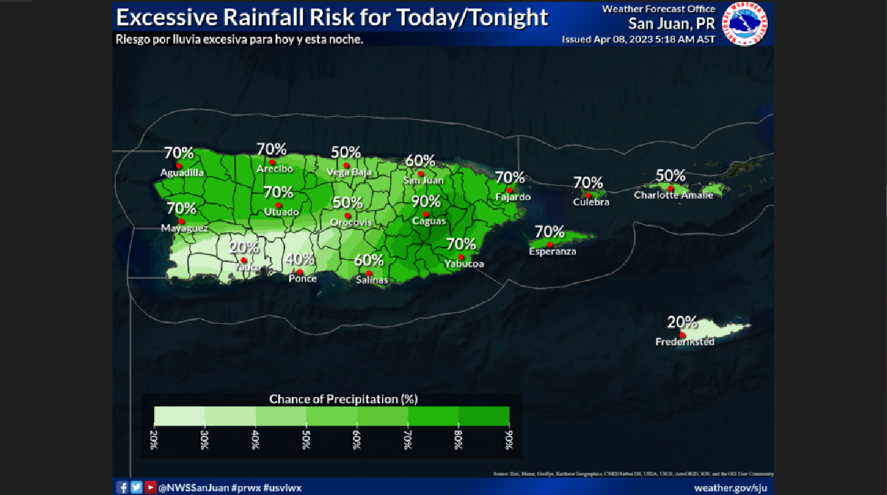
SAN JUAN — The National Weather Service said the risk of thunderstorms and flooding continues today, but should decrease tonight going into Easter Sunday.
WHAT…Moisture and an upper-level trough will continue to result in periods of showers and thunderstorms, particularly during the morning and early in the afternoon hours.
WHERE… During the morning hours, the heaviest rain will continue to be focused over the eastern third of Puerto Rico. Nevertheless, periods of showers and thunderstorms are still expected across the forecast area.

WHEN…Through at least tonight, improving Sunday onwards.
IMPACTS…Excessive runoff and flash floods along rivers, creeks, streams, and other low-lying and flood-prone locations, particularly across the eastern third of Puerto Rico, are still possible. Gusty wind conditions and frequent lightning are possible thunderstorms.
LATEST FORECAST…Monitor the latest Extended Graphical Hazardous Weather Outlook for our 5-day impact-based forecast, which will update daily.
…CHOPPY MARINE CONDITIONS AND MODERATE RISK OF RIP CURRENTS…
WHAT… Wind-driven seas combined with small northeasterly swell pulses will maintain choppy to hazardous marine and coastal conditions across the regional waters.
WHERE…For the marine conditions, Atlantic and offshore Caribbean waters, and Anegada Passage. For the coastal areas, the St. Croix beaches and the local island’s north-and east-facing beaches.

WHEN…Through the weekend.
IMPACTS…Dangerous conditions for small craft. Hazardous rip currents will result in a moderate to high potential for swimmers to be swept away from shore into deeper water.