
SAN JUAN — A tropical depression or storm is likely to form in the next few days between Africa and the Caribbean Islands as we near the peak of the 2023 Atlantic hurricane season.
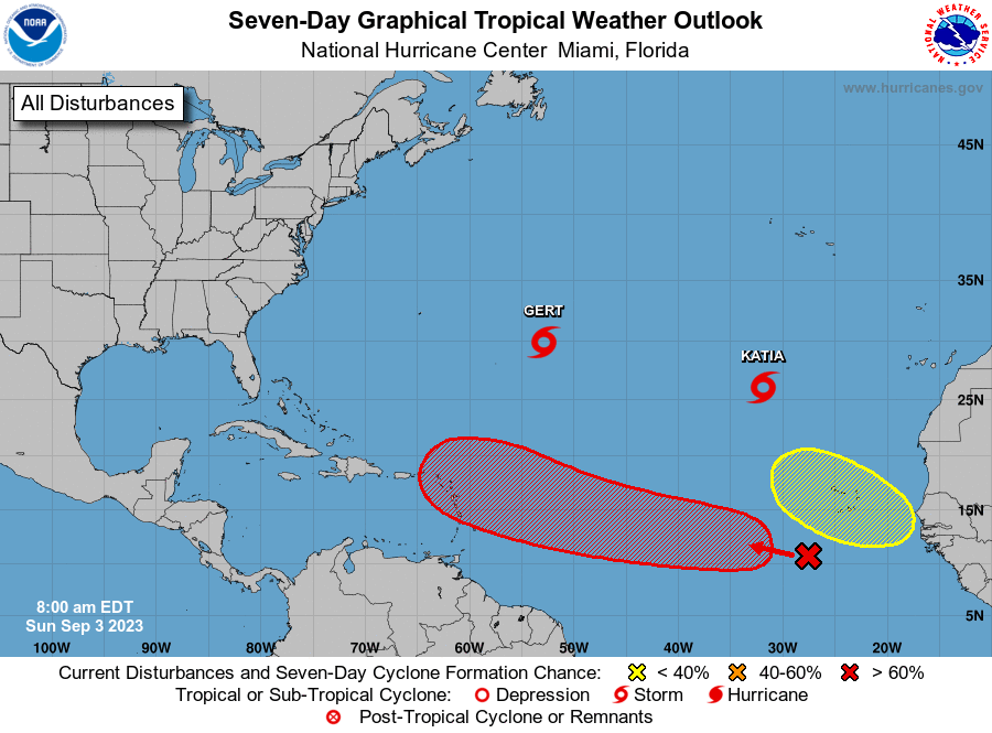
Right now, it’s over the far eastern Atlantic as marked by the “X” below. It’s a disturbance known as a tropical wave, or African easterly wave. These disturbances in the atmosphere move from east to west off Africa into the Atlantic Ocean and are often the seeds of tropical storms and hurricanes.

The disturbance has been deemed Invest 95L by the National Hurricane Center (NHC). This is a naming convention used by the NHC to track disturbances in the Atlantic that have some chance to form into a tropical depression or storm.
Most computer forecast models suggest it will likely develop into a tropical depression or storm around mid-week when it’s between Africa and the Caribbean.
That area of likely development is highlighted in red on the map below. “Lee” will be the name given to the next Atlantic tropical storm.

A separate area closer to Africa is also being watched for development, but this potential system is most likely to curve out into the open Atlantic.
“The disturbance has lots of runway to organize into a mature tropical storm or hurricane on its track to the general vicinity of the northeastern Caribbean islands next week,” said FOX Weather Hurricane Specialist Bryan Norcross. “On the current schedule, the system would reach the islands or the waters north of them about next Saturday.”
