
SAN JUAN — Moisture is pooling with a low level convergence due to the combination of a broad surface trough, along with the proximity of a mid to upper level trough (TUTT) through the upcoming weekend.
The unstable air mass will maintain a very moist weather pattern across the islands and coastal waters.
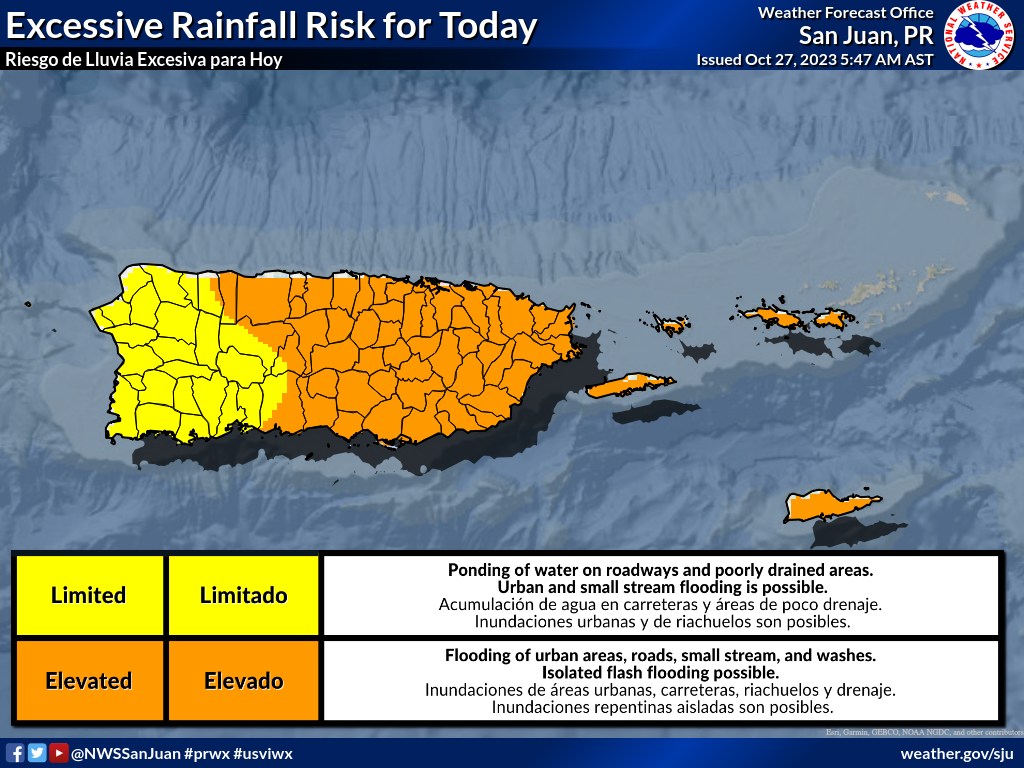
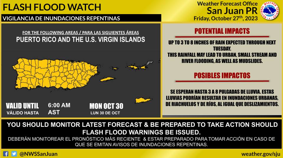
This pattern will support favorable conditions for elevated risk of urban and small stream flooding and flash flooding across portions of Puerto Rico and the U.S. Virgin Islands.
A strong extratropical cyclone (formerly Tammy) associated with an occluded front is located a few hundred miles east of Bermuda.
This low is forecast to become separated from the front soon, and conditions appear favorable for the system to redevelop into a tropical storm later today or tomorrow.
Regardless of tropical redevelopment, the system is likely to bring gusty winds to Bermuda during the next day or so, and a gale warning is in effect for the island.
Interests on Bermuda should monitor the progress of this system. For additional information, including storm and gale warnings, see High Seas Forecasts issued by the National Weather Service and products from the Bermuda Weather Service.
* Formation chance through 48 hours…high…70 percent.
* Formation chance through 7 days…high…70 percent.
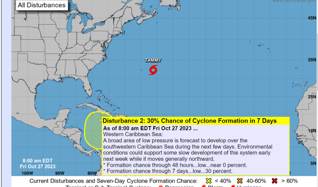
Western Caribbean Sea
A broad area of low pressure is forecast to develop over the southwestern Caribbean Sea during the next few days.
Environmental conditions could support some slow development of this system early next week while it moves generally northward.
* Formation chance through 48 hours…low…near 0 percent.
* Formation chance through 7 days…low…30 percent.