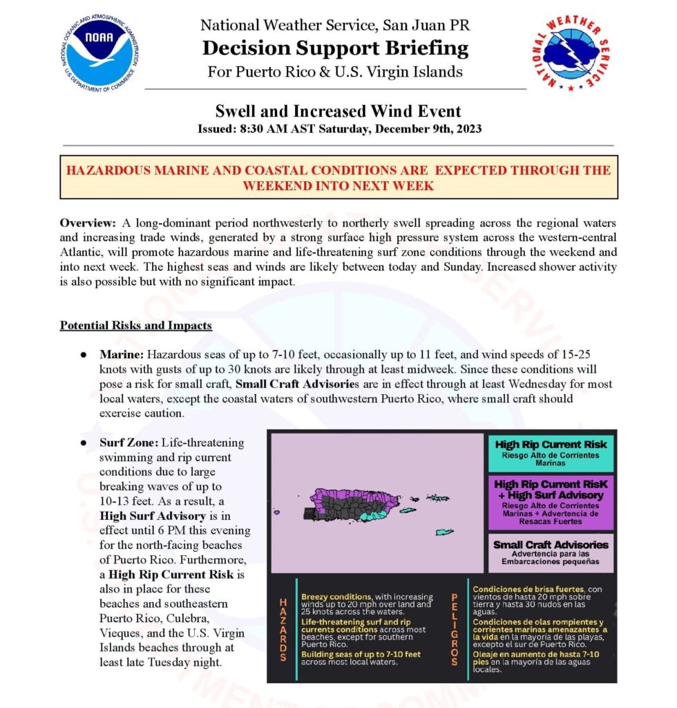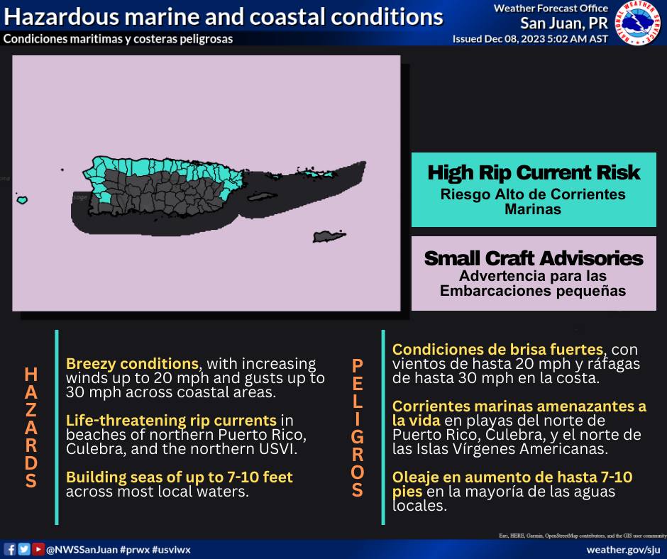
SAN JUAN — A northerly swell and increasing trade winds will promote rough and hazardous marine and coastal conditions through the weekend and early next week. Building seas between 7 and 10 feet are likely through at least Tuesday morning.
Increasing wind speeds of 15-25 mph, generated by a strong surface high-pressure building over the western Atlantic, are expected across most local waters and coastal areas. The highest seas and wind speeds are expected between Saturday and Sunday.
Increased shower activity is also possible but with no significant impact.
Potential Risks and Impacts
● Marine: A dominant long-period northerly swell will spread across the regional waters, likely
causing hazardous seas between 7 and 10 feet through the weekend. This will pose a risk for
small craft. Consequently, Small Craft Advisories are currently active for the offshore Atlantic
waters and coastal waters of northern Puerto Rico. Additional Small Craft Advisories will be in
effect this evening into tonight for most of the local waters due to a combination of the northerly
swell and increasing east-to-northeast trade winds.
● Rip Currents: The risk is high for life-threatening rip currents through Tuesday across the
north-facing beaches of the islands. Rip currents that can sweep even the best swimmers away
from shore into deeper water where it becomes difficult to return to safety.