
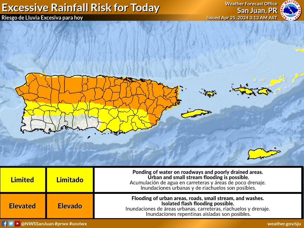
SAN JUAN — We continue under a trend of active afternoons, and today is no the exception.
Once again, heavy rainfall with isolated thunderstorms are expected over portions of northern and eastern Puerto Rico.
Therefore, the potential for flash flooding, mudslides, and river rises remains elevated. Please stay aware of the weather conditions throughout the day!
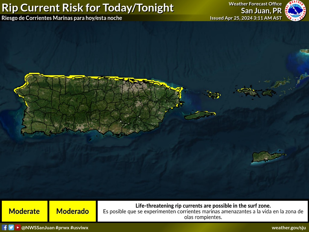
Also, there is a moderate risk of rip currents across the northern beaches of the islands.
TODAY IN THE USVI: Variably cloudy, then becoming mostly cloudy late this morning, then becoming variably cloudy. Scattered showers. Breezy with highs around 90. East winds 15 to 20 mph. Chance of rain 50 percent.
TONIGHT IN THE USVI: Partly cloudy. Isolated showers in the evening, then scattered showers after midnight. Lows around 81. East winds around 15 mph with gusts up to 25 mph. Chance of rain 30 percent.
East-Central Subtropical Atlantic
An area of low pressure located about 900 miles northwest of the Cabo Verde Islands has been producing a small but persistent area of showers and thunderstorms to the east of its center since this morning.
However, the low is forecast to move southwestward at 10 to 15 mph into an area of stronger upper-level winds tonight and tomorrow, and additional development is not expected.
No additional Special Tropical Weather Outlooks are scheduled for this system unless conditions warrant. Regularly scheduled Tropical Weather Outlooks will resume on May 15, 2024, and Special
Tropical Weather Outlooks will be issued as necessary during the remainder of the off-season.
* Formation chance through 48 hours…low…10 percent.
* Formation chance through 7 days…low…10 percent.