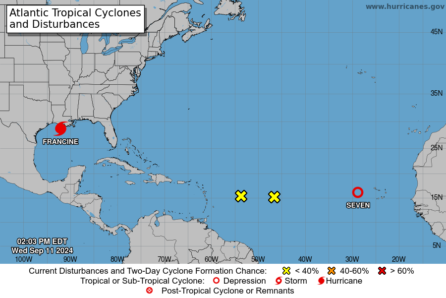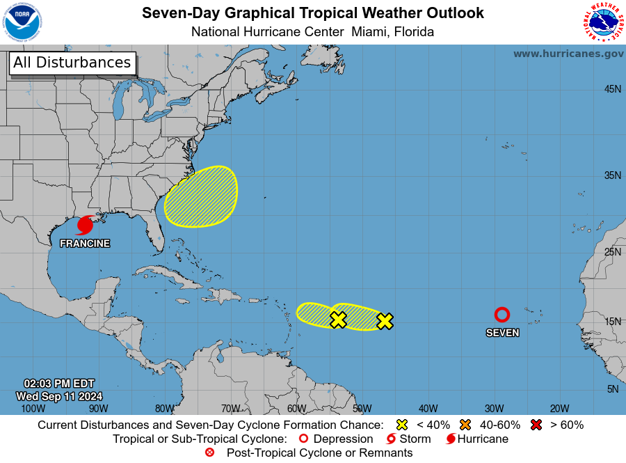
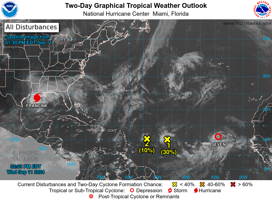
MIAMI — As Hurricane Francine looms in the Gulf of Mexico, the National Hurricane Center is monitoring two additional areas of interest that each have the potential to develop in the next few days.
Invest 92-L and Invest 93-L are each looming in the Atlantic just one day after the peak of hurricane season.
The NHC tagged two additional area they would monitor for development this morning.
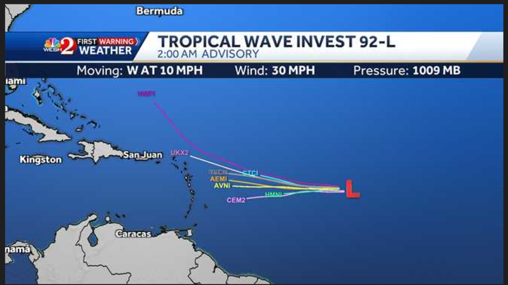
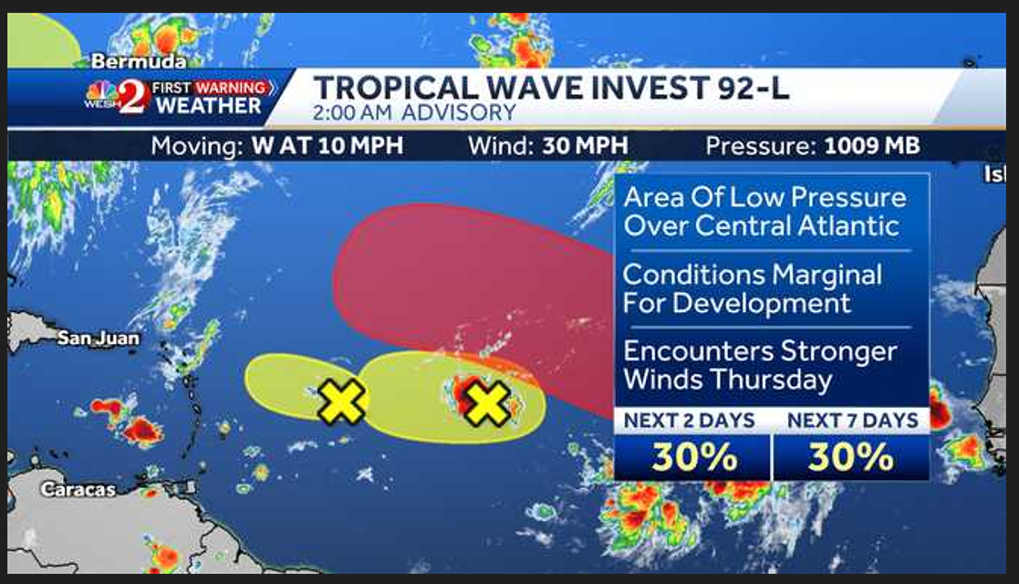
While Invest 92-L previously had a higher chance for development, the NHC says those chances will soon come to an end.
The area of elongated low pressure is currently producing some disorganized showers and thunderstorms over the central tropical Atlantic. As the invest moves westward, environmental conditions seem marginally conducive for development, but the system is expected to reach an area of strong upper-level winds Thursday, likely ending its chances for development.
Formation chances remain low for Invest 92-L, holding at just 30% for the next 48 hours and the next seven days.
Invest 93-L: Eastern and Central Tropical Atlantic
The NHC is also monitoring a second invest with higher chances of formation.
This trough of low pressure near the Cabo Verde Islands is producing a large but disorganized area of showers and thunderstorms that extends southwestward for several hundred miles.
According to the NHC, environmental conditions appear favorable for gradual development of this system and a tropical depression is set to form later this week as the system moves west-northwestward.
Formation chances in the next 48 hours are currently medium (40%), but jump to 80% in the next week.
Disturbance east of Leeward Islands
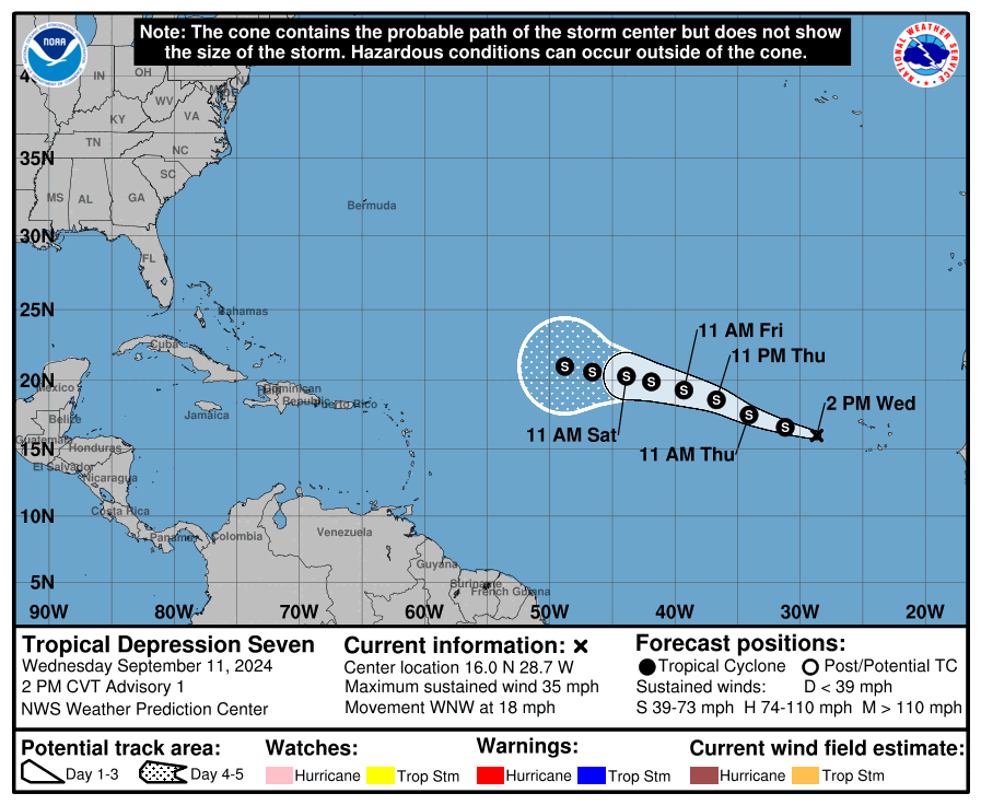
In its 2 p.m. advisory, the NHC tagged a new area of interest, currently located several hundred miles east of the Leeward Islands.
According to the NHC, this disturbance is a small but well-defined area of low pressure that is producing disorganized showers and thunderstorms.
The hurricane center now calls this system “Tropical Depression Seven.”
Formation chances remain very low for now. The NHC says the disturbance is expected to encounter nearby dry air, which could limit development as the system moves west-northwestward.
Additionally, the NHC says environmental conditions are expected to become even less conducive after that. For now, formation chances are very low, holding at just 10% for the next 48 hours and seven days.
Offshore the Southeastern United States
Additionally, the NHC said they were monitoring a non-tropical area of low pressure that could form along a residual frontal boundary a few hundred miles off the U.S. coast.
After that, some subtropical or even tropical development is possible, the NHC said. This would likely occur as the system meanders over the Gulf Stream or drifts slowly northward.
Formation chances remain low, sitting at near 0% for the next 48 hours and only 20% in the next seven days.