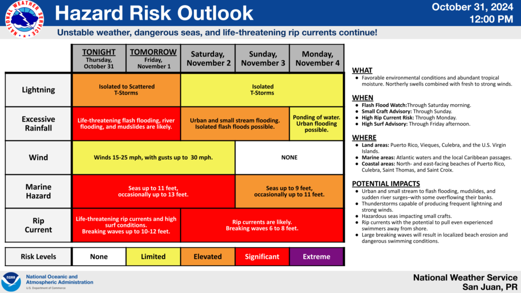
SAN JUAN — A series of mid-to-upper level troughs and above-normal moisture from a nearly stationary front will create ideal conditions for thunderstorm development, with the most intense and frequent activity expected between the rest of today and Saturday morning, the National Weather Service said.
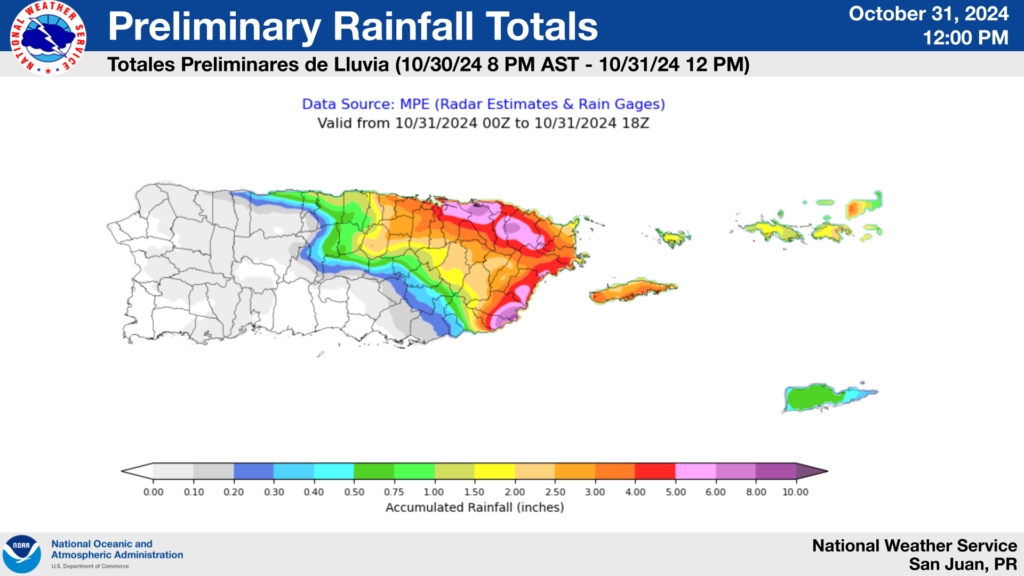
Additional rainfall totals during this period are expected to range from 3 to 4 inches, with locally higher amounts up to 6 inches across northern and eastern Puerto Rico, Vieques, Culebra, and the U.S. Virgin Islands. Elsewhere, expect rainfall amounts around 1 to 3 inches, according to the NWS.
A Flash Flood Watch remains in effect through Saturday morning due to the high likelihood that any extended period of moderate to heavy rainfall will lead to flash flooding, sudden river surges—potentially causing some rivers to exceed flood-stage levels—and mudslides in areas with steep terrain.

In addition, hazardous marine and life-threatening rip current conditions from swell action combined with fresh to strong winds are expected to continue from nowthrough at least early next week.
In effect: Small Craft Advisory for most marine zones and a High Risk of rip currents until at least Sunday morning, along with a High surf advisory in place until at least Friday afternoon for the northern-facing beaches of Puerto Rico.
For updates on excessive rainfall, rip currents, or any other potential hazard risk in the days ahead, visit the Experimental Graphical Hazard Weather Outlook.

