CHRISTIANSTED — Today St. Croix will be variably cloudy, then becoming partly cloudy this late morning and early afternoon, then becoming variably cloudy. Scattered showers. Hazy. Highs around 94. East winds around 15 mph with gusts up to 20 mph. Chance of rain 40 percent.
Tonight St. Croix will be partly cloudy with isolated showers. Hazy. Lows around 83. East winds 10 to 15 mph with gusts up to 20 mph. Chance of rain 20 percent.
Tomorrow St. Croix will be partly cloudy in the morning, then becoming sunny. Isolated showers. Hazy. Highs around 94. East winds 10 to 15 mph. Chance of rain less than 20 percent.
There is a HEAT ADVISORY in effect from 10:00 a.m. to 5:00 p.m.
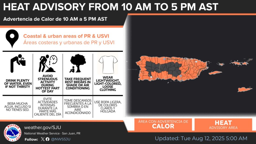
* WHAT…This level of heat affect most individuals sensitive to heat, especially those without effective cooling and/or adequate hydration. Impacts possible in some health system and in heat-sensitive industries.
* WHERE…Portions of the Virgin Islands and Puerto Rico.
* WHEN…From 10 AM this morning to 5 PM AST this afternoon.
* IMPACTS…Hot temperatures and high humidity may cause heat illnesses.
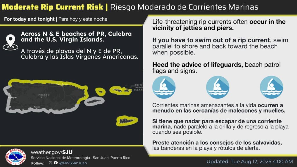
There is a moderate risk of rip currents today and tonight across the highlighted areas.
Swim with caution and always heed the advice of lifeguards. Stay safe!
![]()
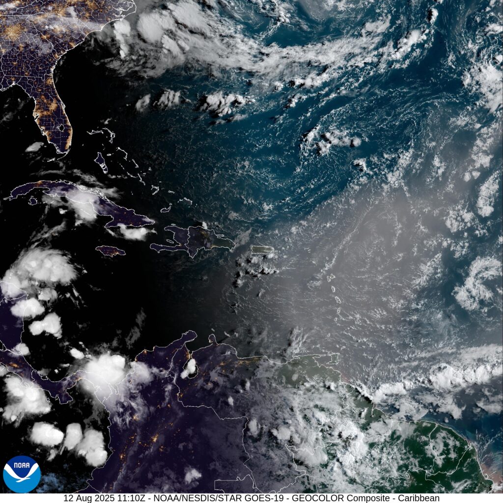
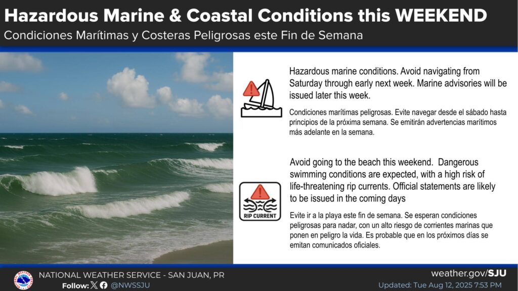
![]() It is still too early to determine the potential rainfall impact across
It is still too early to determine the potential rainfall impact across
Puerto Rico and the U.S. Virgin Islands for the weekend. We encourage everyone to closely monitor updates from the National Hurricane Center and the U.S. National Weather Service in San Juan, PR.
Today August 12, 2025
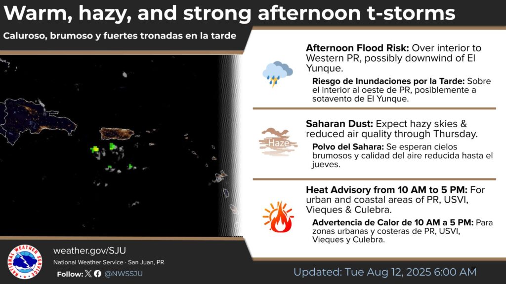
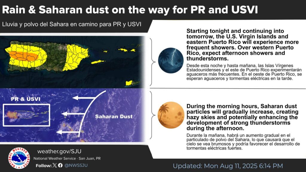
![]() Showers and thunderstorms, especially during the afternoon.
Showers and thunderstorms, especially during the afternoon.
![]() Warm conditions
Warm conditions ![]()
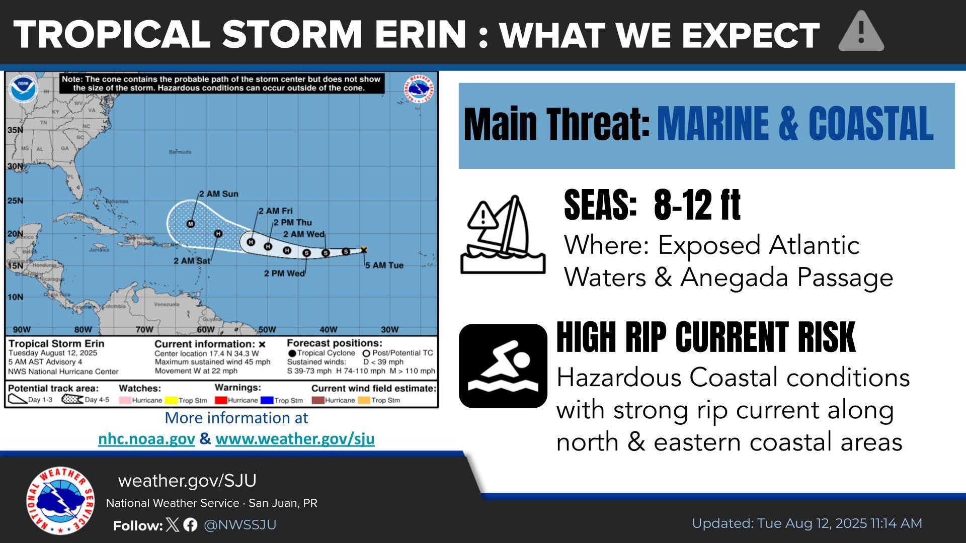
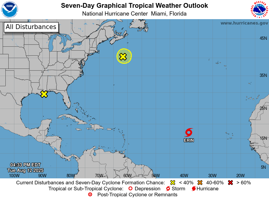
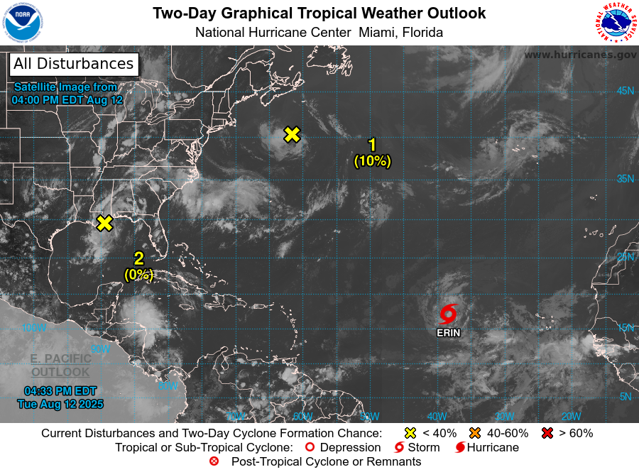
Tropical Storm Erin
At 5 AM AST, the center of Tropical Storm Erin was located near latitude 17.4 N, longitude 34.3 W. Maximum sustained winds are near 45 mph with higher gusts. Gradual strengthening is forecast over the next several days.
![]() Monitoring Erin
Monitoring Erin
![]() Currently: Tropical Storm with maximum sustained winds of 45 mph
Currently: Tropical Storm with maximum sustained winds of 45 mph
![]() Possible indirect impact: Hazardous seas and dangerous rip currents from Saturday through Monday
Possible indirect impact: Hazardous seas and dangerous rip currents from Saturday through Monday
RESIDENTS AND TOURISTS: The possible impact from this system would be precisely these dangerous conditions. We urge everyone to take necessary PRECAUTIONS and avoid activities in the ocean and along the coast. Stay tuned to official bulletins.
![]() No watches or warnings are currently in effect for the U.S. Virgin Islands and Puerto Rico
No watches or warnings are currently in effect for the U.S. Virgin Islands and Puerto Rico
A las 5 AM AST, el centro de la Tormenta Tropical Erin se localizó cerca de la latitud 17.4 N, longitud 34.3 O. Los vientos máximos sostenidos están cerca de 45 mph con ráfagas más altas. Se pronostica un fortalecimiento gradual durante los próximos días.