
Current Conditions & Immediate Forecast
By V.I. Free Press Staff
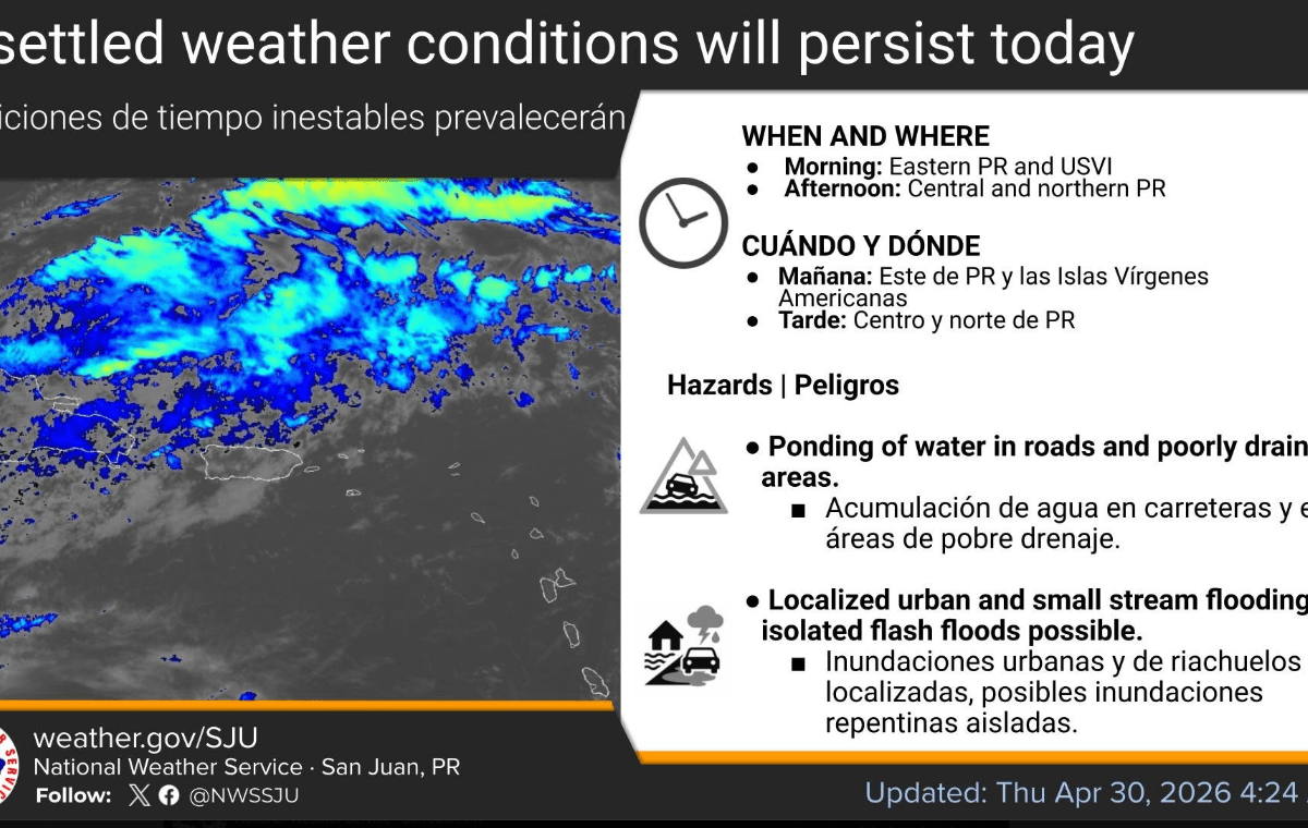
While Puerto Rico is bracing for thunderstorms and flooding, the U.S. Virgin Islands can expect a significantly calmer afternoon.
- Sky Conditions: Mainly fair weather with occasional passing showers.
- Winds: East-southeast winds up to 12 mph, with higher gusts possible.
- Marine: Seas remain manageable at 3 to 5 feet, though a moderate risk of rip currents persists for northern-exposed beaches, including St. Thomas and St. John.
The Drying Trend (Friday – Saturday) A high-pressure system is strengthening to our north, which will usher in a “drying trend” starting late Friday.
- Lower Moisture: Precipitable water levels will drop from 1.90 inches today to roughly 1.60 inches by Saturday, leading to more stable and clear conditions.
Extended Outlook (Sunday – Next Thursday) The forecast indicates a transition into a tranquil, seasonal pattern dominated by high pressure over the central Atlantic.
- The Heat Factor: This is the primary story for the coming week. East to southeast winds will pull in warmer air, keeping temperatures above normal.
- Heat Indices: Expect daytime highs in the upper 80s to low 90s. When combined with the humidity, the “feels like” temperature (heat index) is projected to reach or exceed 100°F daily across coastal and urban areas.
- Rain Chances: Early next week (Monday–Wednesday) looks particularly dry, with rain chances dipping as low as 10–30%. Moisture is expected to return by next Thursday as an upper-level trough approaches the region.
Summary for VIFP Readers: The heavy rains hitting our neighbors to the west won’t be a major factor for the USVI this weekend. Instead, the territory should prepare for a sustained heat event. With heat indices topping 100°F through next week, the focus remains on hydration and heat safety.