 John McCarthy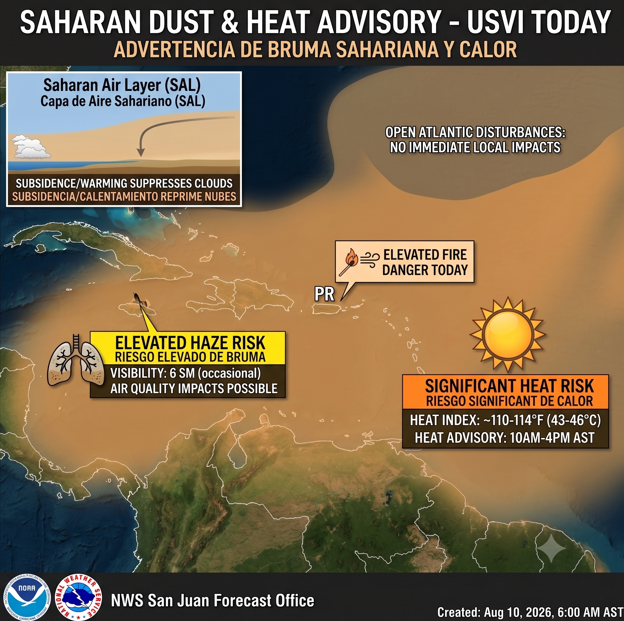
By: Virgin Islands Free Press News Desk
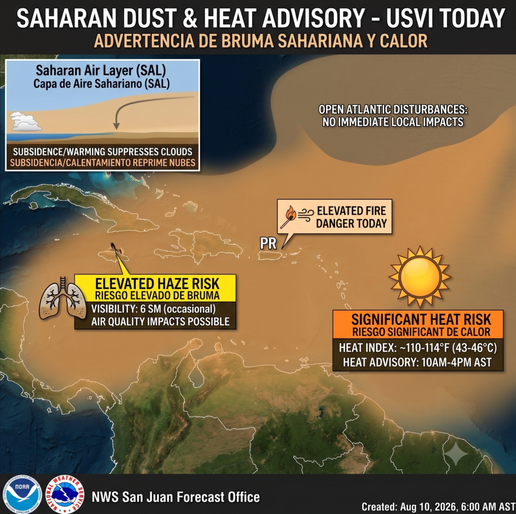
ST. CROIX — While weather maps across the open Atlantic show three developing tropical disturbances on the radar, local conditions in the U.S. Virgin Islands today are being dictated by a far more immediate reality: oppressive heat, dry air, and a dense blanket of Saharan dust.
The National Weather Service in San Juan has placed the territory under a Heat Advisory through 4:00 PM AST today, with heat indices expected to soar between 110°F and 114°F across lower elevations and coastal stretches. The atmospheric lid created by the Saharan Air Layer is suppressing shower activity and baking the terrain, while fine dust particles have pulled visibility down to roughly six statute miles.
Beyond the thermal stress, the combination of gusty afternoon trade winds and sun-stressed vegetation has elevated local fire danger. Any spark in dry brush carries the potential for rapid spread under today’s ambient conditions, making outdoor hot work or careless ignitions particularly risky. Passengers disembarking in Frederiksted today will find stepping off the ship akin to entering the thermal test chamber of an Elon Musk battery facility—relentless, dry, and intense.
As for those three Atlantic systems highlighted by the National Hurricane Center? Forecasters stress that it remains far too early to project any track or intensity impacts for the territory. Upper-level winds and dry air ahead of the lead wave are expected to hamper fast organization as the systems march westward.
For today, the primary forecast focus remains grounded on land: limit extended exposure during peak sunshine hours, guard against heat exhaustion, and monitor air quality updates as haze levels pulse through the region.