CHRISTIANSTED — Today: Cloudy with isolated thunderstorms. Showers. Highs around 89. West winds 15 to 20 mph with gusts up to 25 mph. Chance of rain 80 percent.
Tonight: Breezy. Mostly cloudy with numerous showers with isolated thunderstorms. Lows around 81. Southwest winds 15 to 25 mph with gusts up to 30 mph. Chance of rain 70 percent.
Tomorrow: Breezy. Mostly cloudy with isolated thunderstorms. Numerous showers, mainly in the morning. Highs around 90. South winds 20 to 25 mph with gusts up to 30 mph. Chance of rain 70 percent.
Tomorrow night: Breezy. Mostly cloudy with numerous showers with isolated thunderstorms. Lows around 79. South winds 15 to 20 mph with gusts up to 25 mph. Chance of rain 70 percent.
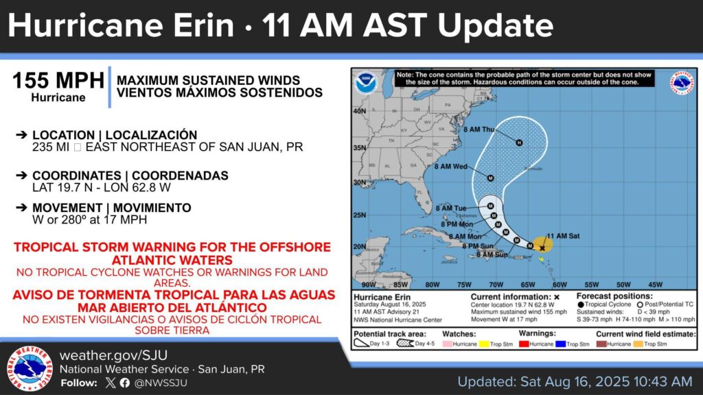
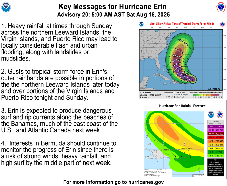
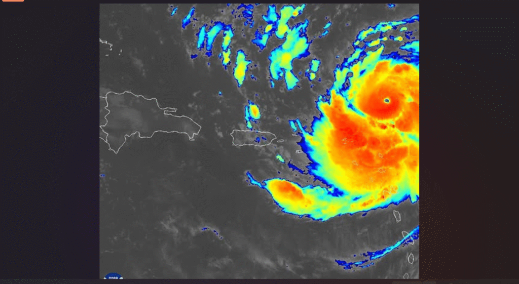
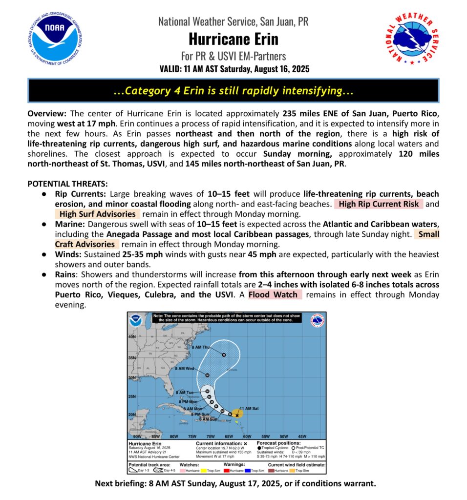
UPDATE: Erin is now a Category 4 Hurricane, just to the east-northeast of the U.S. Virgin Islands and Puerto Rico. Impact remains the same.
The outer rainbands of Erin will continue to move across the islands throughout the day, producing heavy rain with thunderstorms and gusty winds.
The hurricane hunters came back to St. Croix today.

Photo by: Kevin Bot/Facebook