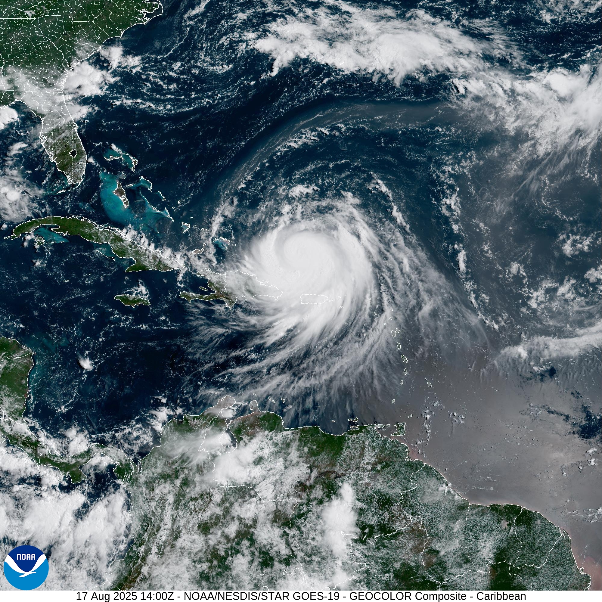
CHRISTIANSTED — Hurricane Erin’s outer rainbands continued producing gusty winds and heavy rainfall across the U.S. Virgin Islands and Puerto Rico today, the National Weather Service said.
[ 8 PM · August 17 ] ![]()
![]() We just had a close call with Hurricane Erin, but the Atlantic hurricane season is far from over — in fact, we’re in the peak of the season (July 15–Oct 15)!
We just had a close call with Hurricane Erin, but the Atlantic hurricane season is far from over — in fact, we’re in the peak of the season (July 15–Oct 15)!
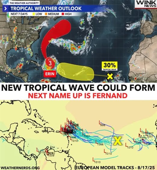
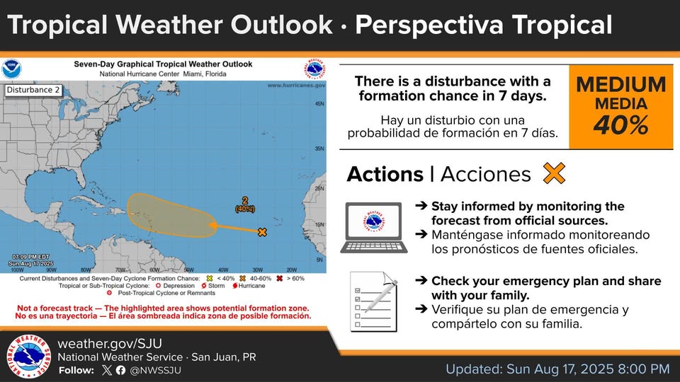
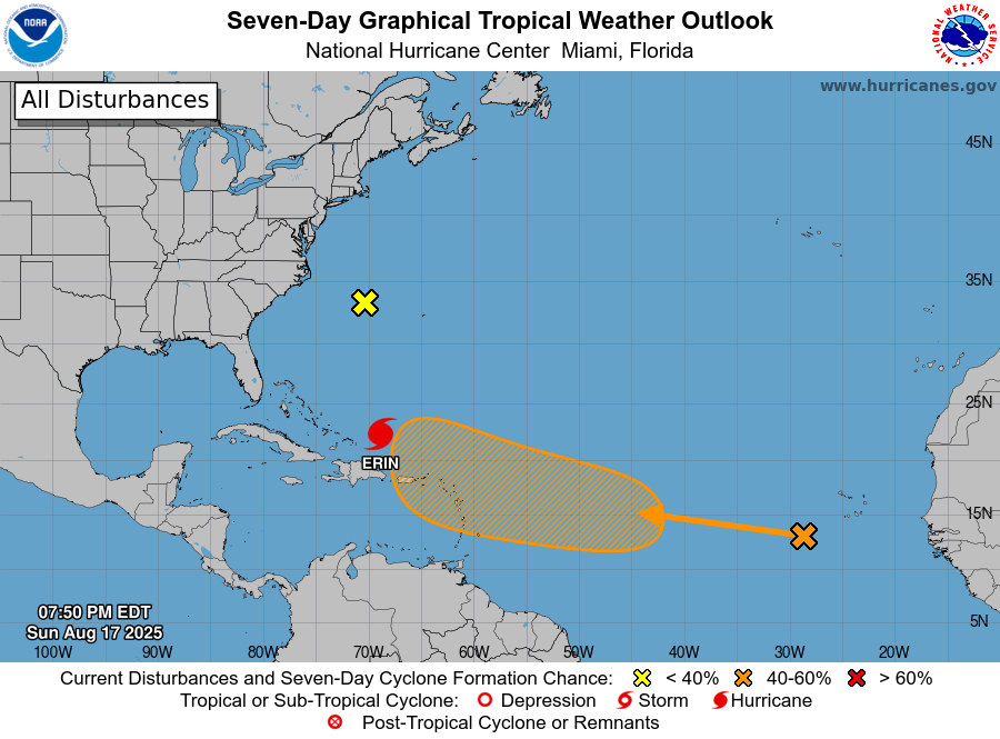
![]() While Erin moves away (now over 300 miles northwest of San Juan, Puerto Rico), our eyes turn eastward. The National Hurricane Center is monitoring a tropical wave near the Cabo Verde Islands.
While Erin moves away (now over 300 miles northwest of San Juan, Puerto Rico), our eyes turn eastward. The National Hurricane Center is monitoring a tropical wave near the Cabo Verde Islands.
![]() Right now it’s disorganized, but conditions could allow gradual development later this week. By the weekend or early next week, it may approach the northeastern Caribbean or the southwest Atlantic.
Right now it’s disorganized, but conditions could allow gradual development later this week. By the weekend or early next week, it may approach the northeastern Caribbean or the southwest Atlantic.
![]() Development chances:
Development chances:
![]() Next 48 hrs
Next 48 hrs ![]() Low (0%)
Low (0%)
![]() Next 7 days
Next 7 days ![]() Medium (40%)
Medium (40%)
![]() Stay alert, stay prepared — hurricane season is just warming up.
Stay alert, stay prepared — hurricane season is just warming up.
#PRwx#USVIwx#HurricaneSeason#StayPrepared ·
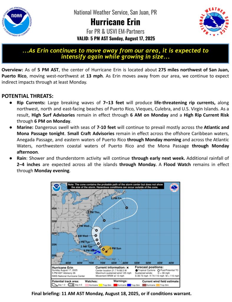
The NWS in San Juan has issued a * Special Marine Warning for…Anegada Passage east of Virgin Gorda and Saint Croix south to 17N…Caribbean Waters of Puerto Rico from 10 NM to 17N, including the Coastal Waters of Saint Croix…Coastal Waters east of Puerto Rico, around Vieques, and around and just north of Culebra and Saint John…Coastal Waters from Cabo San Juan to the waters between Anegada Island and Virgin Gorda and North 10 NM…Coastal Waters of Southern Puerto Rico out 10 NM…until 7:45 a.m. today.
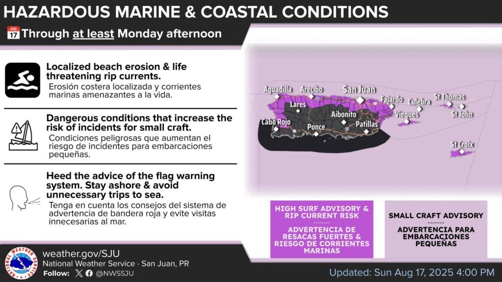
Marine and coastal conditions
- High Surf Advisory through Monday morning (large breaking waves 7-13 feet)
- High Rip Current Risk through Monday afternoon.
- Small Craft Advisories through at least Monday afternoon (Seas 7-10 feet).
Tonight: Breezy. Mostly cloudy with numerous showers with isolated thunderstorms. Lows around 82. South winds 15 to 20 mph with gusts up to 25 mph. Chance of rain 60 percent.
Tomorrow: Breezy. Mostly cloudy with scattered showers with isolated thunderstorms. Highs around 90. Temperature falling in the afternoon. South winds 15 to 20 mph with gusts up to 25 mph. Chance of rain 50 percent.