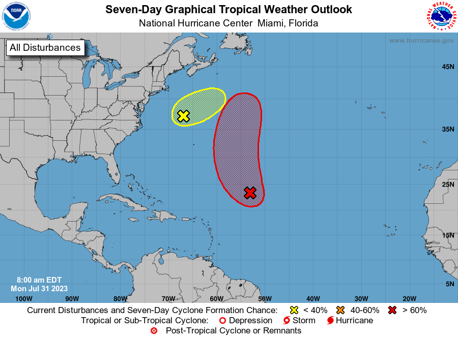
MIAMI — The National Hurricane Center is still watching a disturbance in the central tropical Atlantic with a high formation chance in the next seven days and 48 hrs.
Shower and thunderstorm activity continues in association with an area of low pressure located about 700 miles east-northeast of the northern Leeward Islands. But the system does not currently have a well-defined center of circulation.
Environmental conditions are forecast to be sufficiently favorable for development over the next few days, and a tropical depression or storm is likely to form during the next day or so.

The system is expected to move northwestward at 10 to 15 mph today, and then turn northward over the central subtropical Atlantic by late tonight or Tuesday.
Additional information on this system, including gale warnings, can be found in High Seas Forecasts issued by the National Weather Service.
* Formation chance through 48 hours…high…70 percent.
* Formation chance through 7 days…high…80 percent.

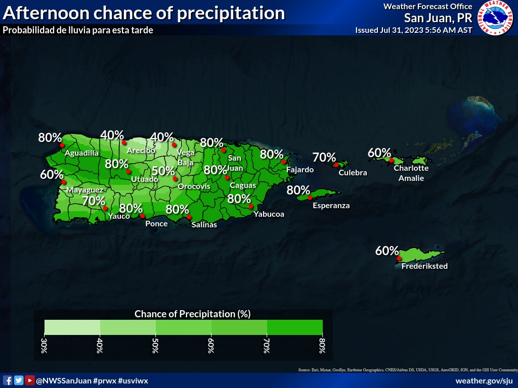
Expect another hot day today with some rainfall activity starting this afternoon.
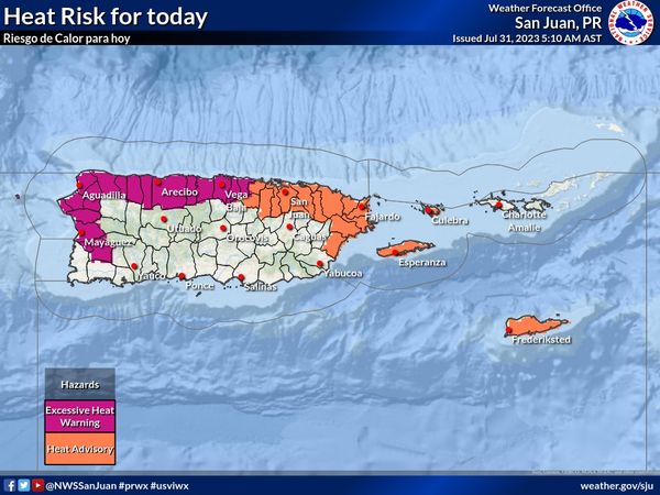
An Excessive Heat Warning will be in effect from 10 AM to 5 PM for the northern interior, northwest and west of Puerto Rico. There will be a Heat Advisory for northeast and east Puerto Rico, Culebra, and St. Croix. There is a moderate rip current risk for the northern interior and northwest sections of Puerto Rico.
Off the U.S. Mid-Atlantic Coast
Shower and thunderstorm activity has changed little in association with an area of low pressure located offshore of the U.S. Mid-Atlantic coast.
The system appears to be acquiring non-tropical characteristics as it begins to merge with a frontal boundary, and its chances of becoming a tropical cyclone appear to be decreasing.
Regardless, the low is expected to begin producing gale-force winds today while it moves quickly toward the east-northeast at about 30 mph.
* Formation chance through 48 hours…low…20 percent.
* Formation chance through 7 days…low…20 percent.

