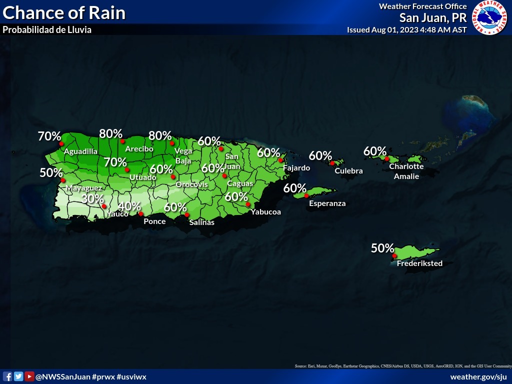
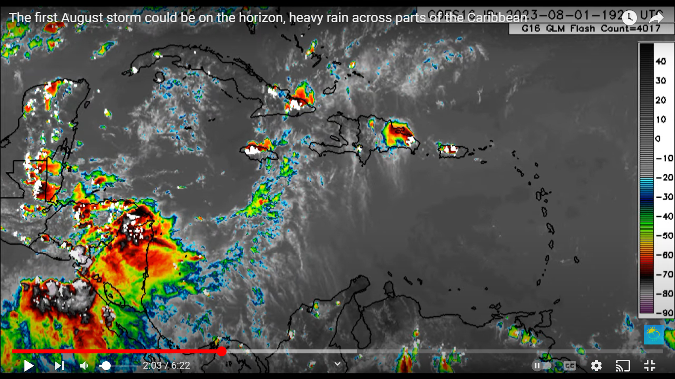
SAN JUAN — The month of August arrived with a tropical wave that should increase the frequency of rainfall in the Virgin Islands and the east and south of Puerto Rico in the morning.
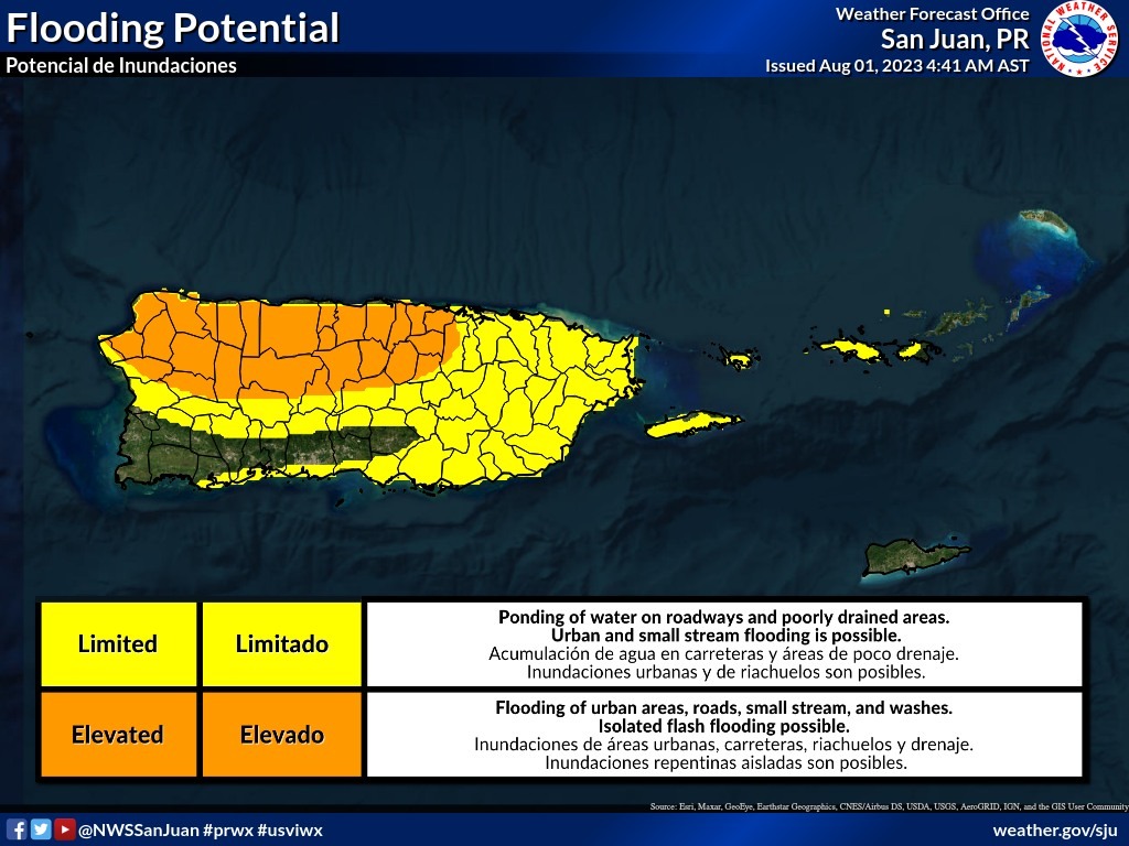
The afternoon should be active for Inland, North and West in Puerto Rico where the risk of flooding is high. Aside from rain, another hot day is expected, although cloudiness and showers could bring slight relief to some sectors.
A tropical wave that should increase showers across the Virgin Islands, and eastern and southern Puerto Rico this morning. An active afternoon is expected for the interior, north and west, where an elevated risk for flooding exist. It will be hot too, although the clouds and showers could bring a brief relief for some areas.

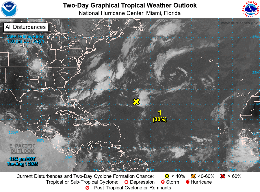
Showers and thunderstorms remain disorganized in association with a low pressure area located about 700 miles northeast of the northern Leeward Islands. Environmental conditions still could support tropical cyclone formation during the next few days while the system moves northwestward and then northward at 10 to 15 mph over the central subtropical Atlantic.
* Formation chance through 48 hours…medium…40 percent.
* Formation chance through 7 days…medium…50 percent.
WESTERN ATLANTIC
Shower and thunderstorm activity continues in association with a gale-force non-tropical low pressure system located over the western Atlantic several hundred miles south-southwest of Cape Race Newfoundland.

The low is forecast to move quickly toward the east-northeast at 30 to 35 mph over colder waters today and tropical development is not expected.
Additional information on the low, including gale warnings, can be found in High Seas Forecasts
issued by the National Weather Service.
* Formation chance through 48 hours…low…10 percent.
* Formation chance through 7 days…low…10 percent.


