
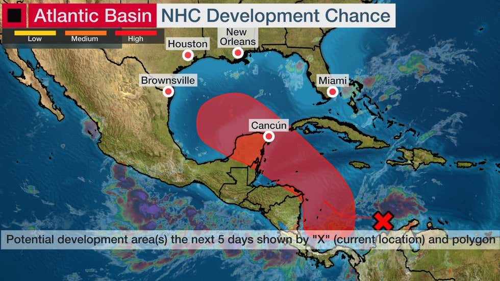
A low-pressure area that is expected to form over the southwestern Caribbean sea over the next day has a 40 percent chance of becoming a hurricane over the next 48 hours, the National Hurricane Center (NHC) said today.
“Environmental conditions are forecast to be conducive for development, and a tropical depression is likely to form late this week or over the weekend,” while the system moves over the northwestern Caribbean Sea, the NHC said.
The disturbance could be a potential concern from Mexico to the western United States Gulf Coast.
It’s too early to know what impacts this system might bring to portions of the western Gulf Coast early next week, but interests from Louisiana and Texas to Mexico should monitor its progress closely the next several days until the forecast comes into greater focus.
Ida and Julian will be the names given to the next two tropical storms that form in the Atlantic this season.
Forecast
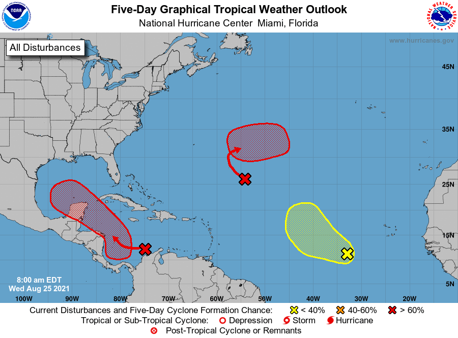
The disturbance is currently located in the central Caribbean Sea, as depicted by the red “X” in the map below.
This system has been designated Invest 99L by the National Hurricane Center, which is a naming convention used to identify features they are being monitoring for possible formation into a tropical depression or storm.
It’s not until later this week or this weekend when forecast models depict a tropical depression or storm forming from this disturbance. That could happen anywhere in the red-shaded area in the map below, near Central America to Mexico’s Yucatan and the southern Gulf.
There could be at least a heavy rain threat from parts of Central America to the Yucatan by later this week into early this weekend.
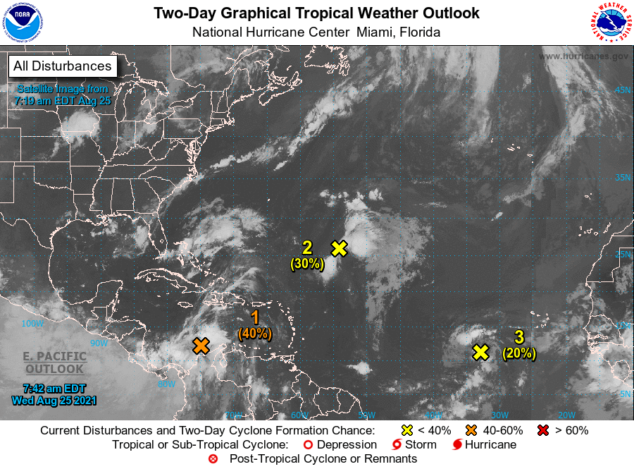
For the North Atlantic...Caribbean Sea and the Gulf of Mexico:

1. A broad area of low pressure is expected to form over the southwestern Caribbean Sea during the next day or so from a tropical wave currently located over northwestern Colombia and the south-central Caribbean Sea.  Environmental conditions are forecast to be conducive for development, and a tropical depression is likely to form late this week or over the weekend while the system moves west-northwestward to northwestward over the northwestern Caribbean
Sea. The disturbance is expected to move near or across the Yucatan Peninsula of Mexico on Saturday, and move into the western Gulf of Mexico by Sunday where conditions could be favorable for additional development to occur.
* Formation chance through 48 hours...medium...40 percent.
* Formation chance through 5 days...high...80 percent.

2. A broad trough of low pressure is producing disorganized showers and thunderstorms over the central tropical Atlantic about 800 miles southeast of Bermuda. Only slow development of this system is expected during the next day or so due to unfavorable upper-level winds. Afterwards, environmental conditions are forecast to become more conducive for development, and a tropical depression is likely to form late this week or this weekend while the system turns eastward over the central Atlantic.
* Formation chance through 48 hours...low...30 percent.
* Formation chance through 5 days...high...80 percent.

3. A tropical wave over the far eastern tropical Atlantic located several hundred miles southwest of the Cabo Verde Islands is producing a disorganized area of showers and thunderstorms. Some development of this system is possible over the next several days while it moves west-northwestward at 10 to 15 mph over the eastern tropical Atlantic. Upper-level winds are forecast to become less conducive for development by this weekend.
* Formation chance through 48 hours...low...20 percent.
* Formation chance through 5 days...low...30 percent.