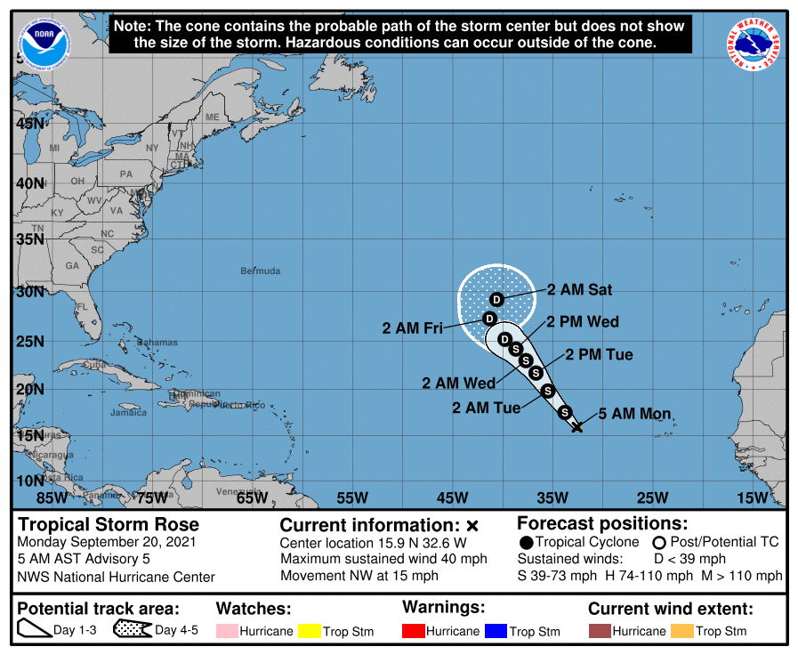
CHRISTIANSTED — The busy tropical season continued on Sunday afternoon as Tropical Depression Seventeen morphed into Tropical Storm Rose.
Rose, the 17th storm of the season, is located about 552 miles west of the southernmost Cabo Verde Islands, the National Hurricane Center said.
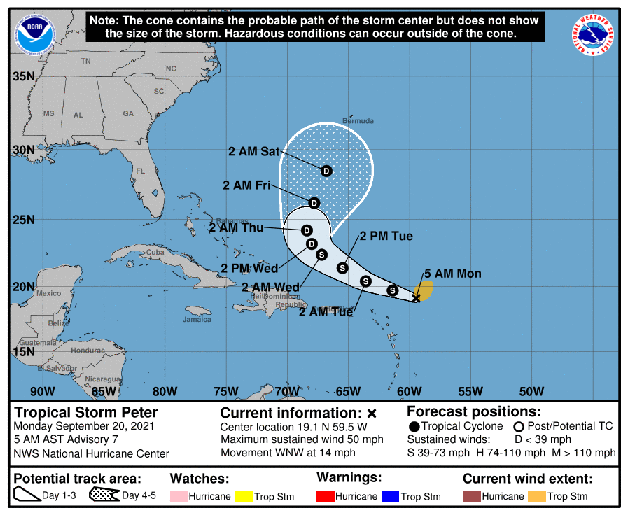
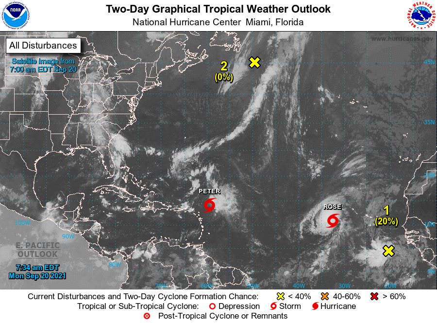
The other active storm currently in the Atlantic basin is Tropical Storm Peter, which was the 16th storm of the 2021 Atlantic hurricane season. Peter strengthened into a storm Sunday morning from a tropical depression.
Located 242 of miles east-northeast of the Northern Leeward Islands, Peter had sustained winds of 45 mph this morning.
Hurricane hunters observed the center of the storm to be farther southwest than in previous National Hurricane Center (NHC) advisories, but its impacts to land are still expected to be minimal as it remains in the open waters of the Atlantic.
“Some strengthening is forecast during the next 24 hours or so as Peter moves over warmer sea-surface temperatures,” the National Hurricane Center said.
Currently no tropical watches or warnings are in effect, but the storm could bring flood threats to parts of the Virgin Islands, Puerto Rico and the Northern Leeward Islands early this week.
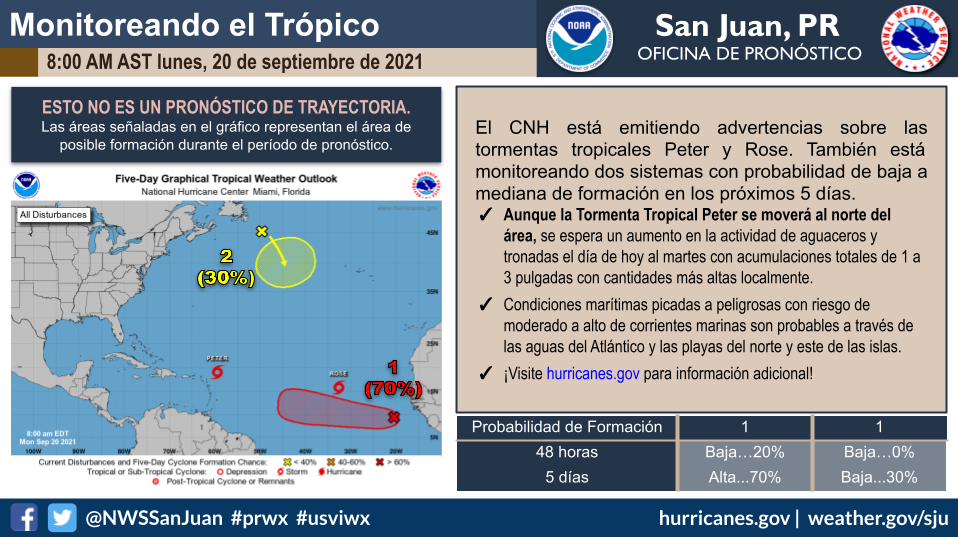
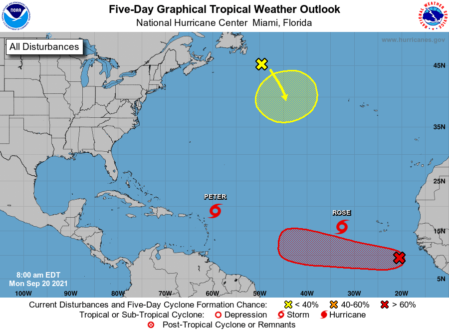
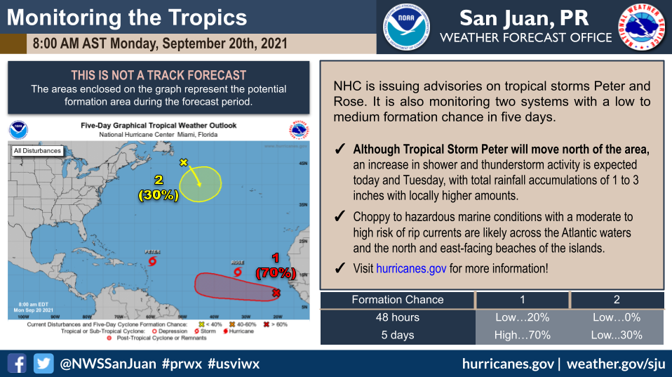
But the NHC is issued these advisories on Tropical Storm Peter, located a few hundred miles east of the northernmost Leeward Islands, and on Tropical Storm Rose, located several hundred miles west of the southernmost Cabo Verde Islands.
1. A tropical wave located over the far eastern tropical Atlantic several hundred miles southeast of the Cabo Verde Islands is producing an area of disorganized showers and thunderstorms.
Environmental conditions appear conducive for gradual development over the next several days, and a tropical depression could form later this week while the system moves westward at 10 to 15 mph across the eastern and central tropical Atlantic Ocean. * Formation chance through 48 hours…low…10 percent. * Formation chance through 5 days…medium…60 percent.
2. A storm-force, non-tropical low pressure system, the remnants of Odette, is located a couple of hundred miles southeast of Newfoundland. This low could acquire some subtropical characteristics by the middle of this week as it moves slowly eastward and then southeastward over warmer waters across the north-central Atlantic Ocean. Additional information on this system, including storm warnings, can be found in High Seas Forecasts issued by the National Weather Service. * Formation chance through 48 hours…low…near 0 percent. * Formation chance through 5 days…low…30 percent.
Public Advisories on Tropical Storm Rose are issued under WMO header WTNT32 KNHC and under AWIPS header MIATCPAT2. Forecast/Advisories on Tropical Storm Rose are issued under WMO header WTNT22 KNHC and under AWIPS header MIATCMAT2.
High Seas Forecasts issued by the National Weather Service can be found under AWIPS header NFDHSFAT1, WMO header FZNT01 KWBC, and online at ocean.weather.gov/shtml/NFDHSFAT1.php