
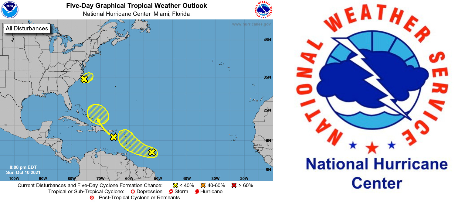
CHARLOTTE AMALIE — Forecasters are monitoring “a vigorous tropical wave” located about 500 miles east-southeast of the Windward Islands, the National Weather Service said today.
The tropical wave is producing a concentrated area of cloudiness and thunderstorms near the wave axis, according to the NWS.
Environmental conditions are forecast to be marginally conducive for some additional development of this system while it moves west-northwestward at about 15 mph over the next few days.
The disturbance is expected to approach the central and northern Lesser Antilles by late tomorrow and early Tuesday and “interests in these areas should monitor the progress of this system,” the NWS said.
Regardless of development, the system will produce locally-heavy rainfall and gusty winds across portions of the central and northern Lesser Antilles on Tuesday and across the Virgin Islands and northern Lesser Antilles on Wednesday. * Formation chance through 48 hours…low…20 percent. * Formation chance through 5 days…low…30 percent.
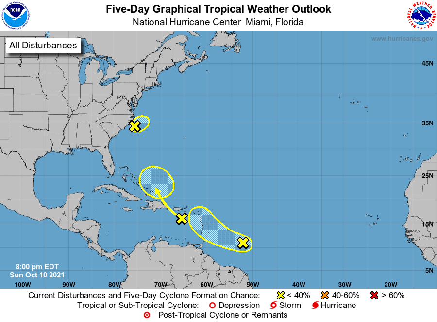
Meanwhile development of a tropical disturbance off the Carolina coast is also possible, according to AccuWeather.
The Atlantic basin remains quiet with no ongoing tropical systems. However, that may change this weekend as a storm tries to form off the Carolina coast.
A broad area of low pressure, designated as 92L, currently sits off the Carolina coast. This area of low pressure is expected to meander off the coast through the weekend, but may drift a bit to the north and west, closer to the Outer Banks of North Carolina. Southerly vertical wind shear is expected to remain over 92L this weekend, keeping the system disorganized and may cause it to become stretched to the north on today.
A front pushing in from the north and west could then interact with 92L and help it form into a tropical or subtropical low pressure area. If this does occur, the most likely time period for development is today into early tomorrow. By later Monday into Monday night, wind shear will increase from the west, putting a halt to any chance of development of the system.
Regardless of tropical or subtropical development, this low will bring gusty winds and moderate to heavy rainfall at times over coastal areas of eastern North Carolina through Sunday.
This activity could extend farther north across southern parts of the Delmarva Peninsula tonight. Onshore winds will combine with high pressure off the northeastern coast of New England to bring higher-than-normal surf to the coastal Carolinas northward to the mid-Atlantic coast of the United States during the upcoming weekend into early next week.
This higher surf will lead to dangerous rip currents along the Carolina coast northward to the mid-Atlantic states. During high tide, this can also lead to flooding in coastal areas.
https://www.nhc.noaa.gov/gtwo.php?basin=atlc&fdays=5