
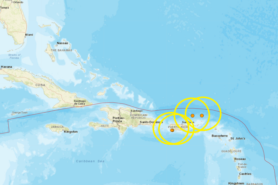
SAN JUAN —Three earthquakes unsettled parts of the U.S. Virgin Islands and Puerto Rico in the last 24 hours.
A moderate 3.6 magnitude quake struck 60 miles north-northwest of St. Thomas. None of the earthquakes that struck our portion of the Caribbean were strong enough to generate a tsunami; and there was no risk of tsunami to either territory.
The second strongest earthquake in today’s seismic activity happened 68 miles north-northeast of St. John. The U.S. Geological Survey said the quake off of Cruz Bay registered as a magnitude 3.4 event.
Two weaker earthquakes hit Puerto Rico: a 2.6 magnitude quake hit 2.5 miles east-southeast of La Parguera, and a 2.9 quake struck 2.75 miles west-southwest of Guanica.
Today’s earthquakes struck along the south coast of Puerto Rico where a strong earthquake hit in 2020. These earthquakes are likely continued aftershocks from that strong earthquake that struck the commonwealth in January 2020. That 6.4 created extensive damage in Puerto Rico, including widespread power failures across much of the island. An earthquake swarm started here in December 2019 and unrest has continued since.
These earthquakes are occurring near the northern edge of the Caribbean Plate, a mostly oceanic tectonic plate underlying Central America and the Caribbean Sea off of the north coast of South America. The Caribbean Plate borders the North American Plate, the South American Plate, the Nazca Plate, and the Cocos Plate. The borders of these plates are home to ongoing seismic activity, including frequent earthquakes, occasional tsunamis, and sometimes even volcanic eruptions.