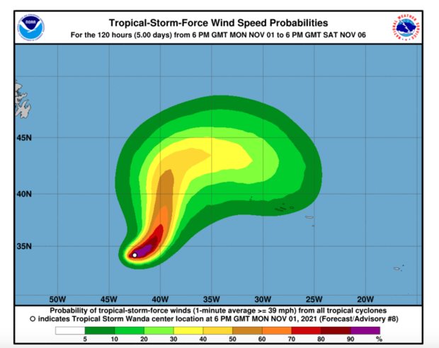
MIAMI — Tropical Storm Wanda formed over the Atlantic Ocean today — and while it isn’t expected to make landfall, it’s still making history. For only the third time ever, forecasters have run out of the typical alphabetical names for storms, forcing them to seek an additional naming system for any storms that occur for the rest of the year.
Wanda has recorded winds of up to 45 miles per hour, and a small strengthening is expected through the next few days, according to the National Hurricane Center.
The storm, which is well out to sea and is not expected to have a major impact or make landfall in the United States, is the 21st storm this season. It’s a very busy season, compared to the average 14 named storms the U.S typically sees.
Lead forecaster Matthew Rosencrans said in August that a reduction in “high-level cross winds,” slightly warmer sea temperatures, and heavier rain in storm start areas are all reasons for the busier than normal season.
The list of names has only been exhausted two other times, in 2020 and in 2005, according to the World Meteorological Organization.
When there are no more names on the regular list, forecasters typically use letters in the Greek alphabet — but the World Meteorological Organization voted to end that practice earlier this year. Meteorologists will now pick any additional storms’ names from a supplemental list. If another storm forms after Wanda, it will be named Adria, according to NOAA.
