
SAN JUAN — The islands remain under the influence of a strong trough that will produce periods of light and moderate rains through tomorrow across Puerto Rico and the U.S. Virgin Islands, the National Weather Service said.
Periods of heavy showers and thunderstorms are still possible. Meanwhile, the winds and pulses of a long-period northerly swell will spread across the Atlantic waters and Caribbean passages through the weekend, according to the NWS.
This will promote rough and hazardous seas for small craft operators and life-threatening rip currents for beachgoers from the northwest to northeast coastlines of the islands.
Potential Risks and Impacts
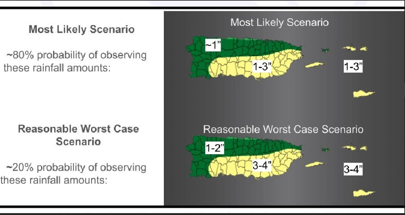
Weather: The potential for flooding rains is moderate. Total rainfall accumulations for the
remainder of the event are expected to range from 1 to 3 inches across the islands. Locally higher
amounts cannot be ruled out. Flash flooding, mudslides, and rapid river rises are possible. Windy
conditions continue today.
Marine: Southwest winds 15 to 20 knots with gusts up to 30 knots today. Seas building between 8
and 10 feet on Thursday and Friday. Small Craft Advisory conditions are in effect for the Atlantic
waters and passages through the weekend or early next week.
Surf Zone: Life-threatening rip currents through Sunday across the north-facing beaches of the
islands. High Surf Advisory conditions from late in the workweek through the weekend. Dangerous
swimming conditions are expected due to large breaking waves and minor beach erosion on
vulnerable beaches.
