
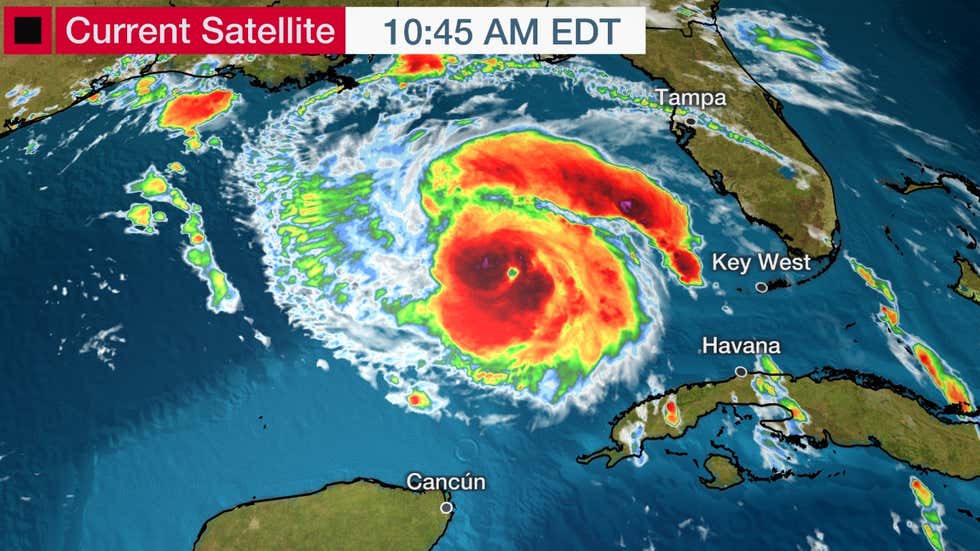
NEW ORLEANS — Hurricane Ida is forecast to rapidly intensify into a major hurricane as it draws closer to the northern Gulf Coast this weekend, where it will bring life-threatening storm surge, dangerous rainfall flooding, potentially catastrophic winds and tornadoes.
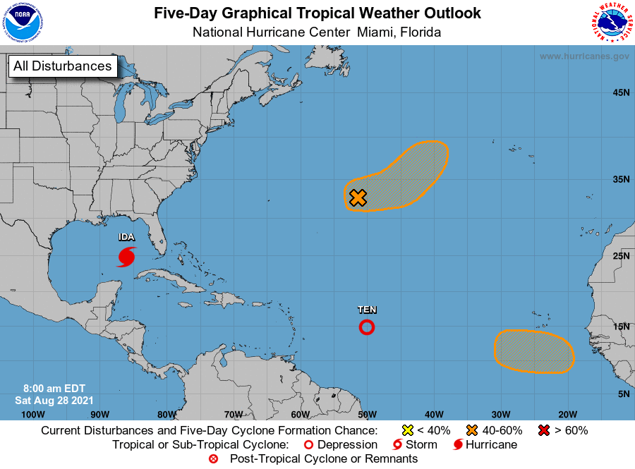
Ida is currently centered 440 miles southeast of New Orleans and is tracking northwest at just over 15 mph. Maximum sustained winds are 85 mph, making Ida a Category 1 hurricane.
Interests along the northern Gulf Coast from Louisiana to Alabama should monitor Ida’s progress closely and finish hurricane preparations on Saturday. Follow the advice of local officials if you are ordered to evacuate.
Current Alerts
Wind
A hurricane warning is posted from Intracoastal City, Louisiana, eastward to the mouth of the Pearl River, including Lake Pontchartrain, Lake Maurepas, and the New Orleans metro area. Tropical-storm-force winds are forecast to arrive in parts of this region late Saturday night into early Sunday, with hurricane conditions developing Sunday and Sunday night.
A hurricane watch continues to be in effect from Cameron, Louisiana, to Intracoastal City, Louisiana, and from the Mouth of the Pearl River to the border between Mississippi and Alabama. These areas are also under a tropical storm warning, which means tropical storm conditions are expected within the next 36 hours.
Finally, a tropical storm watch has been issued near the Alabama coast and for inland portions of Mississippi and Louisiana, where tropical storm conditions are possible within 48 hours.