
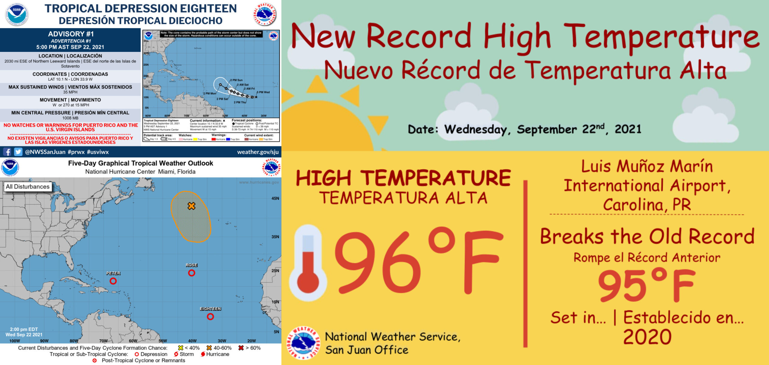
TROPICAL DEPRESSION EIGHTEEN MOVING AT THE SAME SLOW PACE AS HURRICANE IRMA IN 2017
MIAMI — While the Atlantic basin remains active, — only one system is worth watching — Tropical Depression Eighteen which is forecast to become a hurricane this weekend.
New this morning, Peter and Rose have both weakened to tropical depression status in the Atlantic basin. These storms are not likely to re-strengthen over the next few days and will likely dissipate by the weekend.
Elsewhere, the remnants of Odette have increased in the chance of development as it moves over some warmer waters in the north central Atlantic. If this system does redevelop, it will like develop as a subtropical system – meaning it has characteristics of a tropical and non-tropical system. It would retain the name Odette, but it’s unlikely to impact any land areas.
Meanwhile, the biggest area we need to watch remains south and west of the Cape Verde Islands. This wave, known as Invest 98L, became Tropical Depression Eighteen this afternoon. It has been producing consistent shower and storm activity through the overnight hours.

The storm is in a very favorable area with upper level high pressure allowing this system to breath easily. It’s not encountering any shear either and will be moving over very warm waters over the next few days. However, the system is moving at an unusually slow pace – west at 10 to 15 mph.
Typically systems in this part of the Atlantic race west around 20 mph. However due to its slower forward speed, it’s possible this will allow the system to form a bit quicker, as it won’t be sheared due to its fast movement.
Historically, it’s pretty rare for systems off Africa to move this slow towards the Caribbean islands. However we do have a few storms, including Hurricane Irma in 2017, that have emerged off the coast of Africa and moved at roughly the same pace to the Caribbean islands.
Global models do a pretty good job of carrying this system west through the weekend. By Monday morning, most global models suggest Invest 98L will be a tropical storm or hurricane just a couple hundred miles to the East of the Leeward Island chain.
However, models diverge from Monday with how the upper-level pattern will develop after that.

The American model develops an upper-level low near Florida, allowing an opening for the storm to lift north and out to sea. While it may come close to the Leeward Islands, the rest of the Caribbean is spared any significant impacts.
The European and Canadian models suggest a building upper-level ridge to the north of the storm, forcing the storm farther and farther west, intensifying as it moves. This would bring significant impacts to the Leeward Islands, the Virgin Islands and Puerto Rico.
For now, we have a high confidence that the slow movement of the storm will keep it a couple hundred miles east of the Leeward Islands Monday, but low confidence exists on where the storm will go from there.
For now it is too early to talk about the exact impacts to the Caribbean, but its worth a watch for the Leeward Islands, Virgin Islands and Puerto Rico.


