
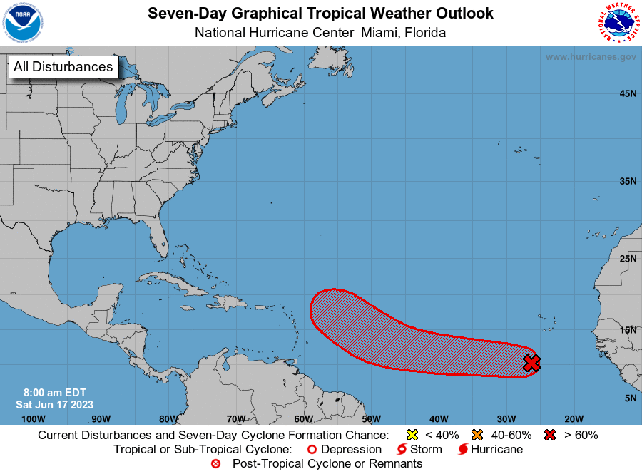
MIAMI — The National Hurricane Center continues to monitor Invest 92L, which could eventually become the second named system of the Atlantic hurricane season.
Forecasters have been watching a disturbance, known as a tropical wave, which entered the ocean from Africa this week and have given it a high chance of tropical development.
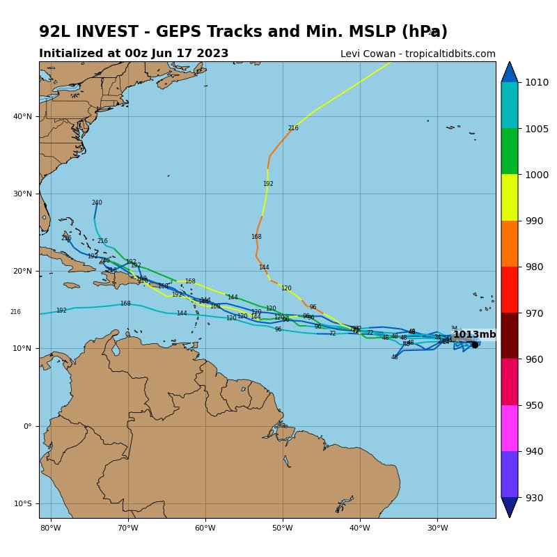
Invest 92L is moving westward at 15-20 mph and is expected to cross through the eastern and central Atlantic over the coming days.
An invest is simply a designation used by the NHC to identify an area of disturbed weather being investigated for possible tropical development.
According to the NHC, Invest 92L has a 30 percent chance of developing into a tropical cyclone within the next two days and a 70 percent chance within the next week.
If the disturbance organizes and gains a center, it would be known as Tropical Depression 3. Once sustained winds reach at least 39 mph, it would earn the name of Tropical Storm Bret.
“A tropical wave located several hundred miles south-southwest of the Cabo Verde Islands is producing a broad area of disorganized showers and thunderstorms,” the National Weather Service said. “Environmental conditions appear conducive for additional development, and a tropical depression is likely to form by the early to middle portion of next week while the system moves westward at 15 to 20 mph across the eastern and central tropical Atlantic.”
Hurricane season officially began on June 1. The first named storm typically forms around June 20, according to NHC data. Arlene, the first named storm of the 2023 Atlantic season, formed on June 2.
Where is Invest 92L going?
It’s too early to know for certain where Invest 92L is headed, but there is consensus in computer models that the system will head west and be in the vicinity of the Lesser Antilles by the end of next week.